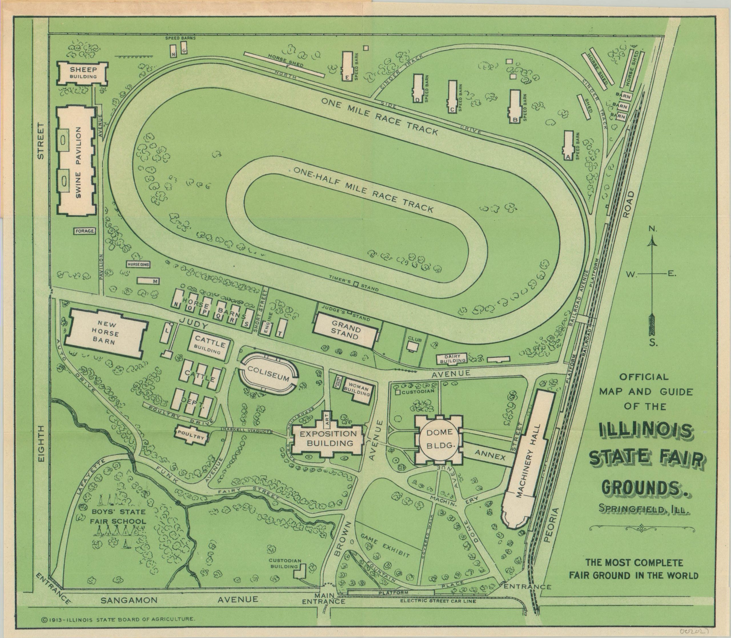
Official Map and Guide of the Illinois State Fair Grounds
$110.00
Pocket map for the 1913 Illinois State Fair in Springfield.
1 in stock
Description
The agrarian nature of the prior century’s state fairs is highlighted on this pocket map, issued by the Illinois State Board of Agriculture for the annual event in 1913. Animals take up a significant amount of the area, with separate exhibits or barns for horses, swine, cattle, game, poultry, sheep and dairy. The race track (built in 1910) would have thrilled fairgoers with horse and automobile contests, while the latest in engineering technology was on display in the Machinery Hall.
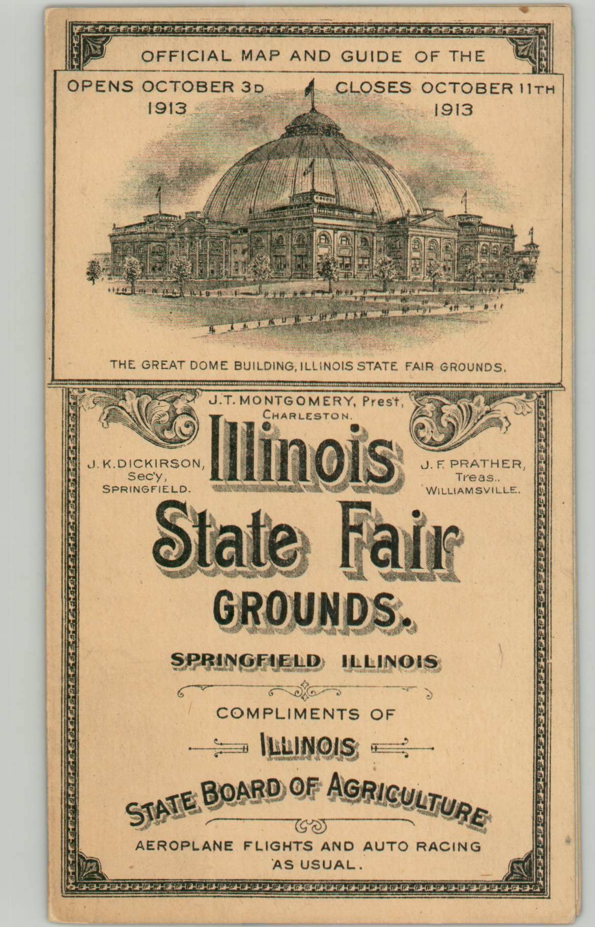
Also of interest is the Dome Building, which was purchased and moved from the 1893 World’s Columbian Exposition in Chicago. A view of the magnificent structure can be seen on the front cover, which also advertises the dates (Oct. 3 -11) and ‘airplane flights and auto racing as usual.’
Map Details
Publication Date: 1913
Author: Illinois State Board of Agriculture
Sheet Width (in): 11.40
Sheet Height (in): 10.00
Condition: A
Condition Description: Folded into six segments and affixed to original paper covers. Near fine.
$110.00
1 in stock