Official Historical Atlas Map of Fresno County
$1,250.00
Fabulous late 19th century atlas of Fresno County, fully restored.
1 in stock


Description
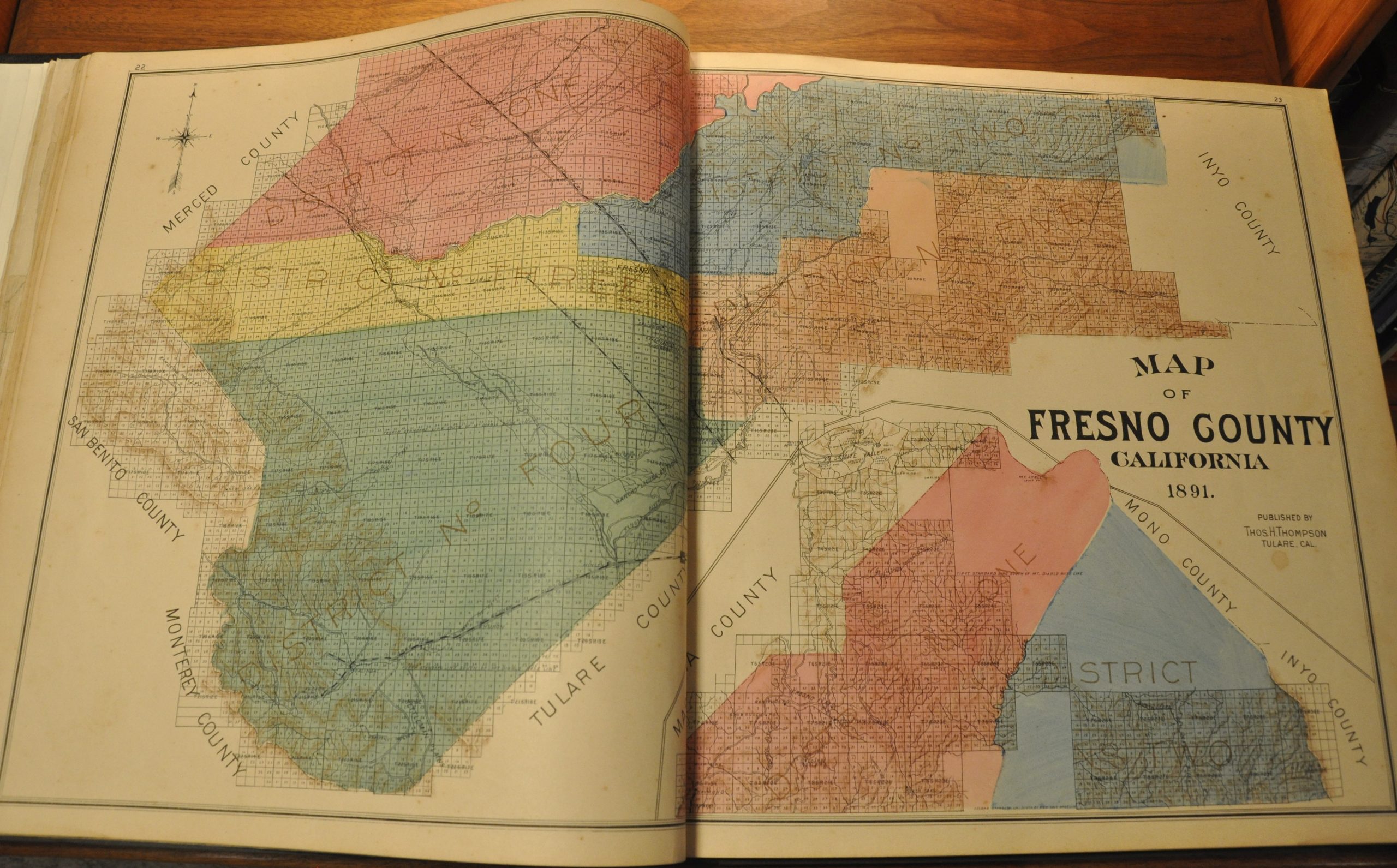
This spectacular atlas of Fresno County, California was published in Tulare by Thomas H. Thompson in 1891. Its county map was apparently of such fine execution that, according to the title page, the Board of Supervisors declared it “the Official Map of Fresno County.”
The map is a quality one – bright colors distinguish the various districts while light shading accentuates topographic details. An inset in the lower right includes the northern portion, which is cut off at the top. Here, large areas remain to be subdivided into sections. Towns, post offices, and transportation routes are labeled across the image; providing an interesting overview of the county in the late 19th century.
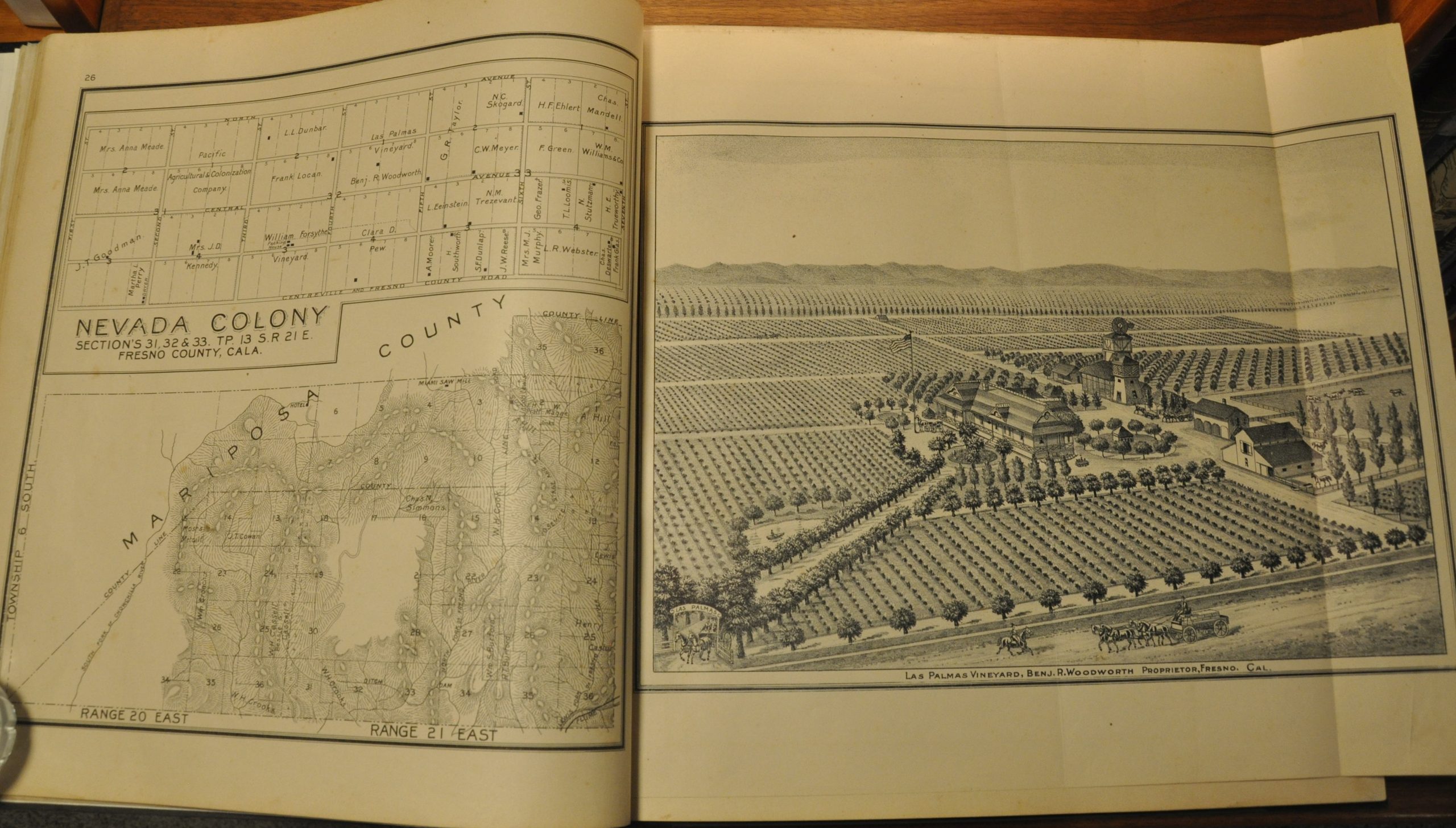
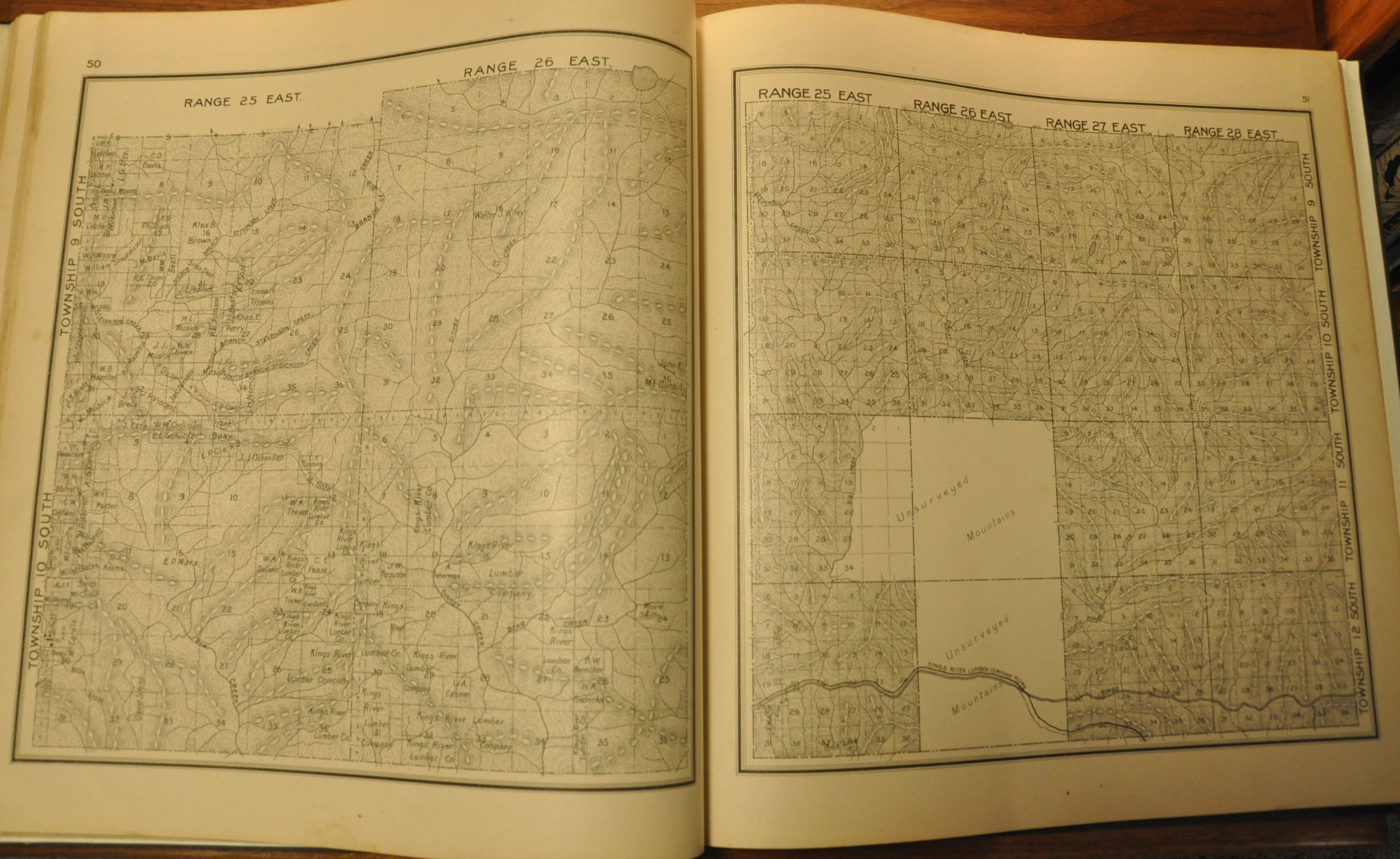
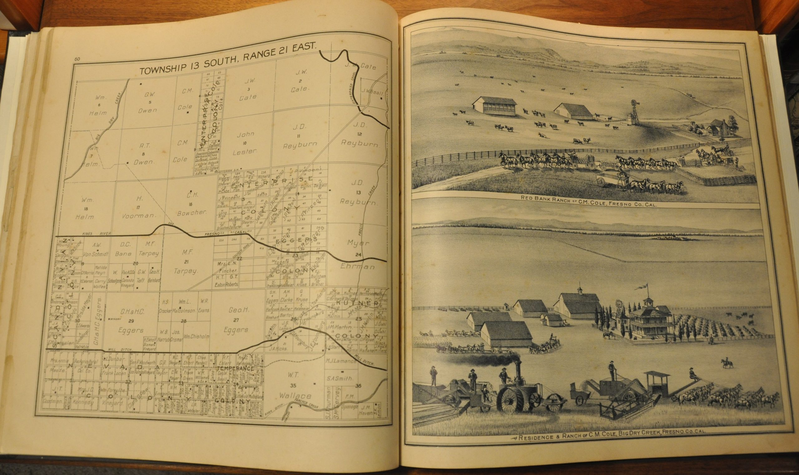
This contemporary detail is emphasized throughout the rest of the atlas, which is arguably of similarly high quality to the county map. A double page map of California highlights how the majority of the state shared the rural composition. It’s followed by over 80 single page maps which show a wealth of information on local industry, county organization, topography, and property ownership. The last is particularly emphasized, with names of individuals or businesses labeled across almost every parcel and property in the county.
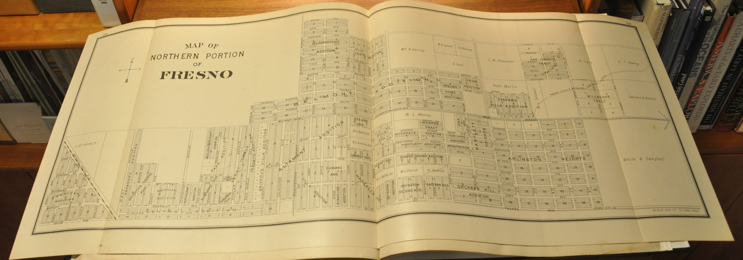
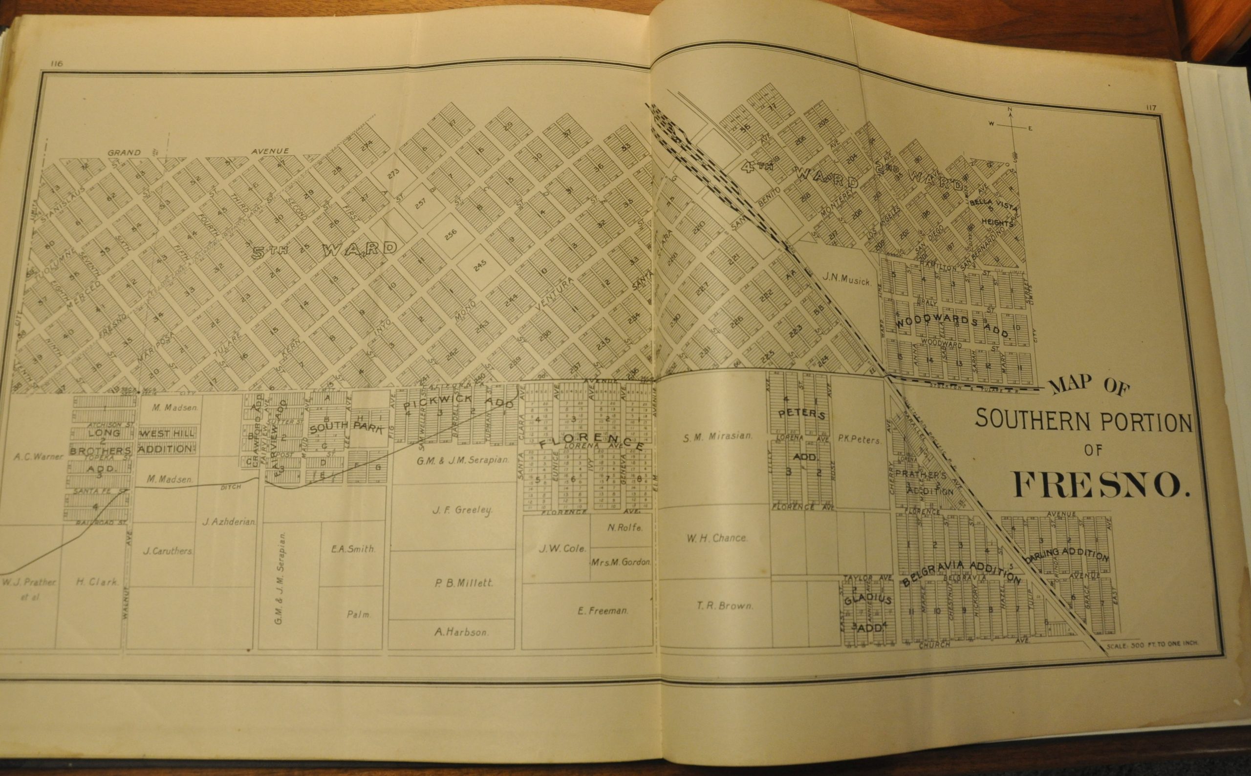
An examination of these names reflects a large immigrant population, and one of the sheets includes an inset map of a local Scandinavian colony. City plans are included for Fresno (3 parts), Selma, and Sanger, in addition to composite sheets covering many smaller towns and villages.
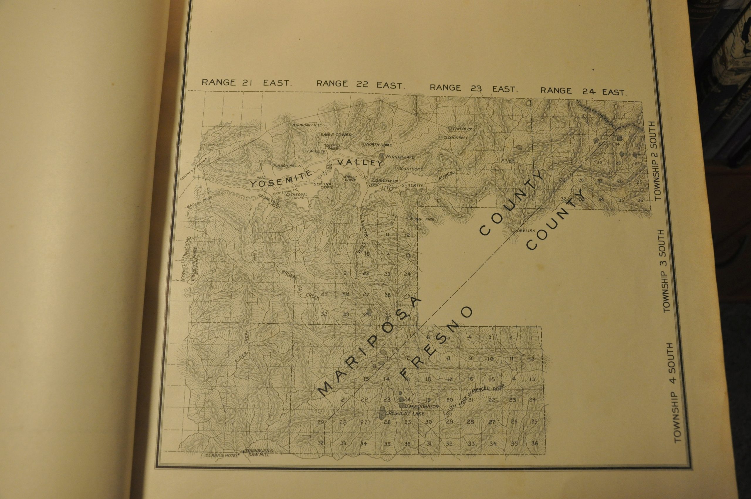
Also of interest is the separate sheet of the Yosemite Valley, despite it being located within adjacent Mariposa County. The year prior to publication, a large portion of the valley had been declared a National Park, and its popularity among tourists and residents was likely at a peak.
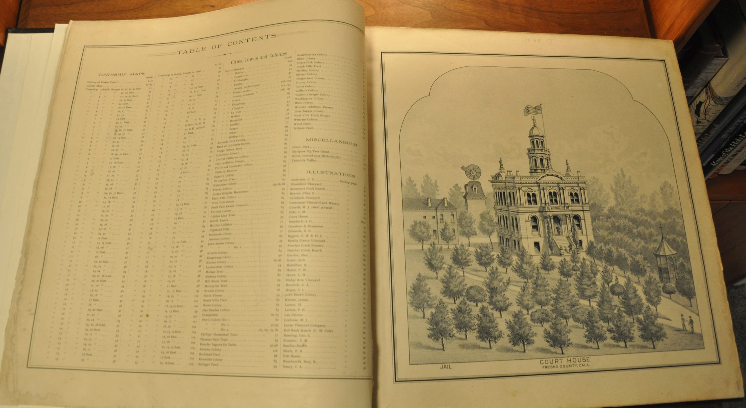
The atlas also contains a number of views and illustrations of local farms (including vineyards) and various properties. One presents a fascinating depiction of an early steam tractor, while others show sprawling ranches, prize livestock, and the county courthouse.
Map Details
Publication Date: 1891
Author: Thomas H. Thompson
Sheet Width (in): 15.00
Sheet Height (in): 16.00
Condition: B+
Condition Description: The entire atlas has been professionally rebound and restored. The original title sheet has been mounted to new quarter leather boards with gilt embossed spine and new endpapers. Contents are generally quite good, though a portion of the margins have been restored or reinforced in several areas on the title page, index sheet, and state map of California. The preface/table of contents has a large tear (repaired) and there's a bit of soiling and faint damp staining in the margins on several sheets. A few have light spotting, and the margins of the patron's directory has a bit of worming. Complete - 122 pages with 18 single page views (3 with fold out panels), 82 single page maps, and 5 double page maps, including a 3 part city plan of Fresno. Remains in very good condition overall.
$1,250.00
1 in stock