Official Highway Service Map Issued by Arkansas State Highway Commission
$65.00
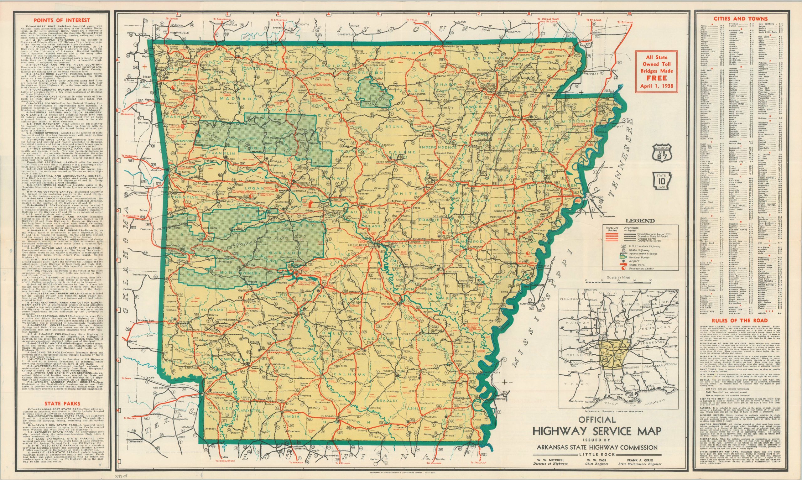
The highways of Arkansas during the late 1930s.
1 in stock
Description
This is the ‘official’ 1938 edition of the Arkansas Highway Map, prepared by the State Highway Commission and lithographed in Little Rock by The Democrat Printing & Lithograph Company. A matrix of four styles of lines in two different colors is used to delineate the various types and surfaces of roads across The Natural State. National Forests and state borders are highlighted in verdant green. Panels of adjacent text identify points of interest, state parks, the rules of the road, and cities and towns. Numerous captioned photographs and additional promotional information are provided on the verso.
Map Details
Publication Date: 1938
Author: Arkansas State Highway Commission
Sheet Width (in): 30.25
Sheet Height (in): 18.40
Condition: A-
Condition Description: Double-sided map brochure with vibrant printed color. Some silverfishing on the surface of the verso does not affect the map. A bit of light toning and wear along folds.
$65.00
1 in stock