Official Highway Map of Wisconsin 1932
$60.00
“Welcome to Wisconsin – The Playground of the Middle West”
1 in stock
Description
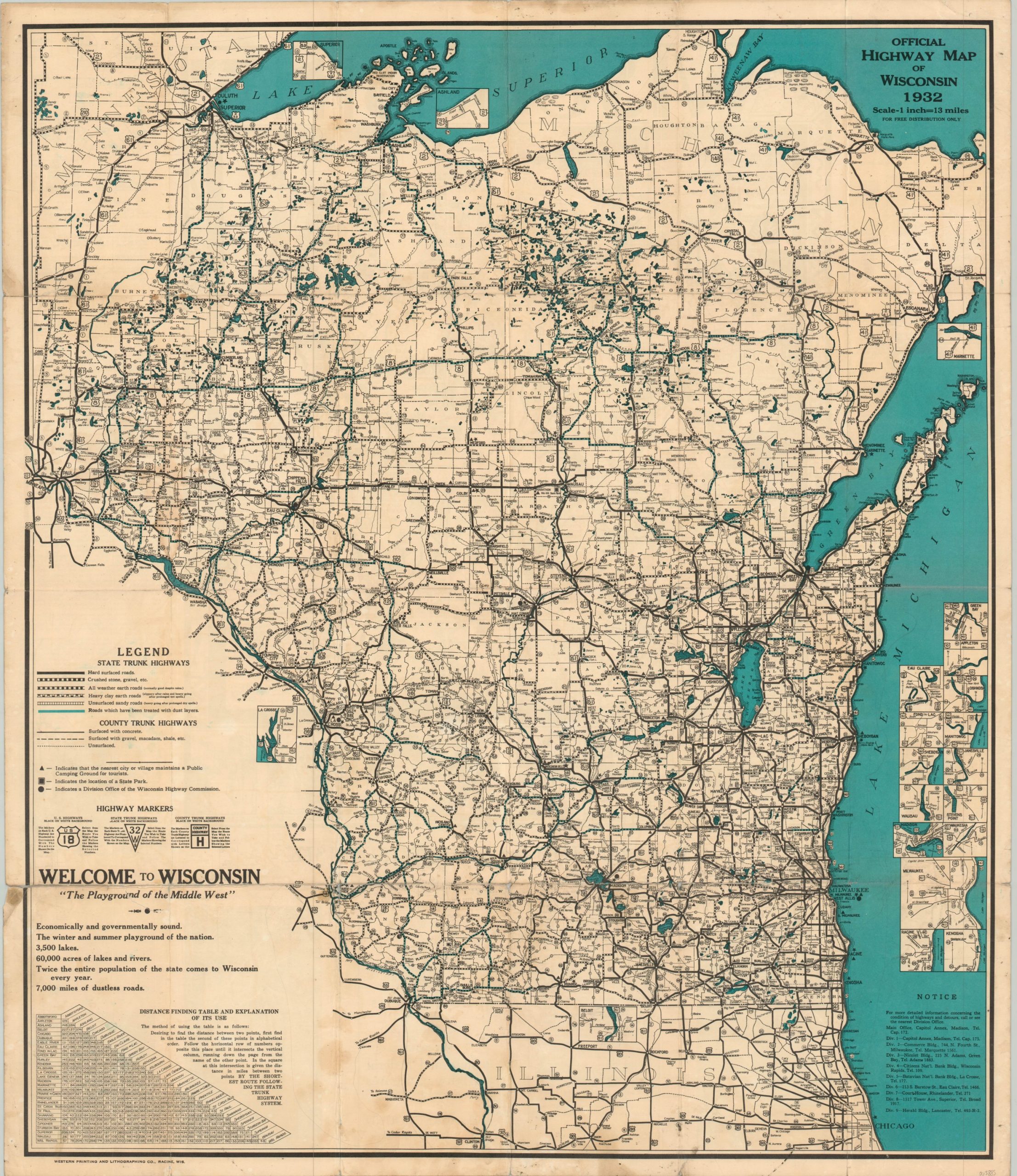
This double-sided map of Wisconsin was published in Madison by the State Highway Commission in 1932. County and state trunk highways are identified by their surface, with the legend above the title block providing further details on the options available to intrepid motorists. Highway markers are also explained in further detail. Over a dozen different street plans for urban areas across the state are presented through inset maps and a distance table can be seen in the lower left.
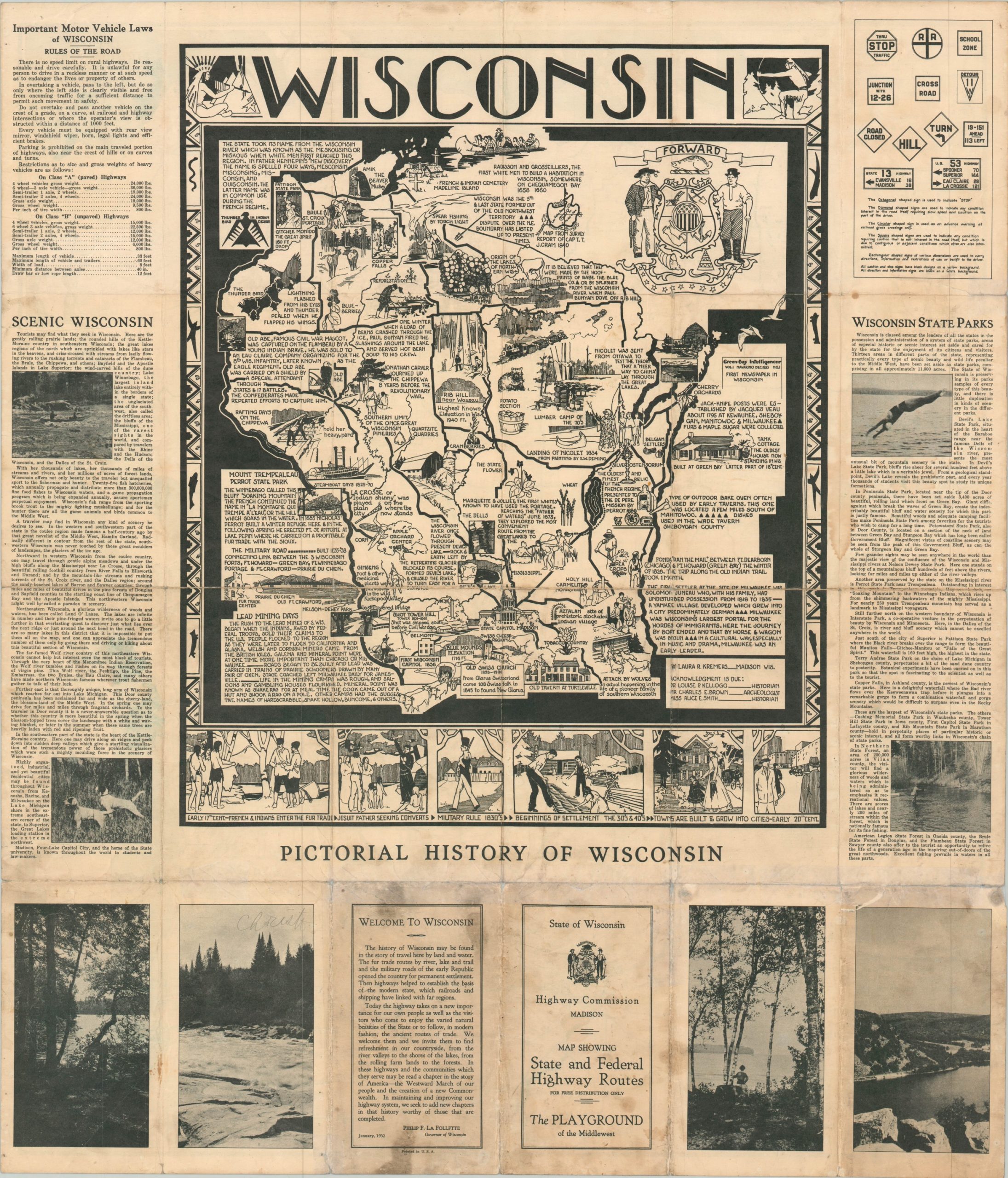
The verso presents a charming pictorial map of the state with an illustrated border drawn by Laura Kremers. Numerous vignettes and annotations describe historic places and events, agricultural and industrial exports, and old transportation routes.
Map Details
Publication Date: 1932
Author: Laura Kremers
Sheet Width (in): 25.5
Sheet Height (in): 29.75
Condition: B
Condition Description: Moderate to heavy wear along former fold lines, including about 12" of cumulative separation that has been repaired on the verso. One jagged tear near the title block has also been repaired. Small holes at fold intersections and some soiling visible in the margins and several spots throughout the image.
$60.00
1 in stock


