
Official Guide Book Golden Gate International Exposition
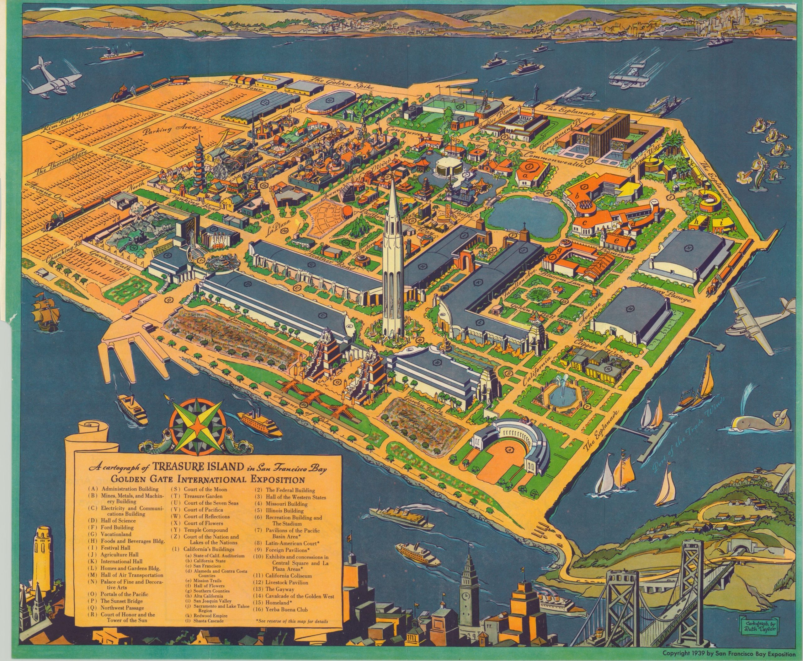
Official Visitor’s Guide to the 1939 Golden Gate International Exposition with fold out pictorial map by Ruth Taylor White.
Out of stock

Description
The construction of the Bay and Golden Gate bridges during the 1930’s was a significant civic affair for the city of San Francisco and included custom ferry tours which allowed residents and tourists to gawk at the progress. The need to commemorate such a pair of milestone engineering achievements was quickly recognized, and in 1935 Yerba Buena Island was chosen as the site for a future World’s Fair to celebrate the completion of the bridges.
The event was ultimately held in 1939 (though a second, artificial island was needed) and this is a lovely example of the official guidebook published for what was called The Golden Gate International Exposition. Nearly 120 pages of text cover all there is to do and see. Information on exhibits, transportation details, aerial photographs, statistics, and more can be found in addition to a fold-out pictorial map by Ruth Taylor White. This colorful bird’s eye view depicts dozens of buildings and attractions and is double-sided, allowing for larger-scale inset maps of various areas on the verso.
Map Details
Publication Date: 1939
Author: San Francisco Bay Exposition
Sheet Width (in): 19.00
Sheet Height (in): 15.75
Condition: A-
Condition Description: The guidebook measures approximate 5.5" x 8" and is in very good condition, complete with original covers. 116 pp. Some fraying to the front and back and one small tear along the edge of the fold out map.
Out of stock