Official Map of Incorporated Village of East Hampton
A scarce mid century survey of the “Playground of the Rich.”
Out of stock
Description
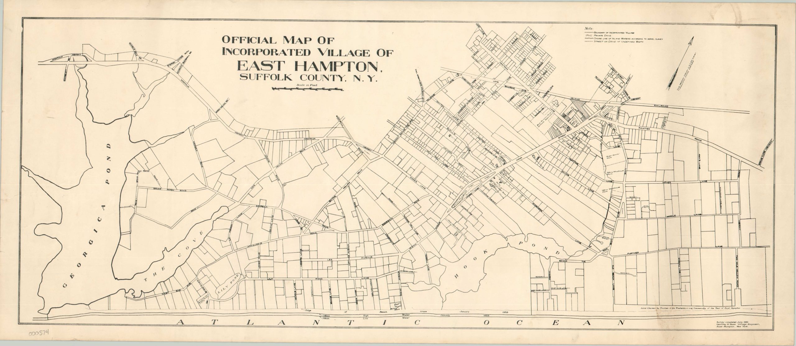
The Hamptons have been associated with wealth, privilege and the upper crust of New York society since the first quarter of the 20th century. East Hampton, an incorporated village at the center of the action, is no exception. With average home prices nearing a million dollars, this wealthy community on the shores of Long Island is one of the most desirable seaside locations in the United States.
In the mid-1950’s, when this survey was issued, East Hampton was known less for its real estate, and more for its art. Jackson Pollock moved to the area in the 1940’s, where he set up an artist studio with fellow abstract expressionist Lee Krasner. The studio continued to operate until Pollock’s death in 1956, which took place on a road just outside the northernmost limit of the map. Published by the village engineer in 1954, the map shows the latest survey results and individually labels streets, parks, water features, and prominent buildings. Unfortunately additional updates would be needed shortly after issue – Hurricane Carol hit in 1954 and caused significant damage to the island, for a time the town of East Hampton was completely isolated. The map is scarce – no institutional holdings could be identified.
Map Details
Publication Date: c. 1954
Author: Geoffrey Bass
Sheet Width (in): 31
Sheet Height (in): 13.50
Condition: B+
Condition Description: The map exhibits some wear, primarily in the form of small edge tears, paper crinkling and several smudges concentrated on the right side of the page.
Out of stock