[Oak Park, Illinois]
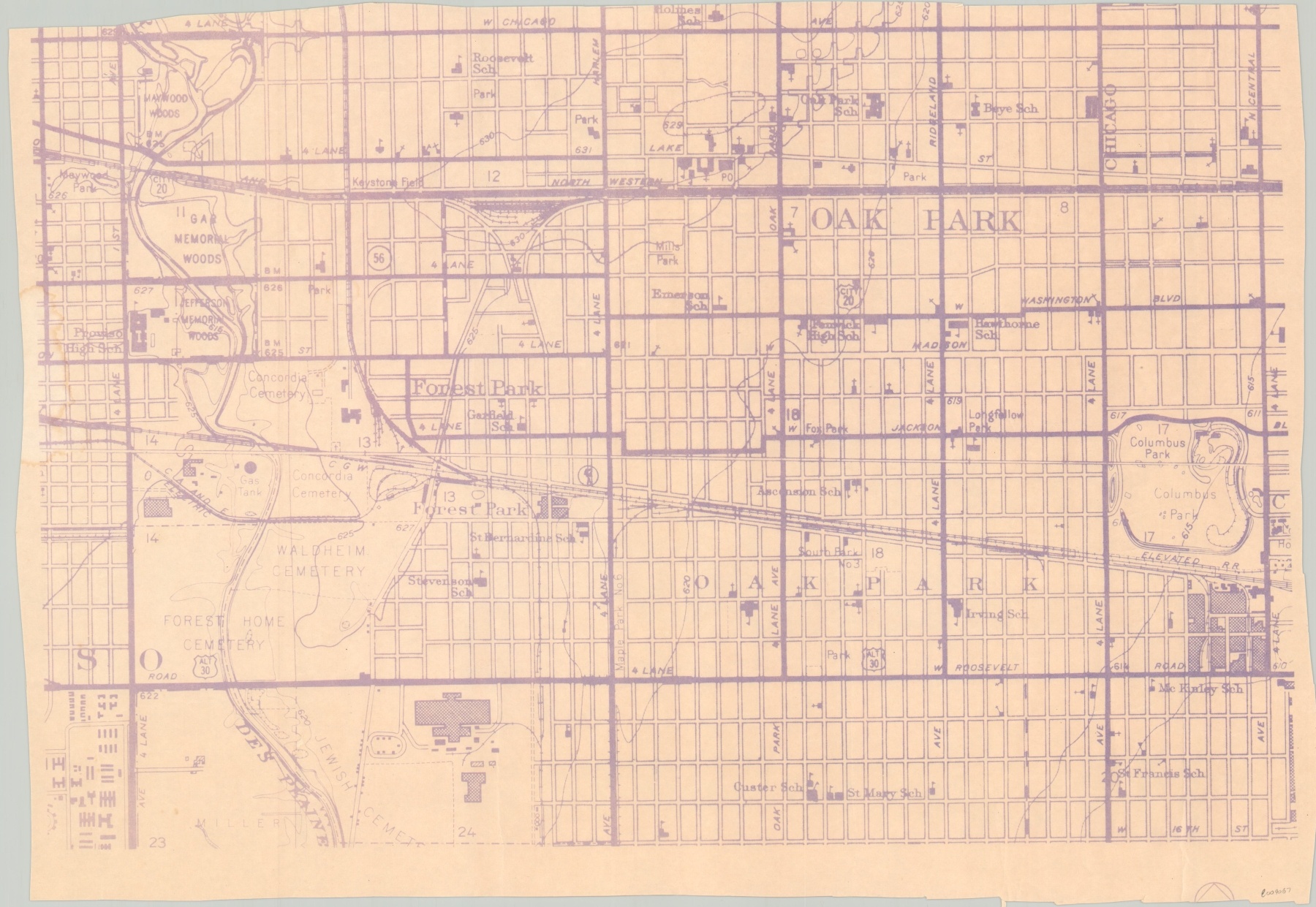
Blueprint scrap covering several of Chicago’s western suburbs.
Out of stock
Description
This detailed blueprint fragment is bordered by Chicago, Central, Roosevelt, and First Avenues and includes the western suburbs of Oak Park, Forest Park, and River Forest. Schools, parks, and cemeteries are individually labeled throughout and transportation routes are noted.
The map appears to be a trimmed portion of a larger sheet, though its publication history and author are unknown.
Map Details
Publication Date: c. 1960s?
Author: Anonymous
Sheet Width (in): 20.9
Sheet Height (in): 14.5
Condition: A-
Condition Description: A scrap of a larger blueprint plan of the western suburbs, with a trimmed upper edge and uneven bottom margin. The ink has faded from age and the paper is slightly toned.
Out of stock