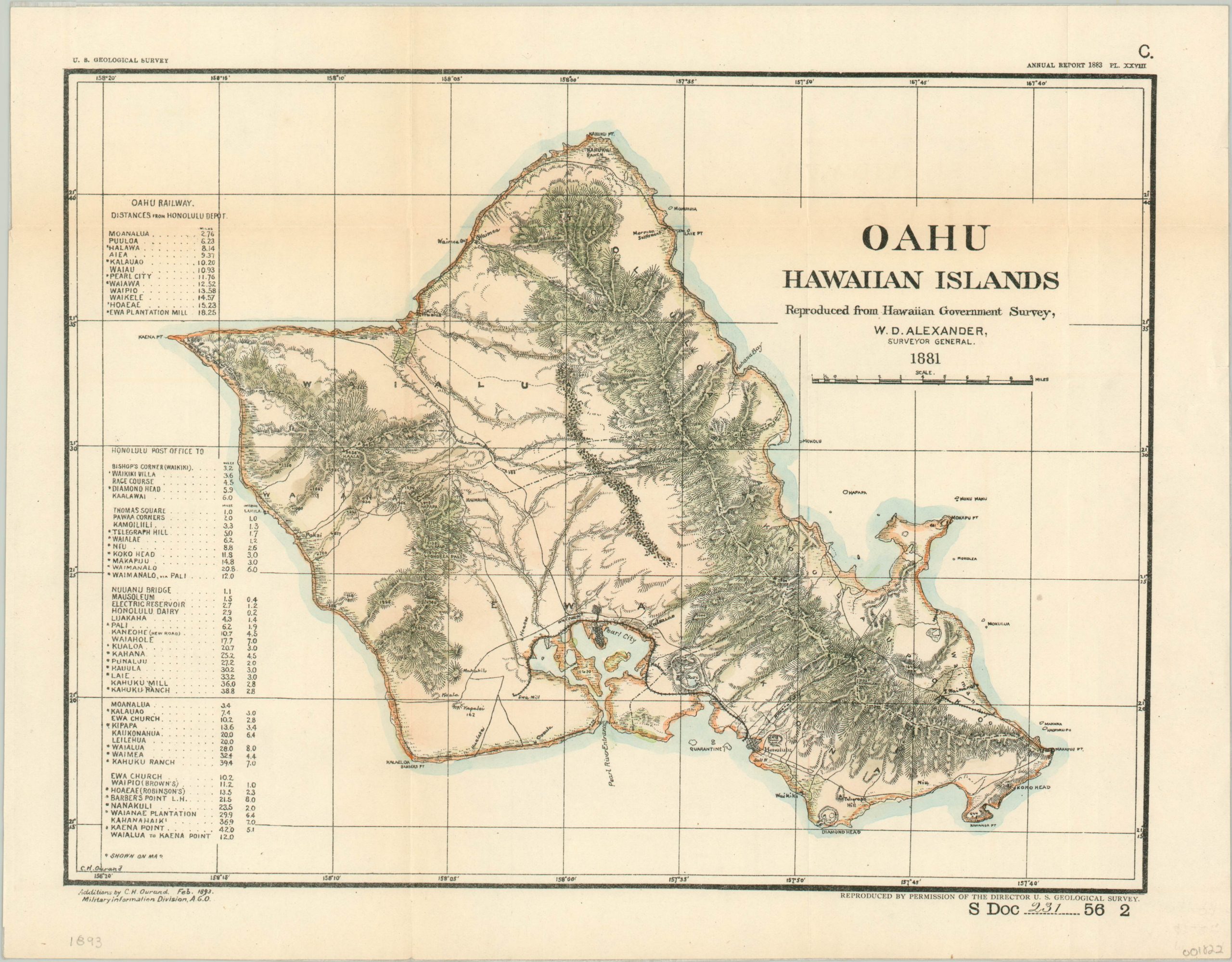
Oahu Hawaiian Islands
$150.00
Government survey of Oahu published the same year as the overthrow of the Hawaiian Kingdom.
1 in stock
Description
On January 17, 1893, a coup d’état against Hawaiian Queen Liliuokalani took place on the island of Oahu. Most of the insurgents were foreigners, including U.S. citizens who called for federal armed forces in support. The revolt was successful and Sanford Dole, of pineapple fame, was declared President of the newly proclaimed Republic of Hawaii. Less than a decade later, the islands would become an official organized territory of the United States.
This map was published by the Government Printing Office the same year as the coup, with updates to an earlier image designed by surveyor W.D. Alexander in 1881. Topography is shown in hachure and a handful of roads and railroads are shown snaking across the island’s rugged terrain. Pearl City and Honolulu are the major urban areas, and several notable geographic features are labeled. Two tables on the left side note distances along the Oahu Railway and from the Honolulu Post Office.
The map was updated by C.H. Ourand of the United States Geological Survey and published in 1893 as part of Senate Document 231.
Map Details
Publication Date: 1893
Author: C.H. Ourand
Sheet Width (in): 14.40
Sheet Height (in): 11.10
Condition: A-
Condition Description: Minor wear and faint discoloration along fold lines. Mounted on Japanese tissue.
$150.00
1 in stock

