Nuove Scoperte Fatte nel 1765, 67 e 69 nel Mare Del Sud
$875.00
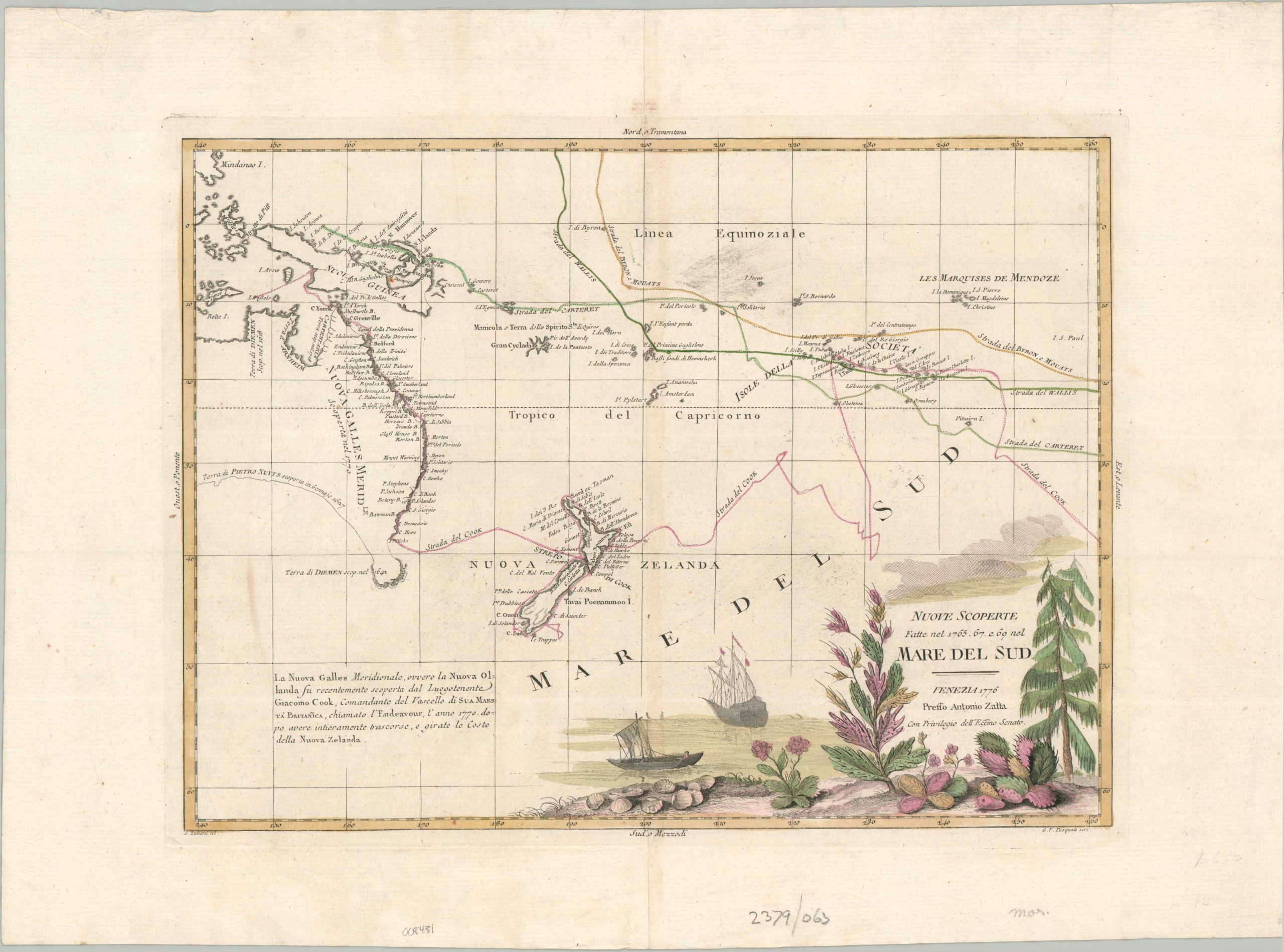
An uncommon and early representation of Cooks’ discoveries in the South Pacific.
1 in stock
Description
This elegant and significant Italian map, published in Venice by Antonio Zatta in 1776, captures the rapid expansion of European geographical knowledge in the Pacific Ocean during the mid-18th century. Drawing upon the “New Discoveries” (Nuove Scoperte) made during the celebrated voyages of British and French explorers, the map serves as a cartographic record of the transition from speculative geography to the modern scientific charting of the Mare Del Sud (South Sea).
The skillfully engraved image tracks the routes and findings of critical expeditions conducted between 1765 and 1769 – Byron/Moucats, Wallis, and Carteret. Most importantly, it presents the discoveries made by Captain James Cook and his crew aboard the HMS Endeavour on his first voyage (1768-1771). New Zealand’s two main islands have been definitively circumnavigated and chartered for the first time. Australia’s eastern coast is filled with new toponyms, though the southern edge remains largely speculative. A decorative title cartouche reflects the exotic new flora discovered on these trips, with a ship at anchor in the background presumed to be Cook’s Endeavour.
Map Details
Publication Date: 1776
Author: Antonio Zatta
Sheet Width (in): 21.7
Sheet Height (in): 16.3
Condition: B+
Condition Description: Copperplate engraved sheet on thick laid paper with attractive old hand color. A quarter sized dark spot, possibly from the original printing, visible in the upper right and some faint toning along the centerfold. One further brown streak visible in the lower left. Good to very good condition overall. Blank on verso.
$875.00
1 in stock