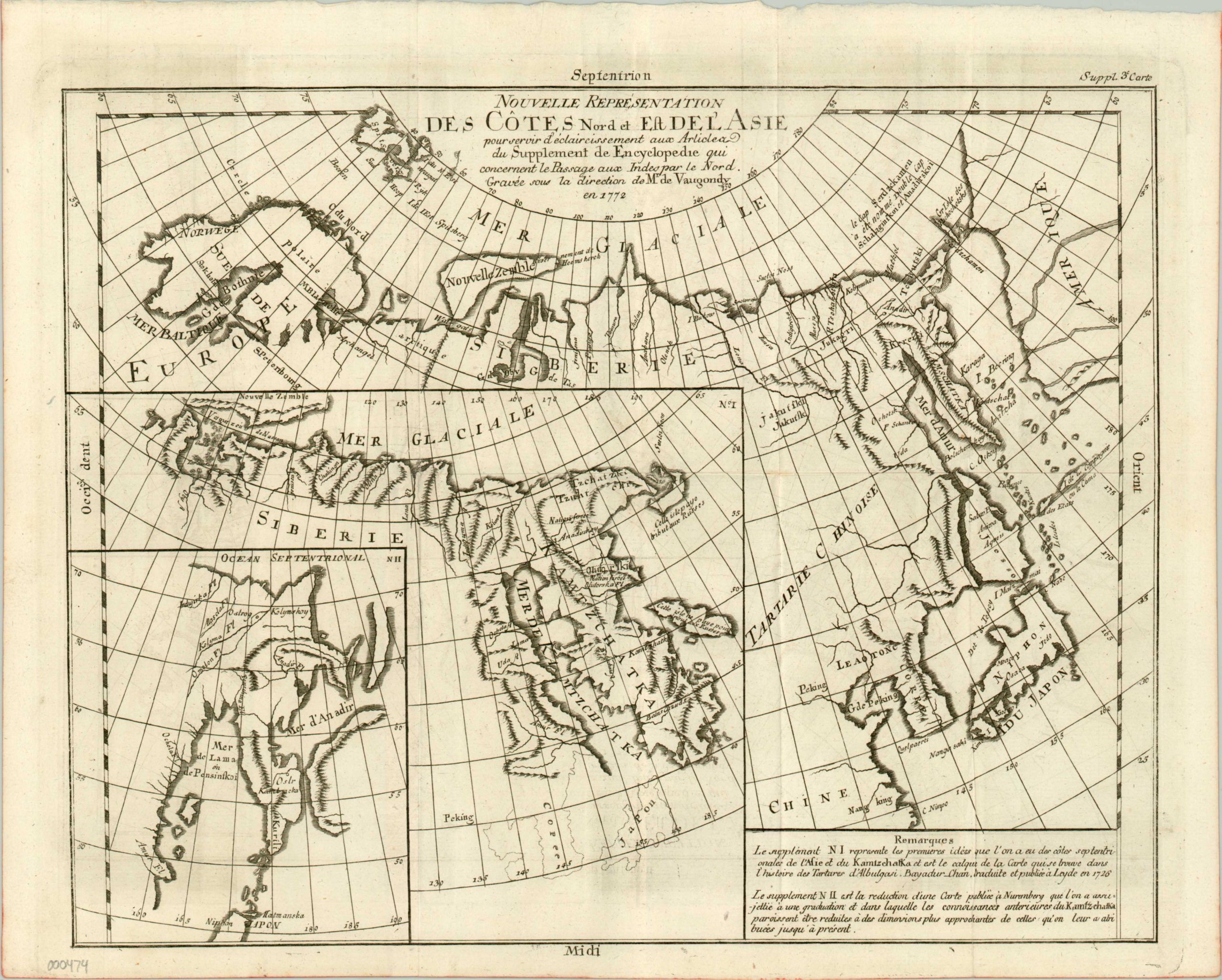
Nouvelle Représentation des Cotes Nord et Est de L’Asie
$175.00
Early cartographic comparison of the Northeast Passage.
Description
While a few in Western Europe was still hopeful for the existence of a Northwest Passage, several German and Russian navigators made expeditions in the 18th century exploring the possibility of a navigable route going the opposite direction through the Arctic. This map, prepared by Diderot for inclusion as a supplement to his famous Encyclopedia, examines three possible conclusions resulting from those explorations. Focusing on the Kamchatka Peninsula in northeastern Russia, various interpretations for possible navigation around the Asian continent are provided with different scales and context.
This early example of comparative cartography was compiled by Didier Robert de Vaugondy who, along with his father Gilles Robert de Vaugondy, was a royal geographer within the French court. This map is one of ten that were prepared for a supplement to Diderot’s Encyclopédie, one of the most influential publications of the 18th century. It challenged the assumption that science and philosophy should be limited to the upper crust of society and revolutionized how information was consumed by the middle classes. Diderot was imprisoned multiple times and the work was officially banned, but was nonetheless released in 27 separate volumes in 1772.
Map Details
Publication Date: 1772
Author: Didier Robert de Vaugondy
Sheet Width (in): 16.50
Sheet Height (in): 13
Condition: A
Condition Description: A bold impression on crisp, clean watermarked paper. One separation along a fold line has been expertly repaired.
$175.00

