Nouvelle Carte Pour Conduire a la Connoissance de la Marine…
$275.00
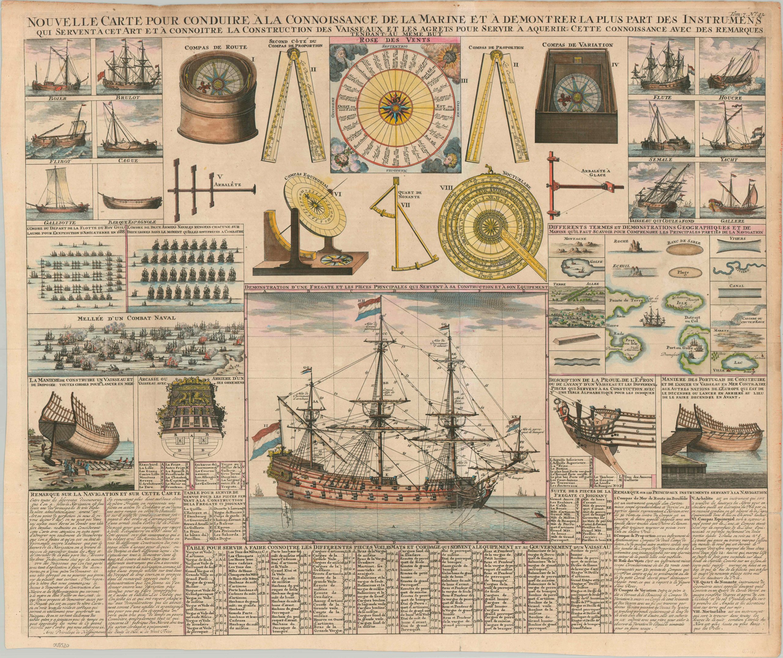
Maritime construction and navigation in the early 18th century.
1 in stock
Description
This collection of informational illustrations, diagrams, and descriptive text conveys the complexity of the primary means of overseas transportation during the Age of Sail. A compass rose, navigational instruments, and measuring tools are pictured at the top of the page. Various categories of sailing vessels with between one and three masts are shown in the upper corners. They are found above depictions of naval combat (center left) and the different water-related symbols and geographic terms that could be found on contemporary maps (center right). A profile view of a large warship highlights a complicated system of ropes, pulleys, blocks, and tackles (over 100 features are labeled) used to control speed and course.
The sheet was published in Paris around 1720 as part of Henri Abraham Chatelain’s important Atlas Historique. This monumental seven-volume set was first issued in Amsterdam between 1705 and 1720 and reprinted until the late 1730s. The scholarly work offers a nuanced synthesis of geography, cosmography, history, religion, ethnology, and political science that provides fascinating contemporary details through the inclusion of descriptive text, maps, charts, diagrams, and illustrations.
Map Details
Publication Date: c. 1720
Author: Henri Abraham Chatelain
Sheet Width (in): 24.20
Sheet Height (in): 20.20
Condition: A-
Condition Description: Professionally cleaned and flattened. Unevenly trimmed margins are slightly toned along the outer edges. A small closed tear in the lower right corner has been repaired on the verso with archival material. One strip, about an inch wide, has lightened somewhat as a result of the binding strip on the verso (now removed). Attractive modern hand col
$275.00
1 in stock