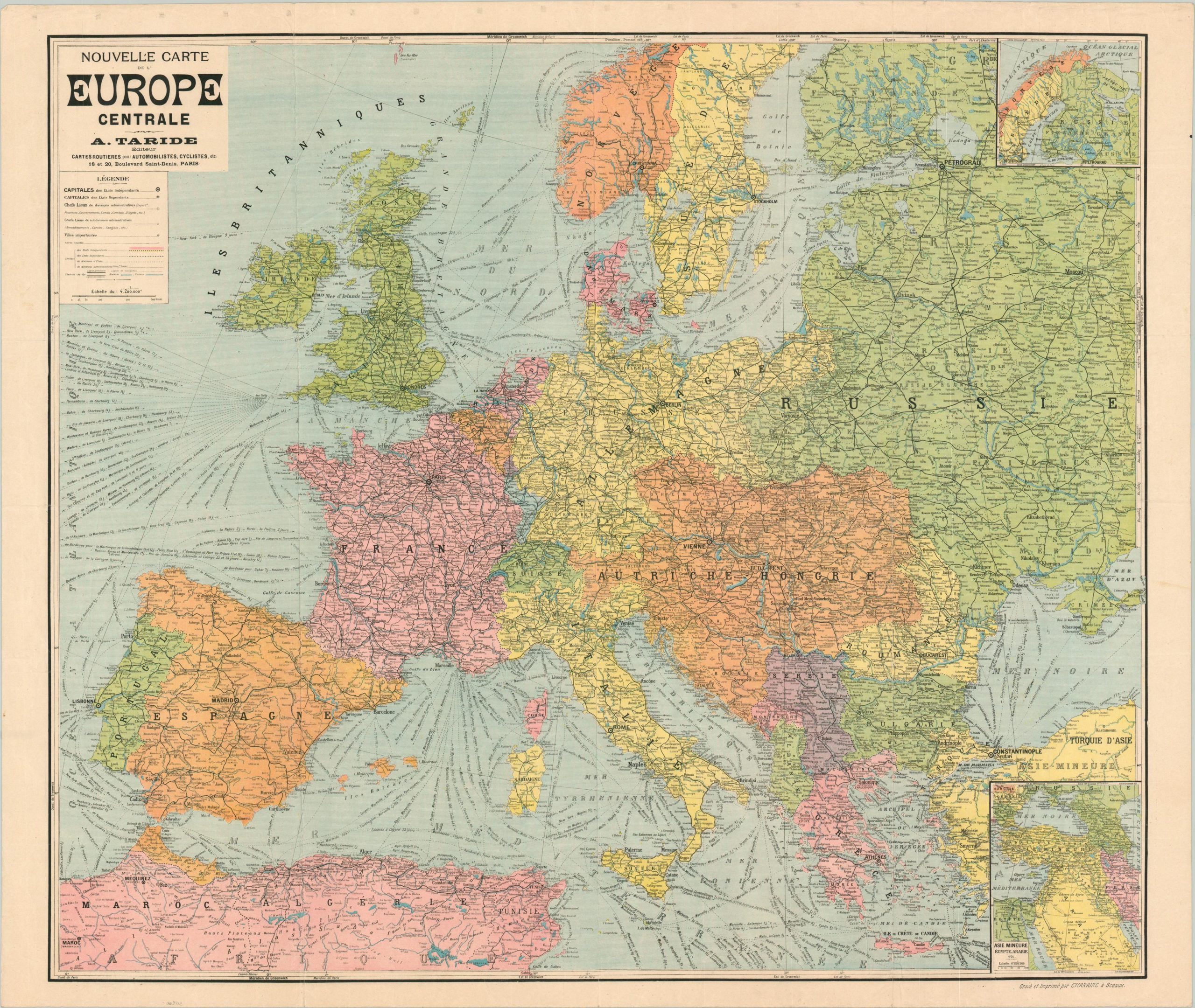
Nouvelle Carte de L’Europe General
$75.00
Europe on the brink of war.
1 in stock
Description
This fascinating and detailed map of Europe was created in Paris by A. Taride and published around 1913 by Charire a Sceaux. Black lines traversing the sheet identify the routes of steamship lines and railroads – the two primary avenues of transportation in the early 20th century. A legend in the upper left identifies the various symbols used within the map while two insets on the right side show Asia Minor and Scandinavia.
Bright lithographed colors highlight the political borders, with an interesting shade of blue used to represent Alsace and Lorraine – then part of Germany but historically French territory. Political borders reflect the end of the Second Balkan War in 1913 – the outbreak of World War I would take place less than a year after the map was published.
Map Details
Publication Date: c. 1913
Author: A. Taride
Sheet Width (in): 40.50
Sheet Height (in): 33.75
Condition: B
Condition Description: Moderate to heavy wear and creasing along four vertical fold lines, including separations at fold intersections, edge tears, and minor sheet abrasion. Wear also visible in the margins and the sheet shows scattered wrinkling from where it was previously rolled.
$75.00
1 in stock

