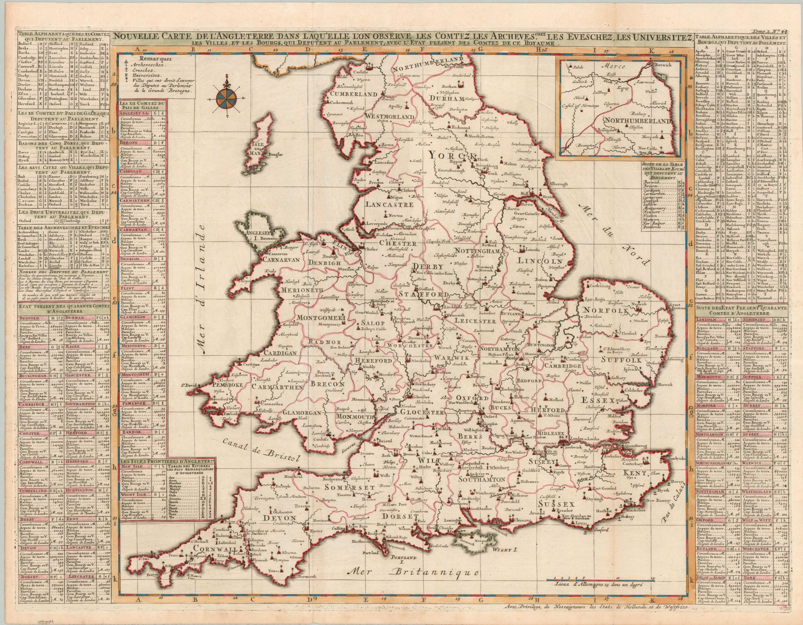
Nouvelle Carte de L’Angleterre dans Laqu’elle L’on Observe les Comtez les Archeves chez Les Eveschez, Les Universitez, les Villes, et les Bourgs…
$100.00
A French political overview of England and Wales from the early 18th century.
1 in stock
Description
“New Map of England in which we observe the Counties, the Archbishops, the Universities, the Cities, and the Boroughs..”. – Approximate title translation.
This lovely hand colored map outlines the urban composition of England and Wales. Ecclesiastical and political units like parishes and counties are outlined and labeled throughout the image. Diosces, universities, and towns represented by Parliament are identified according to the legend in the upper left. Lists on either side of the page offer further details. The copperplate-engraved sheet was originally published in Paris as part of Henri Abraham Chatelain’s important Atlas Historique.
This monumental seven-volume set was first issued in Amsterdam between 1705 and 1720, but was reprinted until the late 1730s. The scholarly, but approachable, work was aimed at a broad audience, eager for new information during the Age of Enlightenment. The breadth of content offers a nuanced synthesis of geography, cosmography, history, religion, ethnology, and political science. The descriptive text (in French) and skillfully engraved maps, diagrams, and illustrations provide a fascinating window into the world of the early 18th century.
Map Details
Publication Date: c. 1720
Author: Henri Abraham Chatelain
Sheet Width (in): 25.9
Sheet Height (in): 16.9
Condition: A-
Condition Description: Copperplate engraved sheet with attractive modern hand color. Creased along old folds, as issued, and some light marginal wear including spotting and edge splits. Some surface discoloration in the upper right, likely as a result of the original plate strike. Very good condition overall.
$100.00
1 in stock