
Nouveau Planisphère Officiel L’Empire Colonial Francais et les Possessions Coloniales des Nations
$275.00
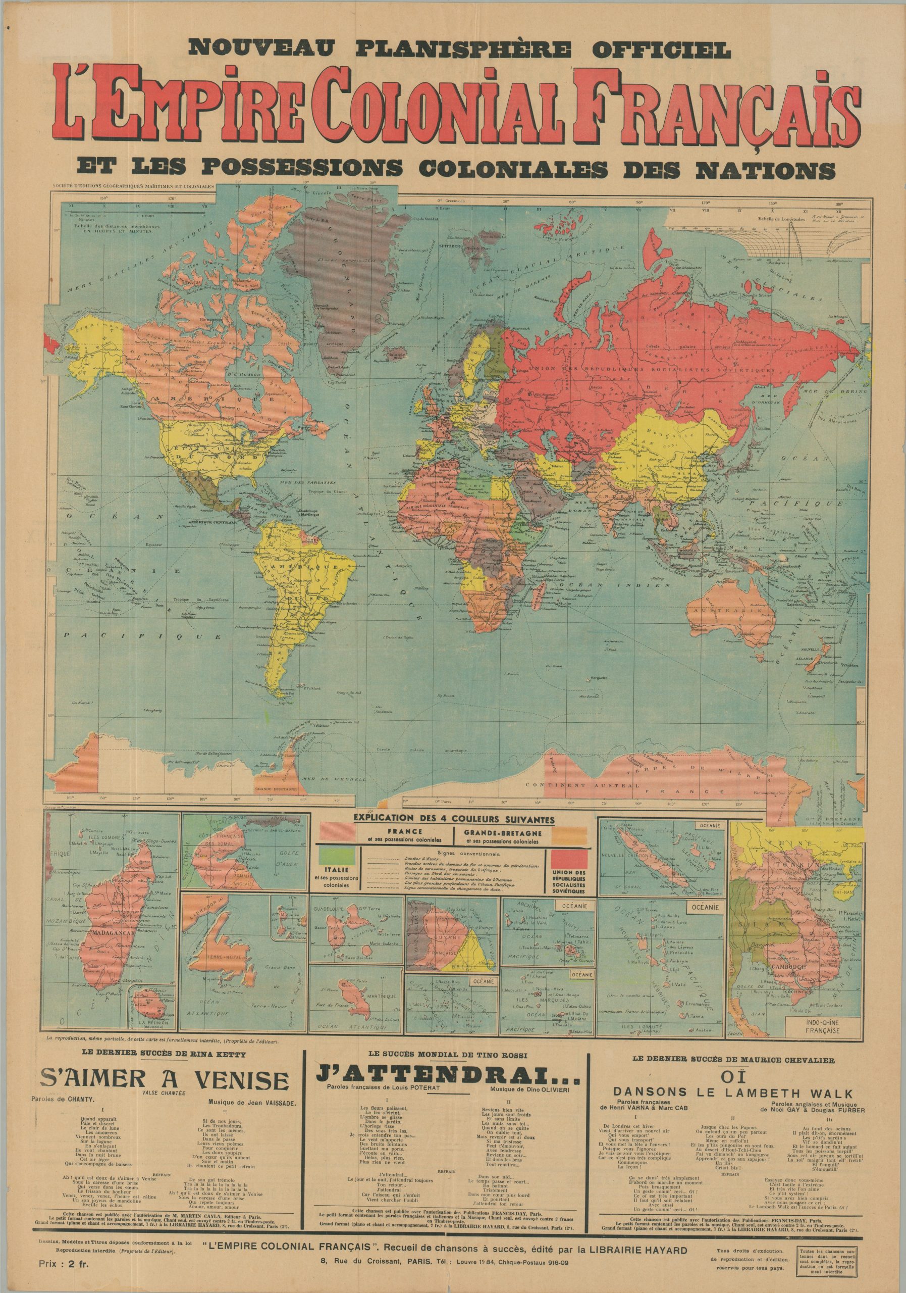
The height of the French global empire, in comparison to the other greatest terrestrial powers.
1 in stock
Description
This interesting and ephemeral map of the world was published as a promotional piece by Librairie Hayard of Paris. Four colors – pink, orange, green, and red highlight the global empires of France, Britain, Italy, and the Soviet Union, respectively. From the deserts of northern Africa to remote islands in the Pacific Ocean, French territorial claims were near their peak, with insets along the bottom presenting some of the more far-flung possessions.
The image presents a clearly-defined overview of the world near the end of the Interwar Period – state borders, limits of human habitation, primary sea routes, and railways penetrating the most remote areas highlight the increasing globalization of the 20th century.
The map, undated, was designed by the Societe d’Editions Geographiques Maritimes et Coloniales around 1936, based on the Italian presence in East Africa. The patriotic piece includes the text for numerous French songs along the bottom and the verso.
Map Details
Publication Date: c. 1936
Author: Societe d'Editions Geographiques Maritimes et Coloniales
Sheet Width (in): 23.50
Sheet Height (in): 33.60
Condition: B+
Condition Description: Color printed map on a large single sheet of newspaper, lightly toned in the margins and faintly worn along old folds. Very good condition overall.
$275.00
1 in stock