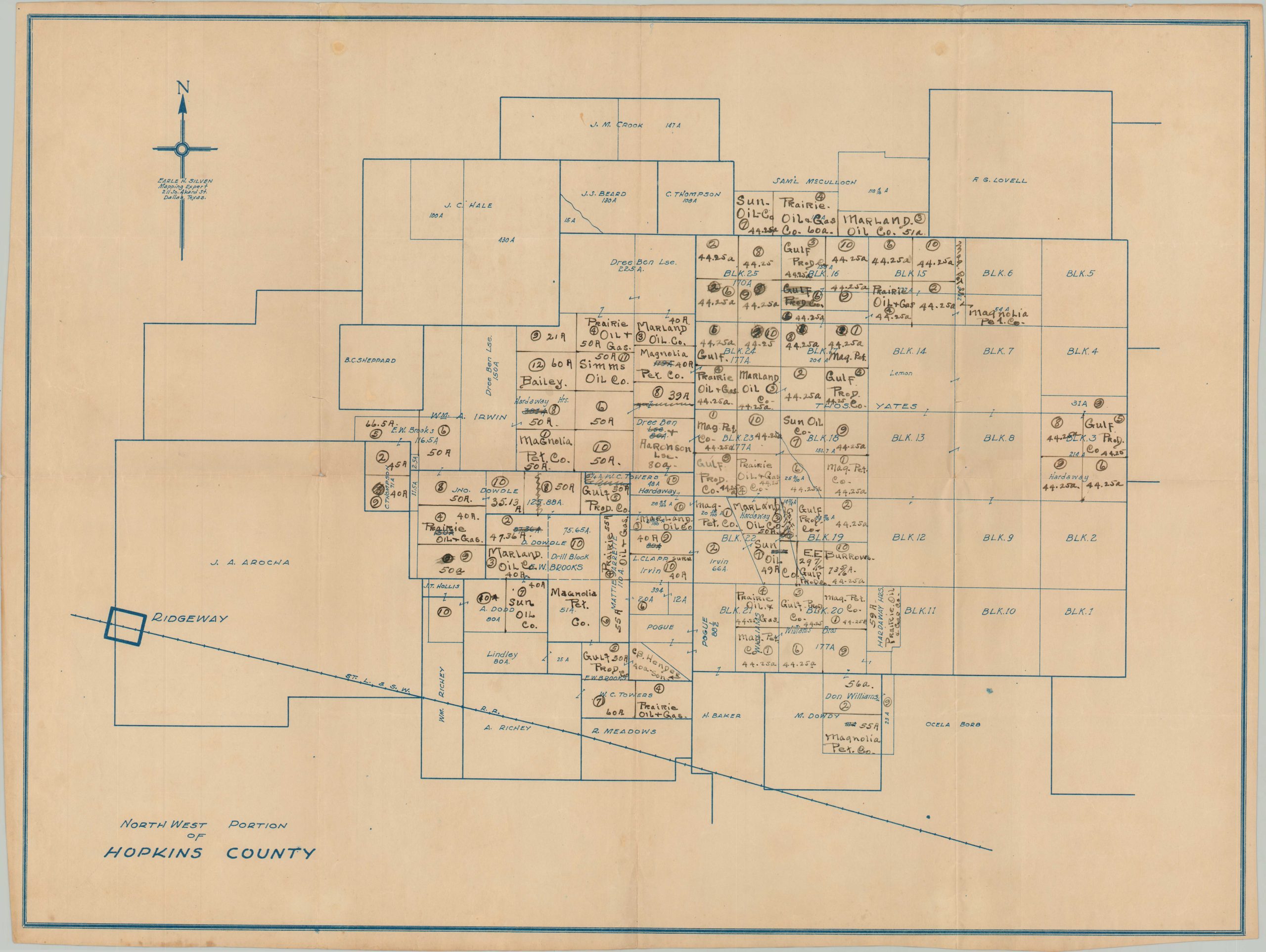
North West Portion of Hopkins County
$350.00
1920s plat map, possibly designed by a local member of the KKK.
1 in stock
Description
This blueprint cadastral map covers the northeastern portion of Hopkins County, Texas. Various landowners and lease holders are noted throughout, with manuscript updates noting a number of oil companies including Prairie Oil & Gas, Sun Oil, and Magnolia Petroleum Company. The small town of Ridgeway can be seen in the lower left, situated on the line of the St Louis & Southwestern Railway.
Drawn by Earle H. Silven, self-described ‘Mapping Expert’ in Dallas. Difficult to date, but probably issued in the mid-1920s. OCLC notes three other maps by Silven (this example is unlisted) dating between 1922 and 1929. Interestingly, modern research on the Klu Klux Klan identifies a man with the same name as a high-ranking member of the hate group during the same period.
Map Details
Publication Date: c. 1930
Author: Earle H. Silven
Sheet Width (in): 28.5
Sheet Height (in): 21.5
Condition: A-
Condition Description: Creased along old fold lines. Two small spots visible in the upper corners, near the edge, and scattered soiling in the lower left corner. Numerous manuscript annotations in old black ink scattered throughout the image. Very good condition overall.
$350.00
1 in stock

