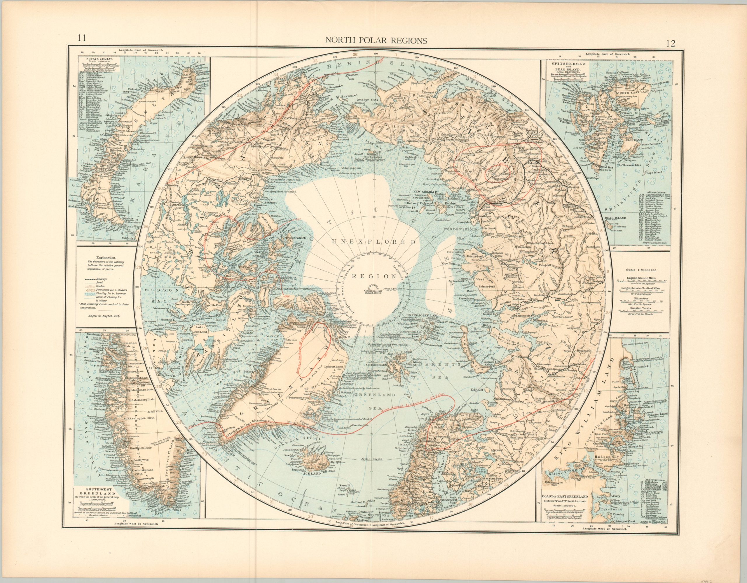
North Polar Region
$50.00
Mapping polar expeditions in the late 19th century
1 in stock
Description
This incredibly detailed map covers a large portion of the Northern Hemisphere centered on the (then unexplored) Arctic Polar Region. It was published in London around 1898 by the Times Company as part of The Times Atlas. Apart from noting typical information like geographic features, major settlements, and political boundaries, the image also reflects the ongoing efforts to successfully reach the North Pole – one of the few remaining milestones available to intrepid explorers.
Numerous references are made to sightings and observations throughout the second half of the 19th century, though it would be approximately another decade before Frederick Cook or Robert Peary (allegedly) reached the North Pole. Inset maps in each corner show the Arctic areas of Nova Zemlya, Spinsbergen, Southwest Greenland, and East Greenland.
Map Details
Publication Date: c. 1898
Author: The Times
Sheet Width (in): 21.75
Sheet Height (in): 16.9
Condition: A-
Condition Description: Faintly toned around the outer edges of the sheet. Light wear and a few small tears also present, confined to the margins well away from the image. Very good to near fine.
$50.00
1 in stock