North Dakota [and] South Dakota
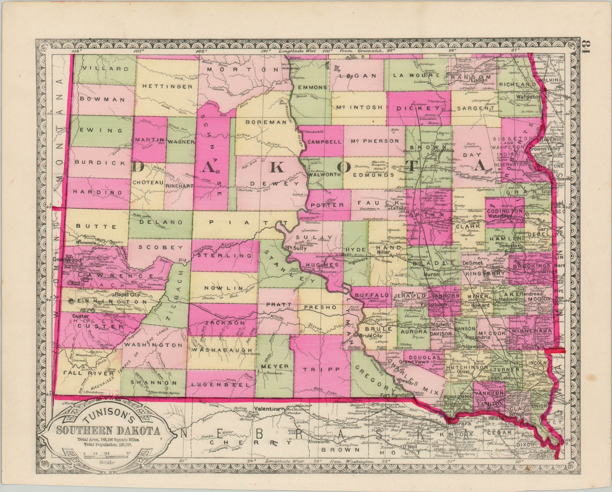
Double sided map of the Dakotas issued a few years before statehood.
Out of stock
Description
This detailed map shows the northern and southern portions of the Dakota Territory, alluding to the eventual states that would be created from the area less than five years after publication. Each half shows an early county configuration and the extensive growth of the railroads. Distances between various points on the line are noted.
Settlements are heavily concentrated along these iron rails and navigable waterways, but otherwise interior details are sparse apart from geographic features. The image still shows Yankton as the territorial capital, even though it was moved to Bismarck two years prior to issue. The map was engraved and published by H.C. Tunison in 1885.
Map Details
Publication Date: 1885
Author: H.C. Tunison
Sheet Width (in): 14.00
Sheet Height (in): 11.20
Condition: A-
Condition Description: A bit of soiling visible in the margins and a few small spots of foxing within the image. Features bright original hand color.
Out of stock


