
North Circumpolar Regions
$60.00
The vast polar unknown.
1 in stock
Description
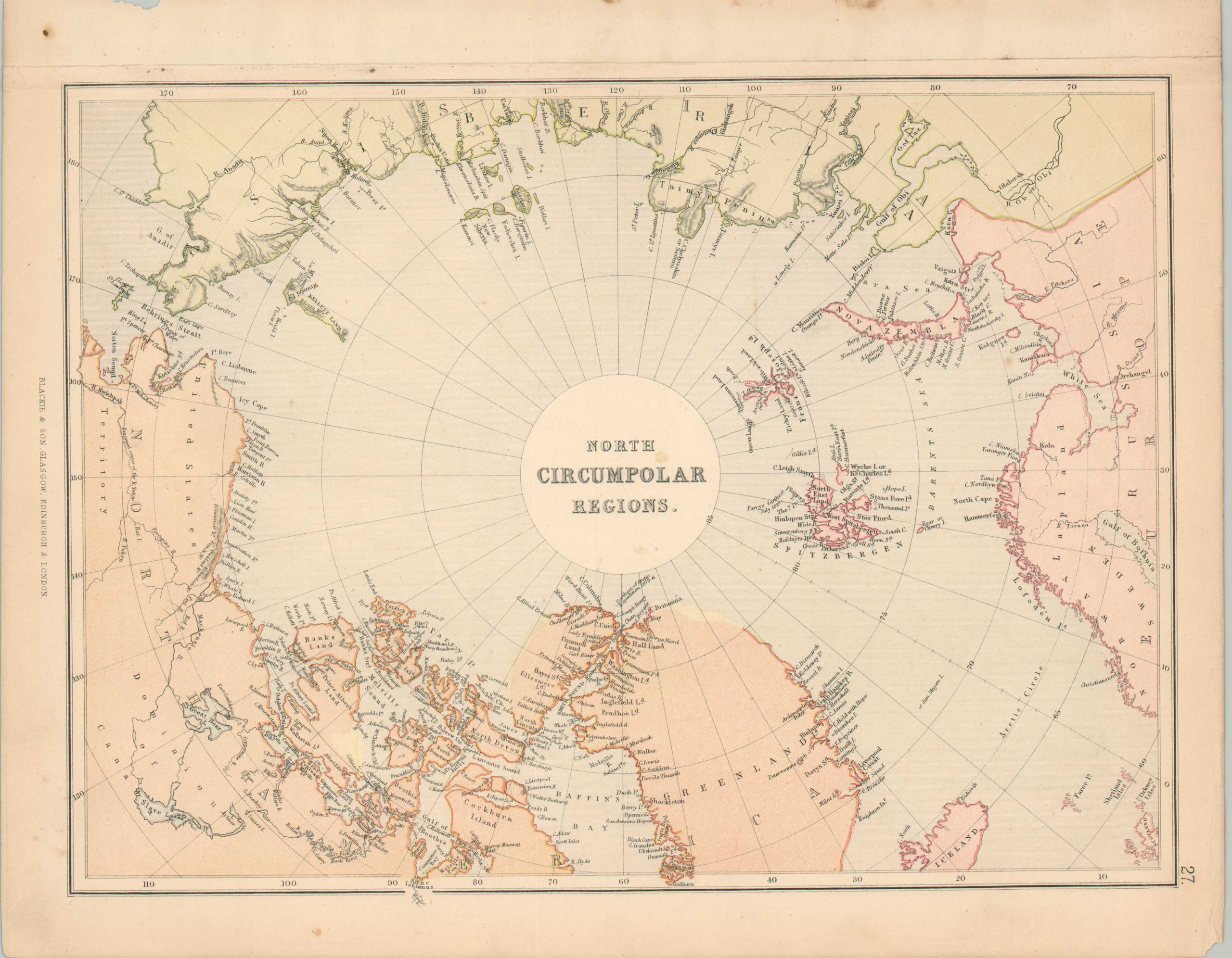
This appealing steel engraved map of the Arctic Circle was published around 1880 by Blackie & Son. Much of the ‘north circumpolar region’ remains unmapped, with points of furthest advance noted for William Edward Parry (1827) and the British Arctic Expedition (1875-76). Oscar and Peterman Lands are situated at the highest latitude, though dotted coastlines reflect circumstantial evidence of their existence. The North Pole remained one of the last great unmapped regions of the world in the late 19th century and was a prized claim for many contemporary explorers.
Map Details
Publication Date: c. 1880
Author: Blackie & Son
Sheet Width (in): 15.1
Sheet Height (in): 12.1
Condition: B+
Condition Description: Ragged upper edge, where previously bound, and toned margins. A few scattered spots, the largest of which is near the center of the sheet. Good to very good overall.
$60.00
1 in stock