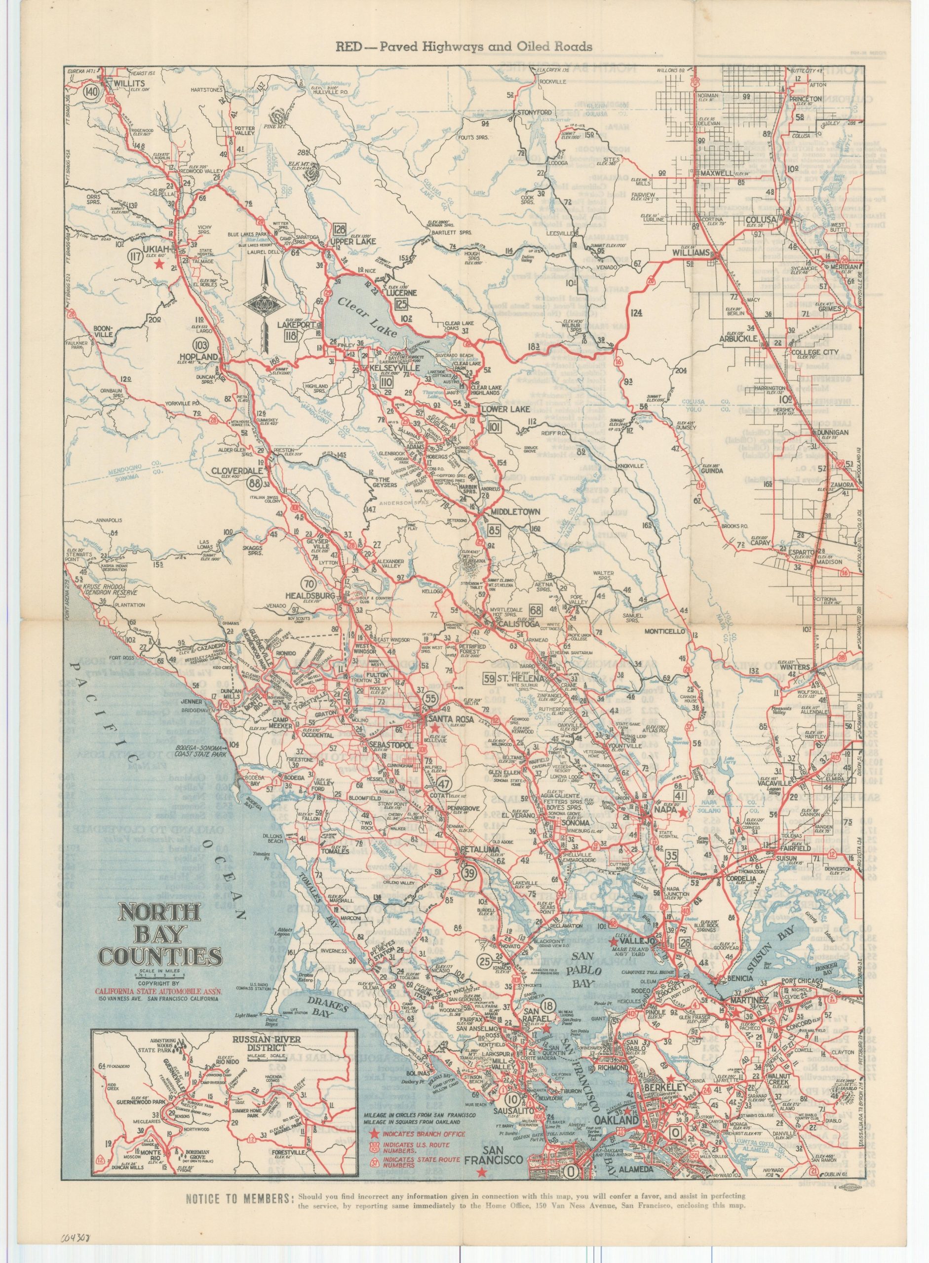
North Bay Counties
$150.00
Paved roads of the North Bay counties by the CSAA.
1 in stock
Description
This interesting postwar road map covers a large area immediately north of San Francisco that includes portions of Marin, Mendocino, Sonoma, Napa, Solano, and Contra Costa Counties. The image depicts the world-renowned wine regions, Clearlake, a part of Mendocino National Forest, and a simple overview of the primary roads around the Bay Area. An inset of the Russian River District, officially organized just a few years prior, can be seen in the lower left.
Paved highways and oiled roads are highlighted in red, while streets made of gravel or dirt are shown in black. Distances between points and elevation grades are noted, reflecting the far different calculations necessary for mid-century automobile tourism. Further distances are provided from San Francisco (circles) and Oakland (squares). A smattering of locations of interest is labeled, including various resorts, country clubs, geographic features, colleges, state institutions, and even a few wineries such as Stag’s Leap. Lists of recommended hotels and distance tables for primary highways are provided on the verso.
Published and copywritten around 1945 in San Francisco by the California State Automobile Association. C.S.A.A. branch offices are noted throughout the image with bright red stars.
Map Details
Publication Date: c. 1945
Author: California State Automobile Association
Sheet Width (in): 12.9
Sheet Height (in): 18.1
Condition: A-
Condition Description: Light wear and some faint discoloration visible along originally issued fold lines, notably the horizontal centerfold. Spots of wrinkling at fold intersections and a few small edge tears. Very good overall.
$150.00
1 in stock

