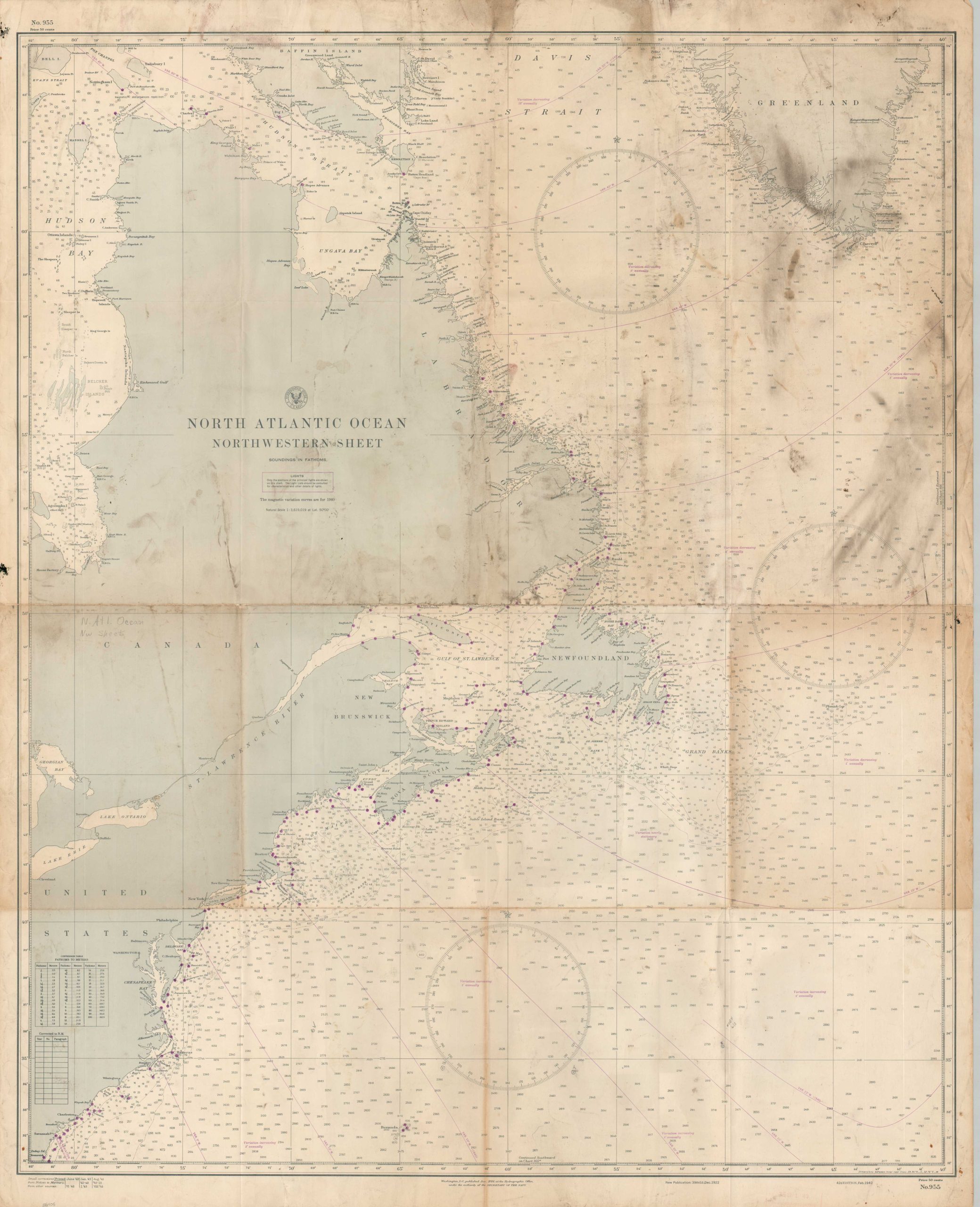
North Atlantic Ocean Northwestern Sheet
$125.00
The deadly waters of the North Atlantic during World War II.
1 in stock
Description
This heavily soiled nautical chart of the North Atlantic Ocean was published by the United States Navy Hydrographic Office in 1942, with updates made through August of the following year according to a table in the lower left corner. It presents the Atlantic Coast north of Savannah, Georgia, Hudson’s Bay, and the southern tip of Greenland. Depth soundings are marked throughout and purple dots denote the location of navigational beacons and lights. During World War II, there were over 100 ships sunk across the vast region.
Map Details
Publication Date: 1943
Author: United States Hydrographic Office
Sheet Width (in): 34.75
Sheet Height (in): 43.25
Condition: B-
Condition Description: Large printed map on thick, sturdy paper. Heavy creasing along fold lines and heavy surface soiling, concentrated in the upper right. A dry, dark substance present in the margins. Scattered pencil annotations throughout, reflecting probable prior use (hence how dirty it is). Fair condition overall, though with an attractive authentic patina.
$125.00
1 in stock