
North America
$110.00
North America as it transitions from the unknown to the known.
1 in stock
Description
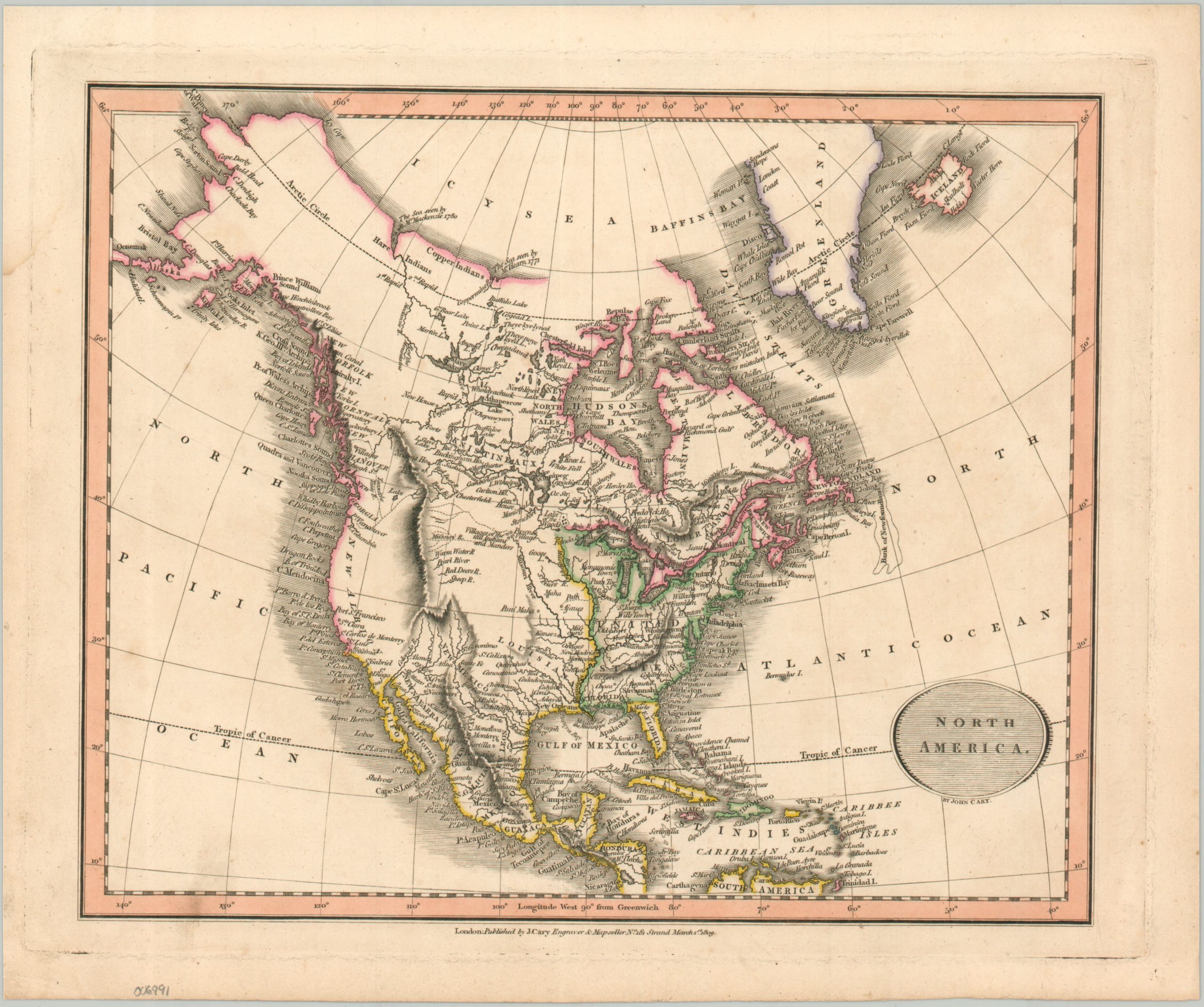
This attractive map of North America was designed and published by the London-based mapmaker John Cary in 1809. Outline color delineates the approximate territorial claims of the United States (green), Spain (yellow), and the United Kingdom (red), though Russian Alaska is mistakenly assigned to the last empire and the Louisiana Purchase has not apparently been registered. An Icy Sea across much of the Arctic gives an impression of a probable Northwest Passage.
Interior details are relatively sparse, though the probable course of the Missouri and Columbia Rivers are shown according to the journey of Lewis and Clark. The Rocky Mountains feature prominently and toponyms identify a variety of Native American villages, frontier settlements, and geographic features (real and imaginary).
Map Details
Publication Date: 1806
Author: John Cary
Sheet Width (in): 13.25
Sheet Height (in): 10.9
Condition: A-
Condition Description: Copperplate engraved map with dome darkening from the plate strike visible in the margin. A small smudge in the lower right enters the neatline, but overall the image is clean and in good shape. Attracted hand color.
$110.00
1 in stock