North America
$350.00
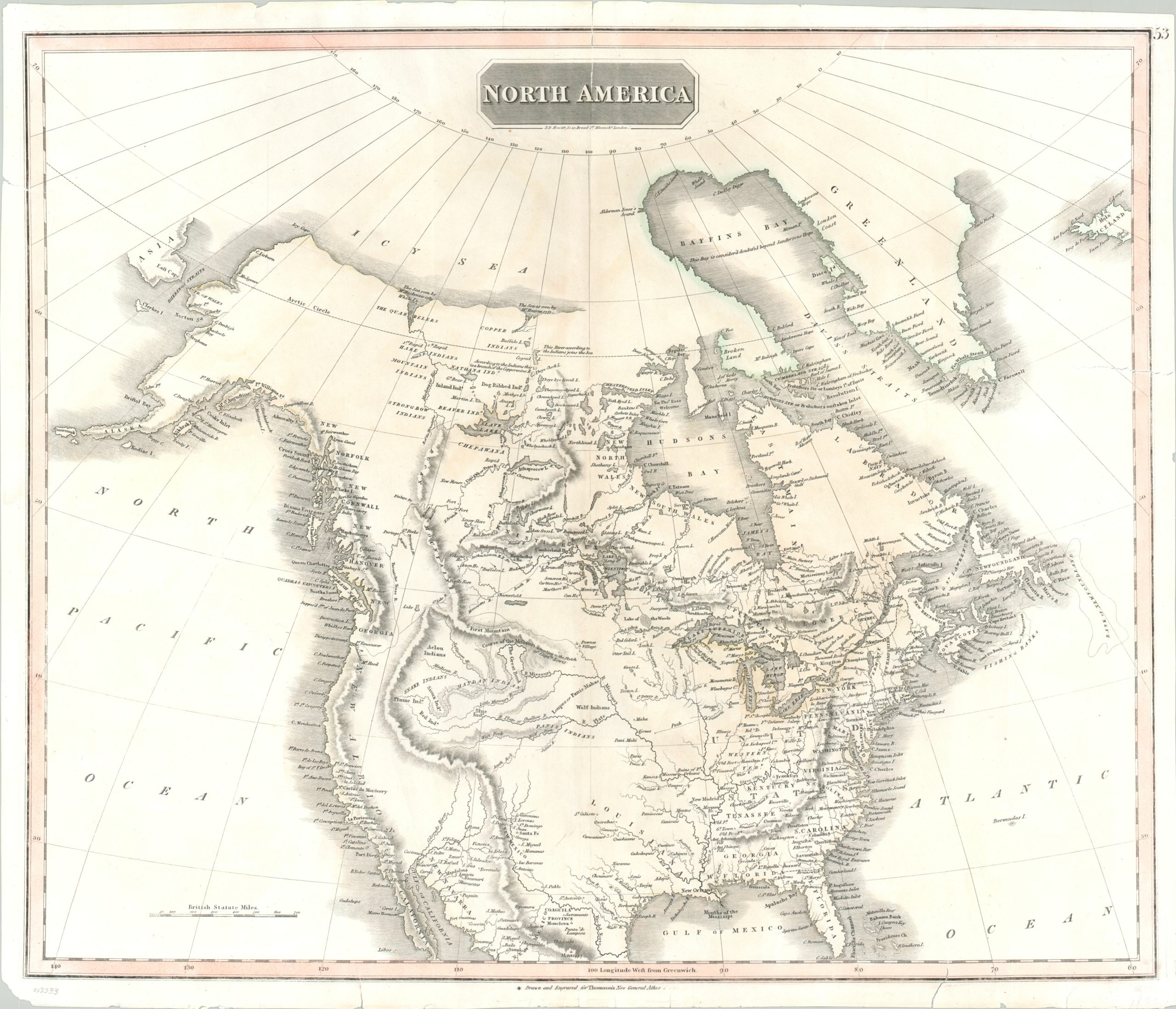
Fascinating map of North America published in the decades following the Lewis & Clark Expedition.
1 in stock
Description
This antique map of North America shows the continent in the first quarter of the 19th century, at a time when there was tremendous uncertainty about the geographic composition of its interior. The latest available information from Spanish, French, British, and American sources is presented within the image. Labels identify settlements, geographic features, and general regional information – interestingly the majority of international and state borders are omitted.
A handful of annotations provide fascinating details; such as the course of the Missouri according to Lewis and Clark, skepticism about the size of Baffin Bay, and the location of a Northwest Fur Company settlement. The presence of Native American villages, frontier fortifications, and large blank spaces – presumably areas unknown – add further to the geographic charm of the early 1800’s.
Published in Edinburgh by John Thomson for inclusion in the 1820 edition of his New General Atlas.
Map Details
Publication Date: 1820
Author: John Thomson
Sheet Width (in): 24.25
Sheet Height (in): 20.50
Condition: B
Condition Description: Numerous tears around the outer edges of the sheet have been repaired on the verso with archival tape, including reinforcing the upper and lower margins. A bit of light discoloration along the centerfold, but overall in good condition.
$350.00
1 in stock