North America
$200.00
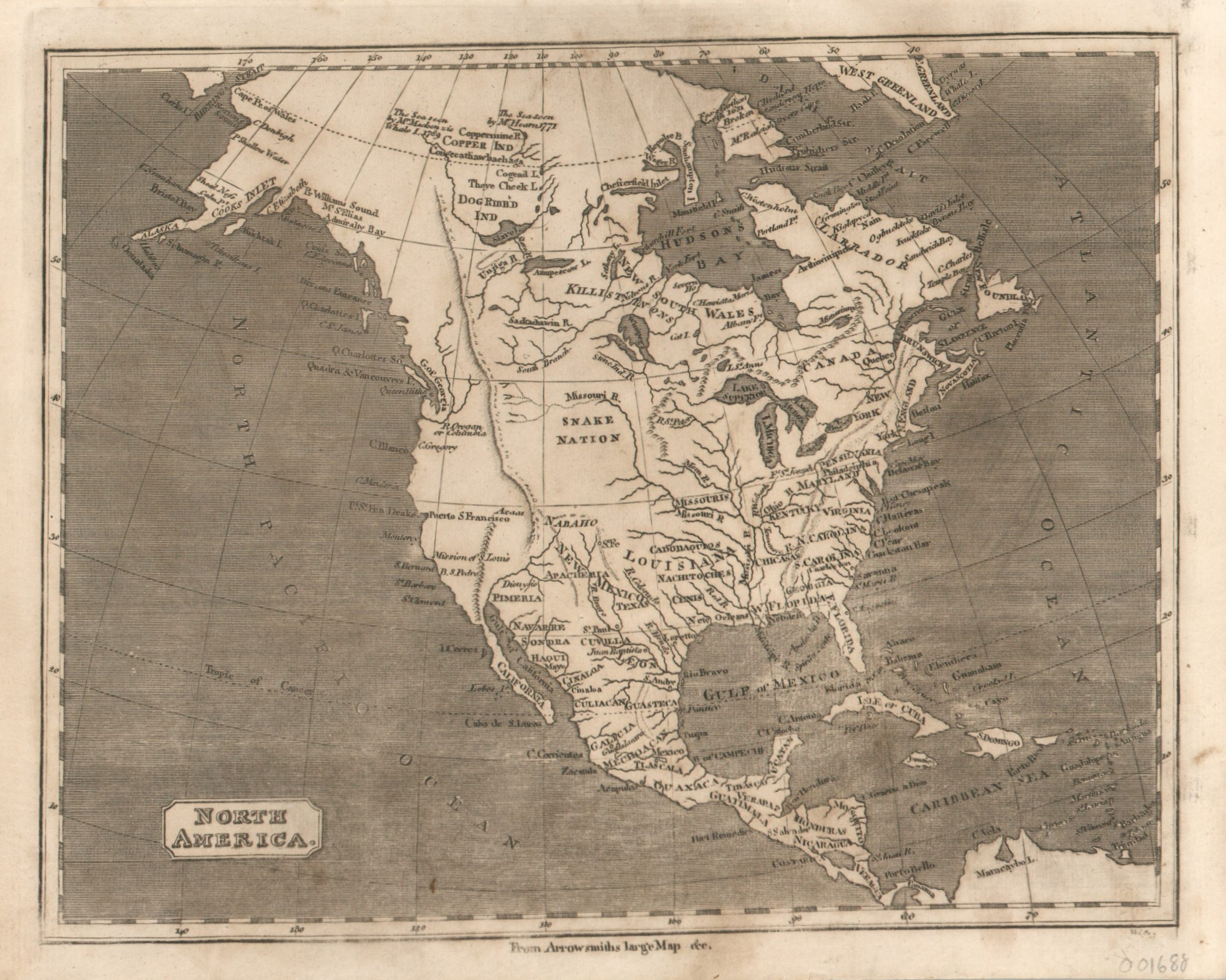
An interesting, if somewhat outdated, look at North America from 1820.
1 in stock
Description
This great little map of North America shows a fascinating perspective of the continent from the early part of the 19th century. A scattered dispersal of regional names reflects colonial territories, Native American lands, and vague approximations of a handful of states. Several notes in the Arctic Circle place exploration results from the 17th and 18th centuries, and three possible courses are shown for the headwaters of the Missouri River.
Though these features would have ostensibly been included to provide evidence of the latest research, the image was practically outdated at the time of publication. The reference at the bottom of the image, ‘From Arrowsmiths large map’ is a further attempt to lend authority – though it may reference a map issued by the famed English cartographer much earlier!
Published in Philadelphia in 1820 by Benjamin Warner and Matthew Carey, for inclusion in A General Atlas: Being a Collection of Maps of the World and Quarters…
Map Details
Publication Date: 1820
Author: Matthew Carey
Sheet Width (in): 10.10
Sheet Height (in): 8.25
Condition: B+
Condition Description: A bit of darkening from the impression and some abrasion has resulted in certain areas being lighter than others, most noticeably in the Gulf of Mexico. Ragged upper edge, and a few small stains in the margins. Expertly cleaned and in good condition.
$200.00
1 in stock