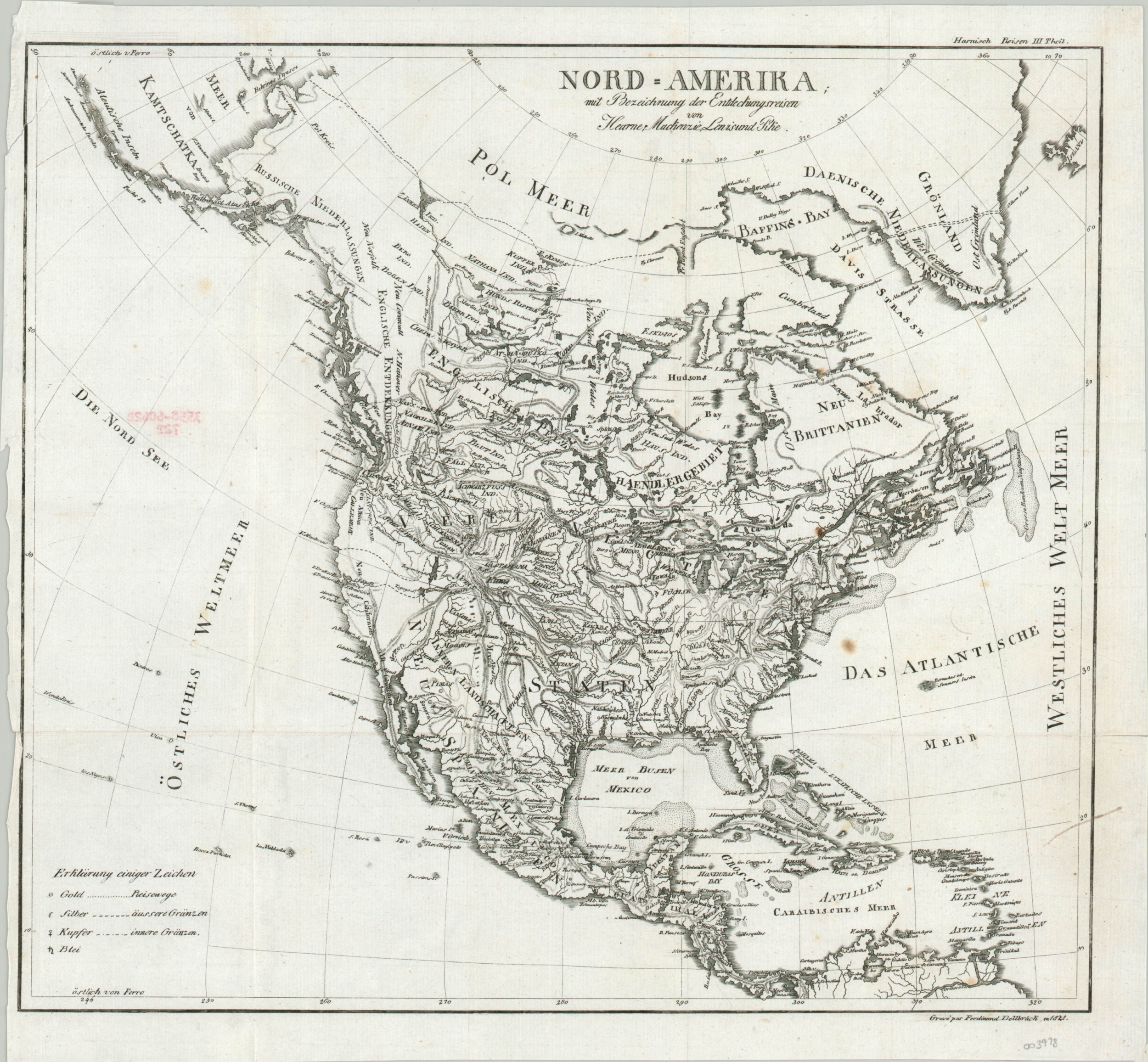
Nord Amerika mit Bezeichnung der Entdeckungsreisen von Hearne, Mackenzie, Lewis and Pike
$300.00
Filling in the map of North America in the early 1820s.
1 in stock
Description
This fascinating German-language map of North America incorporates the exploratory journeys of Samuel Hearne, Alexander Mackenzie, Lewis & Clark, and Zebulon Pike, at least according to the long title. Though it’s possible the latest geographic information is included within the image, the topographic detail leaves much to be desired. Simple hachure outlines a gigantic system of connected mountain ranges across the American West and much of Canada.
Some ridges are part of the ill-defined national borders which allocate to the United States a huge swathe of territory that includes land claimed by Britain and the newly independent Mexico (still labeled as New Spain). Likely possibilities for the Northwest Passage can be seen in the Arctic and a phantom island, Bermeja, is located off the coast of Mexico. A legend in the lower-left identifies the symbols used to denote gold, silver, copper, and lead mines, alluding to the fabulous wealth of the continent over 2 decades before the California Gold Rush.
Engraved by Ferdinand Dellbruck in 1821 and likely published in a German travel volume shortly thereafter.
Map Details
Publication Date: 1821
Author: Ferdinand Dellbruck
Sheet Width (in): 15
Sheet Height (in): 13.5
Condition: B+
Condition Description: Red rubberstamp applied to the verso shows through the paper somewhat and there are a few scattered spots in the center right. Light creasing along former fold lines and a narrow left margin with a small 1" tear, repaired on the verso with archival tape.
$300.00
1 in stock