
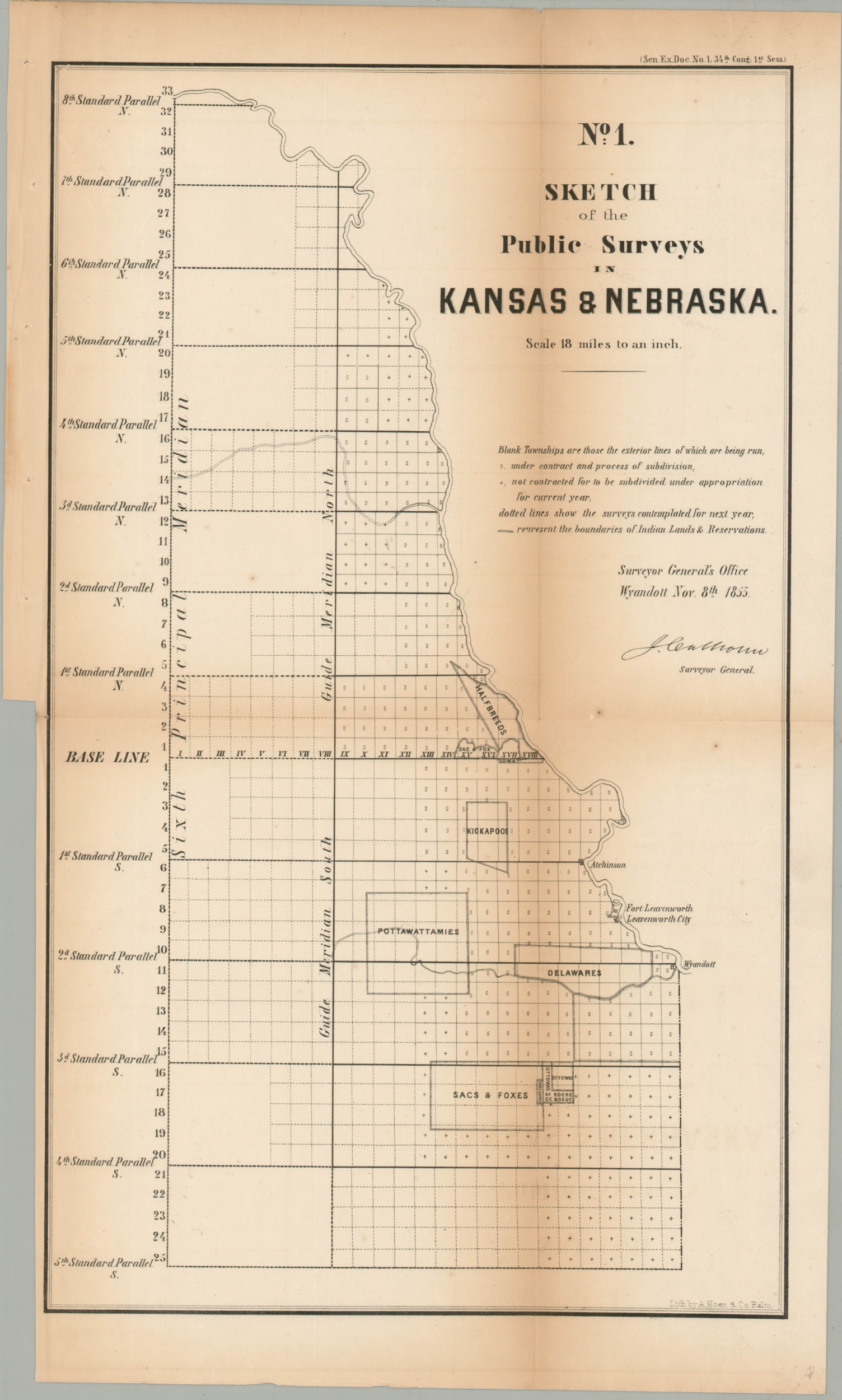
No. 1 Sketch of the Public Surveys in Kansas & Nebraska
$250.00
One of the earliest maps to show the newly created Kansas and Nebraska Territories.
1 in stock
Description
This interesting map shows the progress of surveying performed by the General Land Office in the first years of the Kansas and Nebraska territories, created by the Kansas-Nebraska Act of 1854. Information below the title block provides details on the outlined townships which hug the Missouri River in the eastern portion of the territories.
Organized settlements are limited and include only Atchinson, Fort Leavenworth, Leavenworth City, and Wyandott (Kansas City). Several Native American reservations are outlined. Notable among these is the land set aside for ‘Halfbreeds’ – children of French-Canadian fur trappers and members of local tribes.
The map was compiled by the General Land Office under Surveyor General John Calhoun and published as part of a Senate Report in 1855. Lithography by A. Hoen & Company of Baltimore. At the time of publication, the region was suffering from intense violence as a result of pro and anti-slavery factionalism. Known as ‘Bleeding Kansas’, the conflict stemmed from the issue of popular sovereignty and the legality of slavery in the new states.
Map Details
Publication Date: 1855
Author: General Land Office
Sheet Width (in): 12.5
Sheet Height (in): 21.75
Condition: B+
Condition Description: Moderate toning along former fold lines and a few tiny scattered spots visible just to the right of the image. Fold lines are worn and show light creasing. Good to very good overall.
$250.00
1 in stock