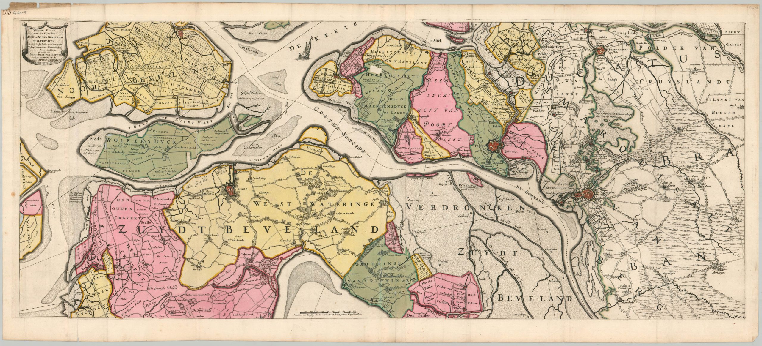
Nieuwe Kaart van de Eilanden Zuid en Noord Beveland Wolfersdyk…
$150.00
An early map of the largest National Park in the Netherlands.
1 in stock
Description
This highly detailed copperplate engraved sheet is the upper half (only) of a large map covering the mouth of the Scheldt River in the Netherlands. The Eastern Schedlt is shown running through a complex series of lowlands, islands, dykes, and canals. Coastal settlements are shown with their respective prominent features, especially fortifications and gardens. A fascinating variety of industries, villages, and landmarks are labeled throughout the image, which highlights the extensive infrastructure needed to maintain the coastal integrity of the Netherlands.
Example at Utrecht University.
Map Details
Publication Date: 1726
Author: Renier Ottens
Sheet Width (in): 45.9
Sheet Height (in): 20.75
Condition: B
Condition Description: Upper half (two sheets, joined at center) of a four sheet map. Full old color, with the oxidization from the green pigment resulting in numerous chips and small holes with some image loss. Creasing along vertical folds, as issued, and moderate wear in the margins. About good condition overall.
$150.00
1 in stock