Nieuwe Kaart van America
$150.00
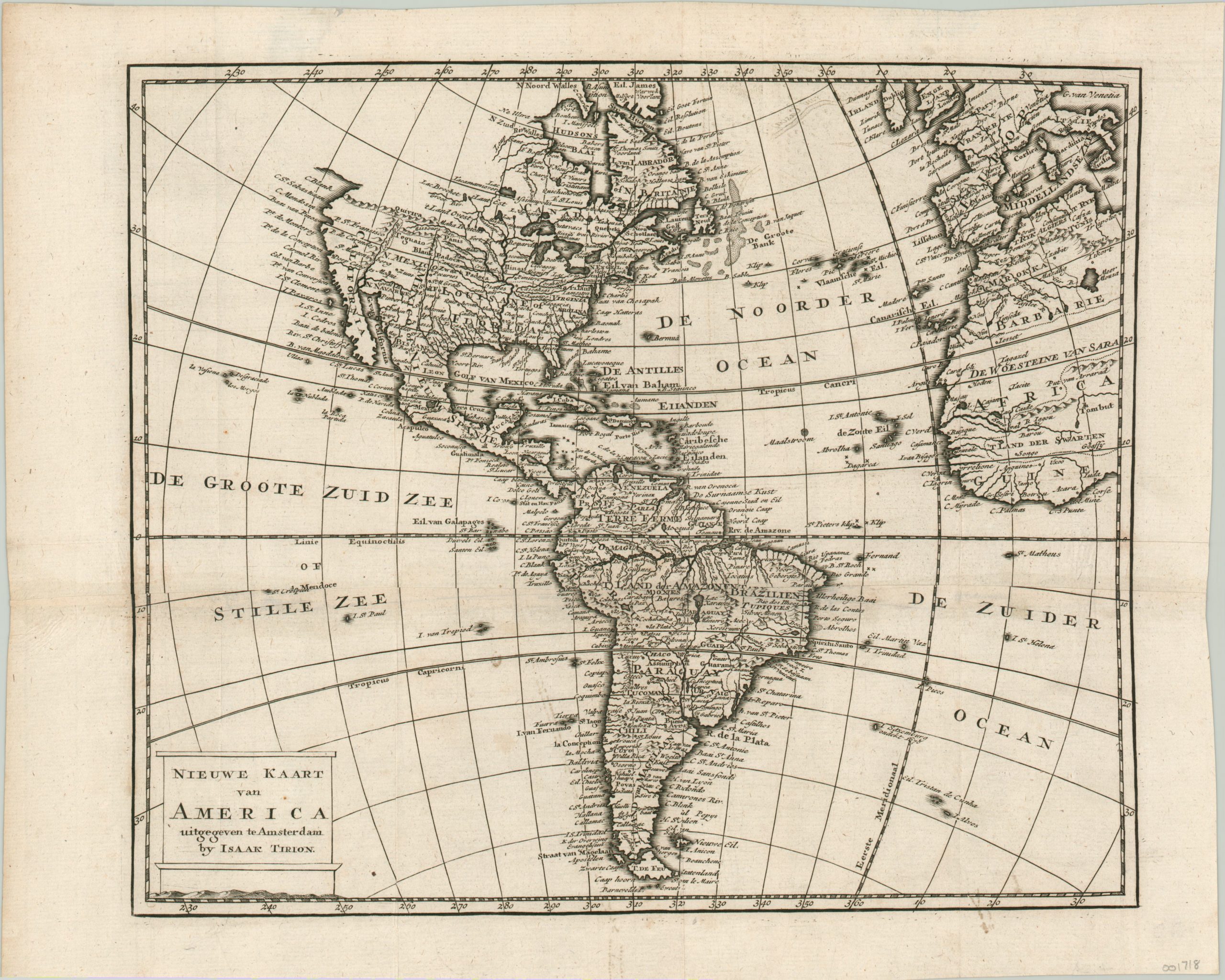
A misprinted map of the Americas.
1 in stock
Description
This interesting 18th century map of the Western Hemisphere was published by Isaak Tirion c. 1765. Fascinating contemporary geographic details are presented on four continents. North America includes a diverse mix of colonial place names and Native American tribes, with the Mississippi River running prominently through the middle. The Pacific Northwest is almost entirely blank, but a few cartographic myths are present in Quivira, the Groot River, and a tantalizing westward opening in Hudson’s Bay.
South America features an enormous Amazon River running from east to west, the fictitious Lake Xarayes in the center, and ‘The Land of Magellan’ in the south. Spurious river systems can be seen in Africa (no Gambia), though the legendary Timbuctoo’s position on the Niger is surprisingly accurate. Western Europe is also included, though the pictorial topography is notably absent.
Map Details
Publication Date: c. 1765
Author: Isaak Tirion
Sheet Width (in): 15.00
Sheet Height (in): 12.00
Condition: A-
Condition Description: A dark impression on a clean sheet, with very faint wear along two vertical fold lines. There is an original misprinted area across a horizontal seam where the two sheets overlap - see near Land der Amazones/Brazilien in South America.
$150.00
1 in stock