Newly Revised War Maps of Solomon Islands
$75.00
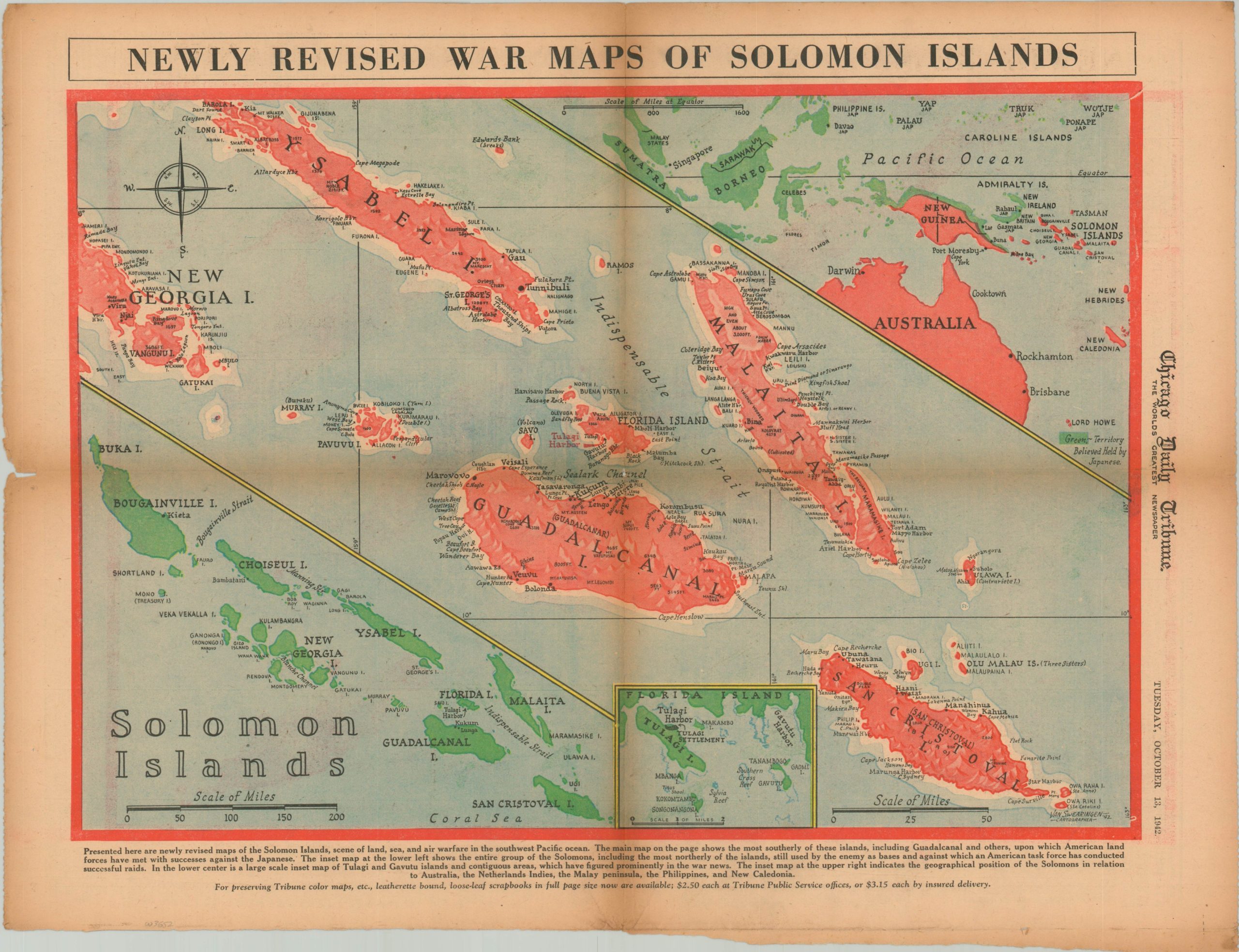
Early successes in the Pacific island hopping campaign.
1 in stock
Description
“Presented here are newly revised maps of the Solomon Islands, scene of land, sea and air warfare in the southwest Pacific ocean. The main map on the page shows the most southerly of these islands, including Guadalcanal and others, upon which American land forces have met with successes against the Japanese. The inset map at the lower left shows the entire group of the Solomons, including the most northerly of the islands, still used by the enemy as bases and against which an American task force has conducted successful raids.
In the lower center is a large scale inset of Tulagi and Gavutu islands and contiguous areas, which have figured prominently in the war news. The inset map at the upper right indicates the geographical position of the Solomons in relation to Australia, the Netherlands indies, the Malay peninsula, the Philippines, and New Caledonia.” [Text at bottom].
The map was designed by Van Swearingen in 1942 (signed lower right) and published in the October 13, 1942 issue of the Chicago Tribune. The following month, an American assault on the island of Bougainville would begin.
Map Details
Publication Date: 1942
Author: Van Swearingen
Sheet Width (in): 23.30
Sheet Height (in): 17.20
Condition: B+
Condition Description: News sheet is moderately toned throughout and shows discoloration along the horizontal centerfold. A .5" hole in the middle of the sheet has been repaired on the verso with archival tape.
$75.00
1 in stock