New York
$250.00
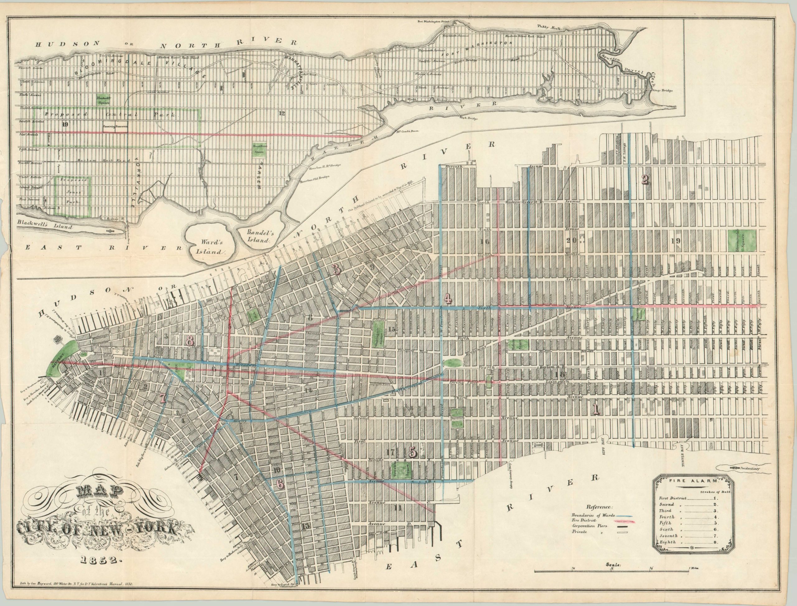
Two part map of New York contrasting the densely populated lower Manhattan with the largely rural upper portions of the island.
Description
This map was designed by George Hayward and issued in the 1852 edition of D.T. Valentine’s Manual to New York City. Within this wide-ranging publication is a host of information about the Big Apple, including its history, economy, political systems and cultural diversity. In addition to numerous prints, portraits of famous residents, and contemporary advertisements, Valentine’s Manual was also known for it’s detailed, yet legible maps.
This is one such example, which uses skilled cross hatching to show the city’s density without adding clutter. Color is scantly applied, but to great affect; setting the borders between wards and fire districts and highlighting the city’s woeful park system (Central Park would not be established until 1857). The fire districts compliment the information provided in the legend and underline the constant threat of disaster from conflagrations that plagued cities throughout the 19th century.
Map Details
Publication Date: 1852
Author: George Hayward
Sheet Width (in): 21.20
Sheet Height (in): 16.30
Condition: B
Condition Description: The left side of the map is ragged, with some wear entering the border of the image. Otherwise only minor soiling and creasing along fold lines.
$250.00

