New York Subways Elevated Lines
New York City at war.
Out of stock
Description
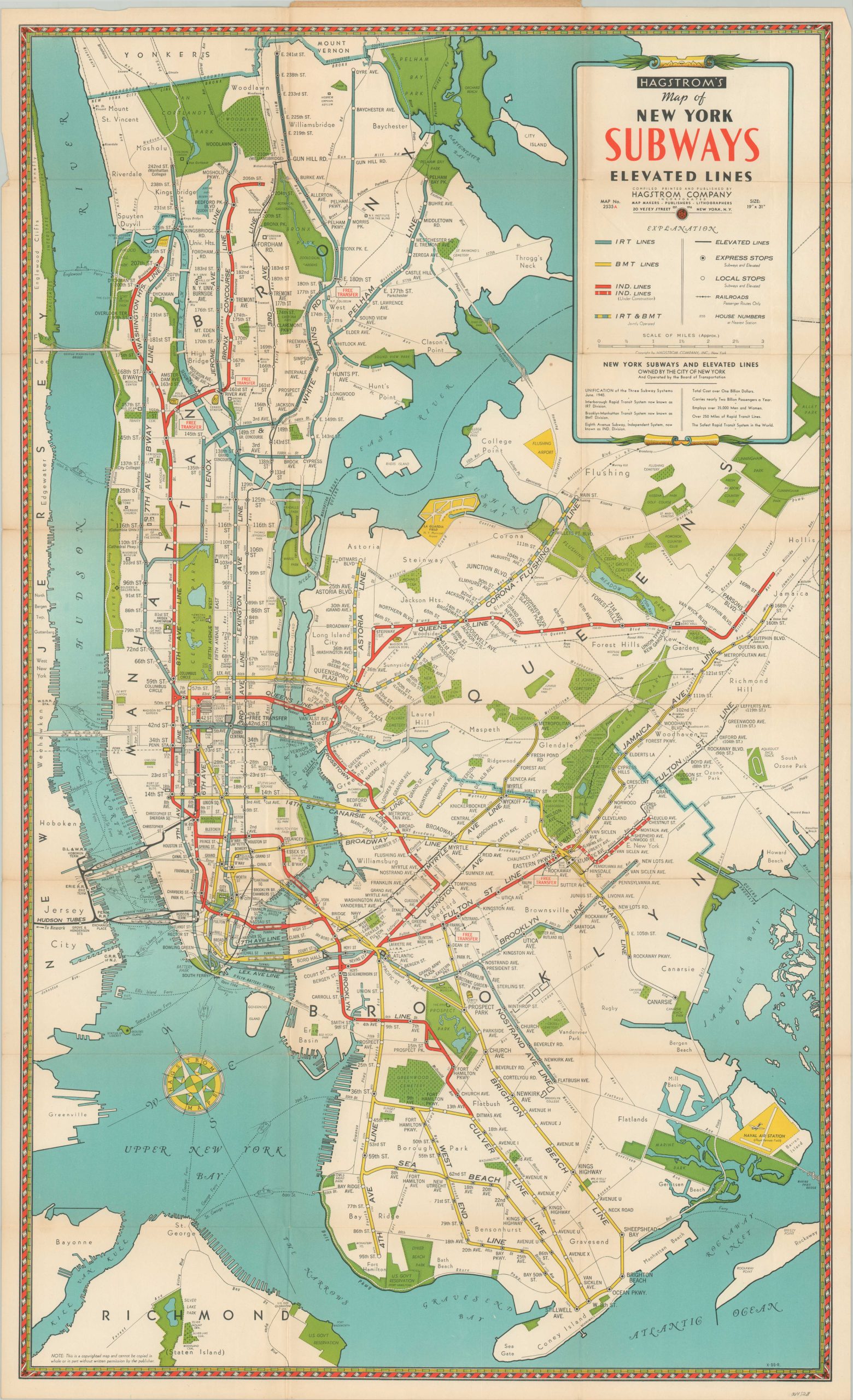
This detailed transportation map of New York City was published locally in 1942 by the Hagstrom Map Company. The routes of various subways, elevated lines, and steam railroads are noted according to the legend in the upper right. Immediately below, text provides a brief summary of the subway system, unified in 1940 and owned/operated by the city.
Of interest is the proposed construction of the Fault St. Line to Euclid Avenue – building was halted by the Great Depression and WWII and would not be completed until 1948. The map also identifies various locations of interest like parks, transportation hubs, public buildings, geographic features, and more. A note near the Brooklyn Battery Tunnel indicates it is scheduled to open in 1944.
Map Details
Publication Date: 1942
Author: Hagstrom Map Company
Sheet Width (in): 18.5
Sheet Height (in):
Condition: B+
Condition Description: Pocket map folded into 24 segments and affixed to original black paper wraps (front cover present, but separated). Creasing and some light wear along fold lines and around the outer edges of the sheet. Faint discoloration visible along a few fold lines. Good to very good overall.
Out of stock