New York Central Lines
$80.00
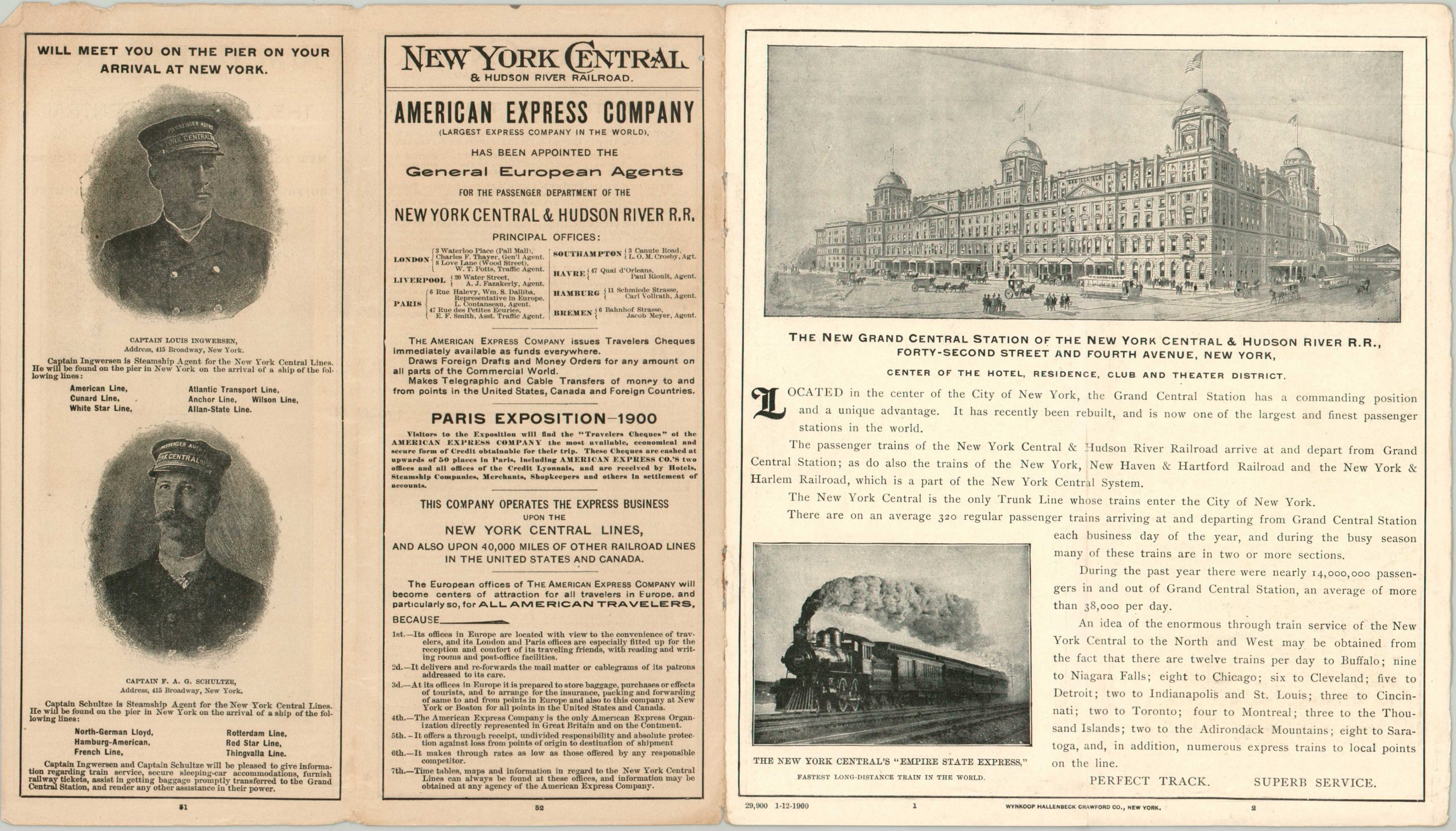
One of the first views of the brand new Grand Central Station, serving the lines of the New York Central Railroad.
1 in stock


Description
This detailed railroad map was issued by The Matthews-Northrup Company of Buffalo and covers much of the northeastern and midwestern United States. The image presents the various routes of the New York Central Railway and its connections.
A clearly distorted base map (note the size of Connecticut vs. that of Ohio) identifies place names and geographic features, while stations are crammed along each boldly noted line in operation. The map was included as the centerfold in a promotional brochure issued by the railroad in 1900. Text and photographs promote the newly completed Grand Central Station (opening that October), magnificent scenery, and luxurious accommodations. Timetables, a rate list, and advertisements for both the Paris Exposition of 1900 and the 1901 Pan-American Exposition in Buffalo are also included in the brochure.
Map Details
Publication Date: 1900
Author: Matthews-Northrup Company
Sheet Width (in): 15.75
Sheet Height (in): 9.00
Condition: B
Condition Description: Centerfold map in a brochure with 56 numbered panels and stapled binding, folded over twice. The first two sheets have become entirely separated and there's a bit of rusting and small holes from the staples, but otherwise the contents are in good condition overall. Slight wear along the outer edges and
$80.00
1 in stock