New York and Brooklyn
$195.00
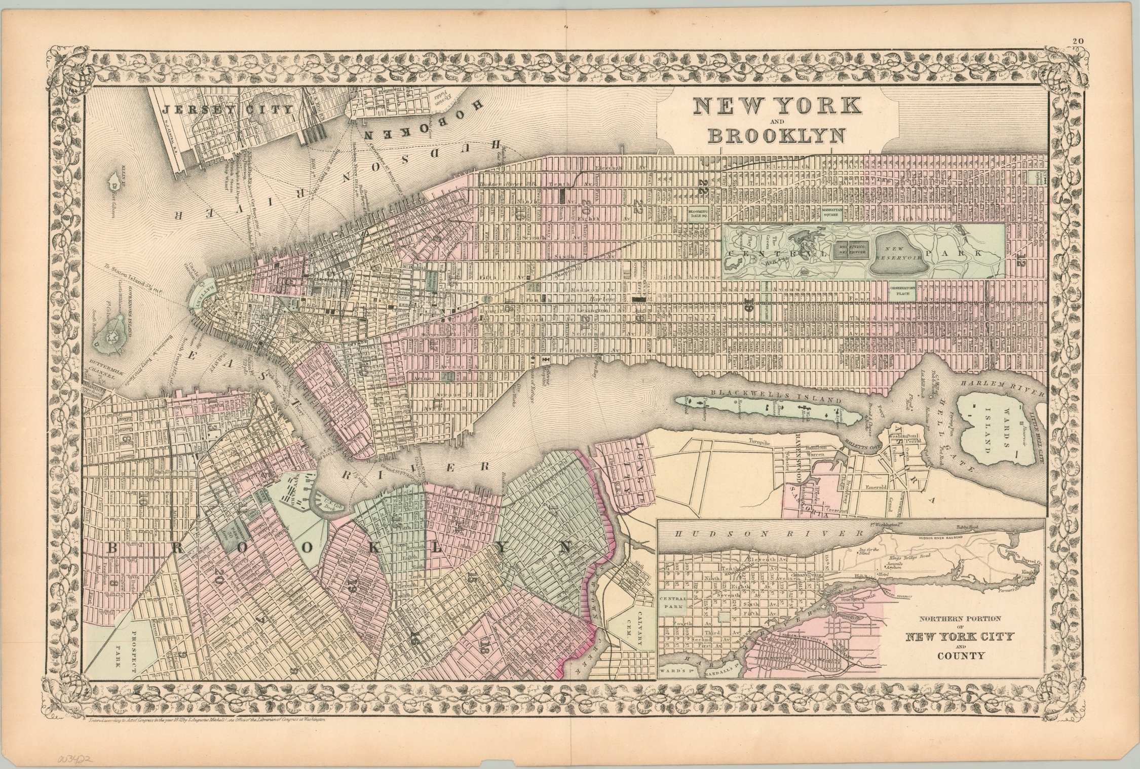
Map of New York published shortly after the city’s population hit 1 million.
1 in stock
Description
This attractively engraved map covers most of the cities of Brooklyn and New York (they wouldn’t merge until 1898), plus portions of Hoboken and Jersey City on the opposite bank of the Hudson River. An inset map in the lower right shows the northern half of Manhattan Island, in addition to what would eventually become the Bronx.
Wards are individually numbered and were colored by hand, likely with the assistance of a stencil. The image includes a wealth of contemporary details on transportation networks, the location of important buildings, and defensive fortifications. Of particular interest is Grand Central Depot, completed the year prior to publication and located not far from the orphan asylum.
Published by Samuel Augustus Mitchell in New York in 1872 as part of his New Universal Atlas.
Map Details
Publication Date: 1872
Author: Samuel Augustus Mitchell
Sheet Width (in): 22.50
Sheet Height (in): 15.00
Condition: A
Condition Description: Lightly toned and a few small tears around the outer edges of the sheet, but otherwise in near fine condition.
$195.00
1 in stock