
New York
$200.00
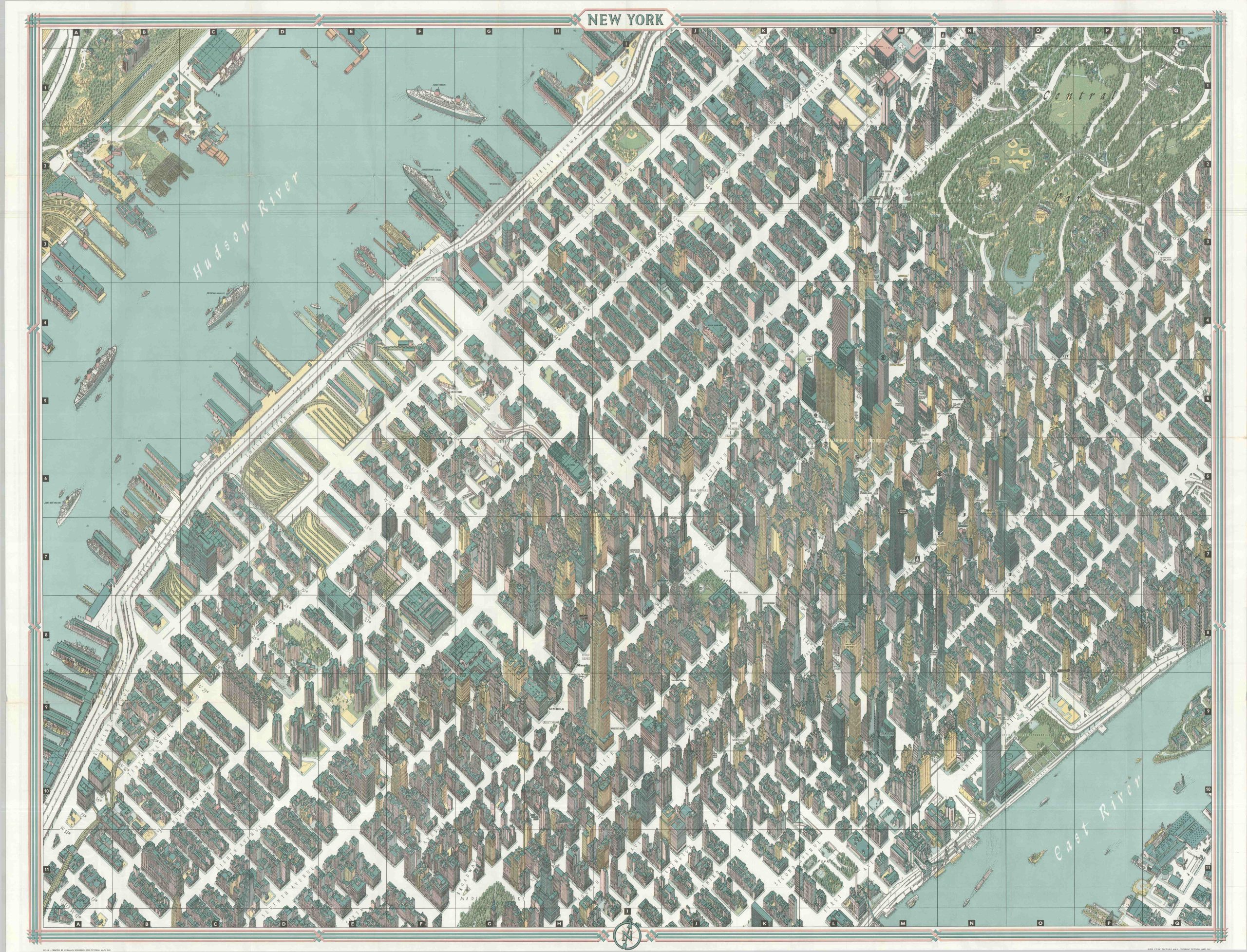
An uncommon variant of Bollmann’s iconic view of Manhattan.
1 in stock
Description
This finely detailed image captures Manhattan between 13th and 68th Streets with a precision previously unseen in the world of mass-produced commercial cartography. According to text in a contemporary guidebook, the bird ‘s-eye view is the first such map of New York City drawn since 1866. It was designed by the German immigrant Hermann Bollmann, who applied core mathematical principles to the numerous views he created throughout his career. This particular example was illustrated (by hand) using nearly 70,000 photographs taken from all across the city, including 17,000 images captured from the sky!
New York’s iconic skyscrapers are shown with incredible accuracy, in addition to port facilities, southern Central Park, dense residential districts, and distinct landmarks. Of notable interest are the Empire State Building, United Nations Headquarters, Lincoln Center, and the newly-completed Pan Am Building. Distances between quadrant lines are exactly 1,000 feet, allowing the reader to easily plot a sightseeing trip. To achieve the unique isometric projection and precise scale, “Bollmann has used several unique devices which remain his secret…and in this age of automation, Bollmann’s cameras are his only compromise with the present.”
Published in New York by Pictorial Maps, Inc. around 1963 as a souvenir for the upcoming New York World’s Fair (1964). This example was printed in Dortmund (West Germany) by Busche. Features a detailed transportation map of New York and the five boroughs on the verso.
Map Details
Publication Date: 1963
Author: Hermann Bollmann
Sheet Width (in): 43
Sheet Height (in): 33.75
Condition: A
Condition Description: Large-double sided map with light wear and creasing along original folds and in the margins. Very good to near fine condition overall.
$200.00
1 in stock