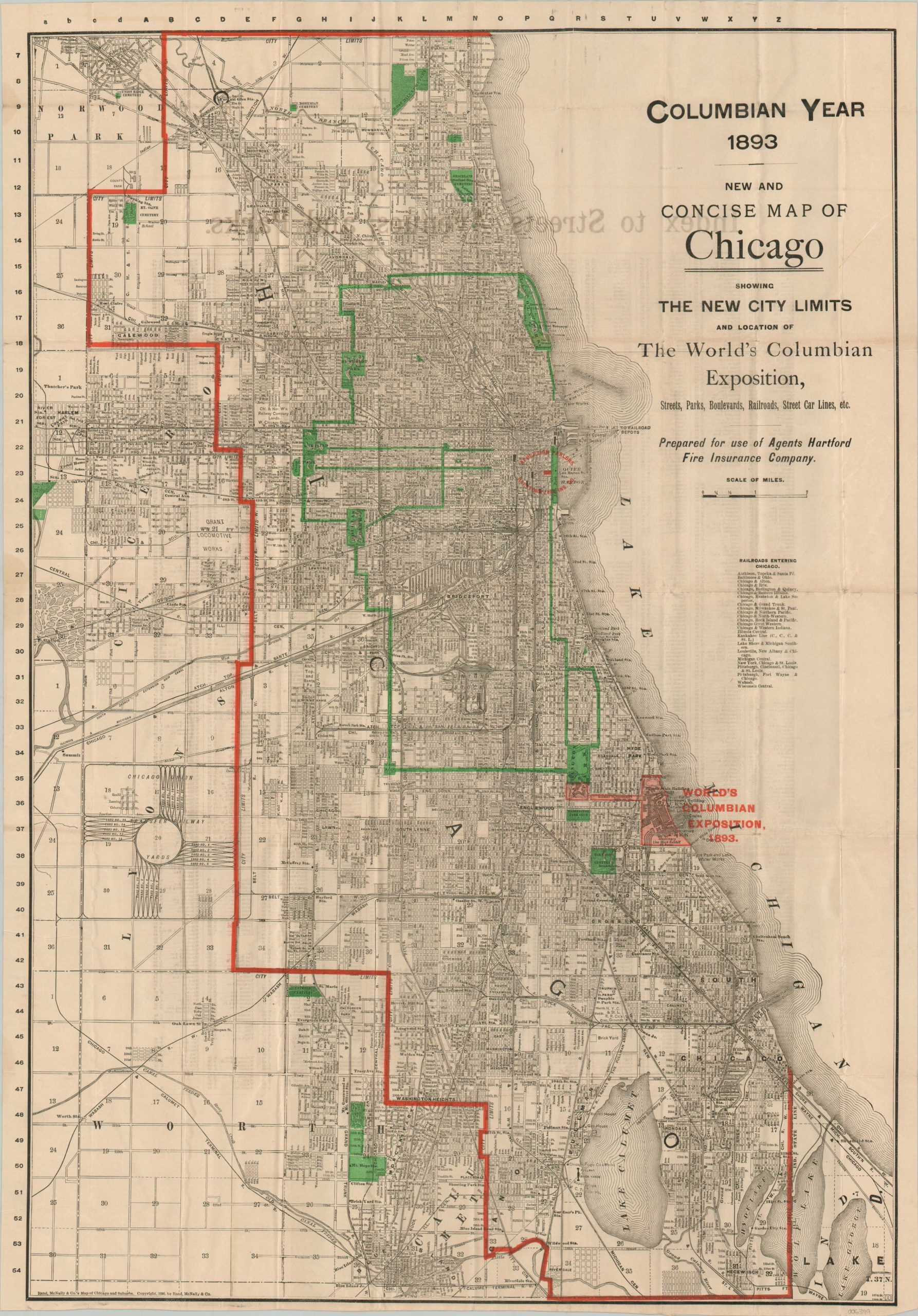
New and Concise Map of Chicago Showing the New City Limits and Location of the World’s Columbian Exposition
Chicago when H.H. Holmes prowled the streets.
Out of stock

Description
This wonderfully detailed city plan of Chicago was designed and published in 1893 by the Rand McNally Company. It was prepared for use by agents of the Hartford Insurance Company, with the address for their reception apartments shown on the cover (202 Michigan Ave). The Columbian Expo, a World’s Fair held that year, was likely the sales opportunity of a lifetime; seeing as it was held in a city celebrating the rapid recovery from the Great Chicago Fire of 1871 (in addition to the 400th anniversary of Columbus’ voyage). The grounds of the Columbian Exposition are highlighted in red in Jackson Park, while green overprinting notes the parks, cemeteries, and tree-lined boulevards.
As told in Erik Larson’s Devil in the White City, the infamous killer H.H. Holmes was operating in Chicago at the time of publication. He rented a large building at the corner of 63rd Street and Wallace (nicknamed ‘The Murder House’), where many of his more than two dozen confessed murders took place. Holmes was executed by hanging in 1896. https://interactive.wttw.com/timemachine/devil-white-city
Map Details
Publication Date: 1893
Author: Rand McNally
Sheet Width (in): 19.75
Sheet Height (in): 18
Condition: A-
Condition Description: Double-sided pocket map disbound from original paper wraps (present). Sharp creasing along folds and several spots of clean separation at fold intersections. Scattered toning and wear consistent with age. Very good condition overall.
Out of stock