Nester’s New York City Maps
$45.00
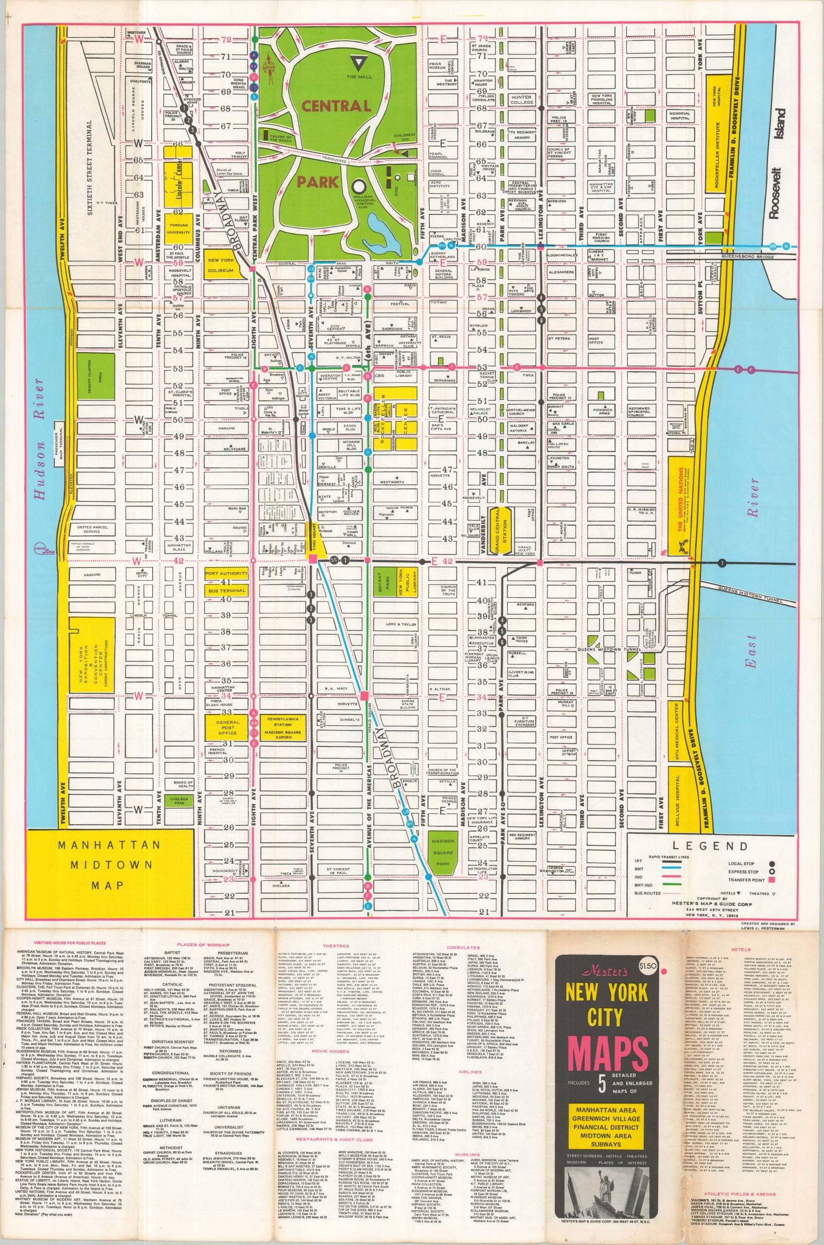
New York City during the 1970s.
1 in stock

Description
This double-sided brochure “includes 5 detailed and enlarged maps of Manhattan Area, Greenwich Village, Financial District, Midtown Area, and Subways”, according to the front cover. Each is presented at a slightly different scale and identifies locations of interest, relevant transit stops, geographic features, and notable local businesses.
Created and designed by Lewis J. Nesterman. Published locally, probably in the mid-1970s, by Nester’s Maps & Guides Corporation.
Map Details
Publication Date: c. 1975
Author: Lewis J. Nesterman
Sheet Width (in): 40.75
Sheet Height (in): 26.76
Condition: B
Condition Description: Double-sided map, heavily worn along originally issued folds. The front panels are heavily toned and there are several small splits along the creased weak spots. Good condition, for a used map from the 1970s.
$45.00
1 in stock