Nebraska
$95.00
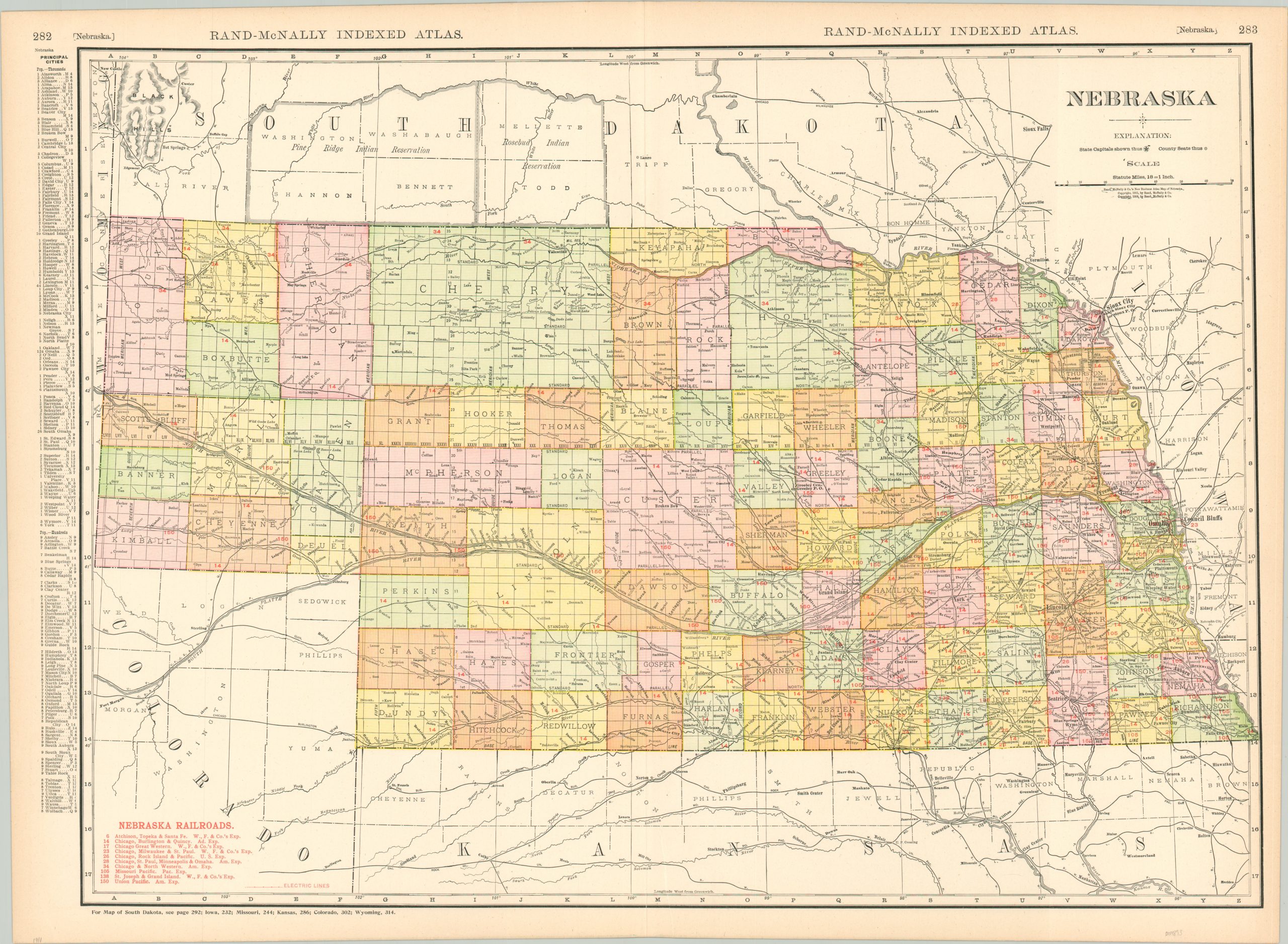
The railroads of Nebraska in 1911.
1 in stock
Description
This colorful map of Nebraska was published in Chicago in 1911 by Rand McNally as part of the firm’s popular Indexed Atlas. At the time, the pace of consolidation among railroad companies required innovative printing processes to provide up-to-date and accurate information. As a result, red text applied to the base map identifies the ten different railroad companies in operation at the time of publication. Most notable among them is the Union Pacific, the nation’s first Transcontinental Railroad, running along the Platte River. Electric railway lines are also noted in red, though these are mostly confined to the cities of Lincoln and Omaha and their surrounding suburbs.
A fascinating variety of settlements, geographic features, and other locations of interest are labeled across the image. The left margin contains an index of principal cities with their respective populations. This continues on the verso, which presents an elaborate list of counties, creeks, rivers, towns, post offices, and other names places across the state.
Map Details
Publication Date: 1911
Author: Rand McNally
Sheet Width (in): 28.5
Sheet Height (in): 20.5
Condition: A-
Condition Description: Faint toning and soiling around the outer edges of the sheet and a 3" closed tear adjacent to the fold line has been repaired on the verso with archival tape. Very good overall.
$95.00
1 in stock