Navajoland USA
First edition pictorial map of the Navajo Nation.
Out of stock
Description
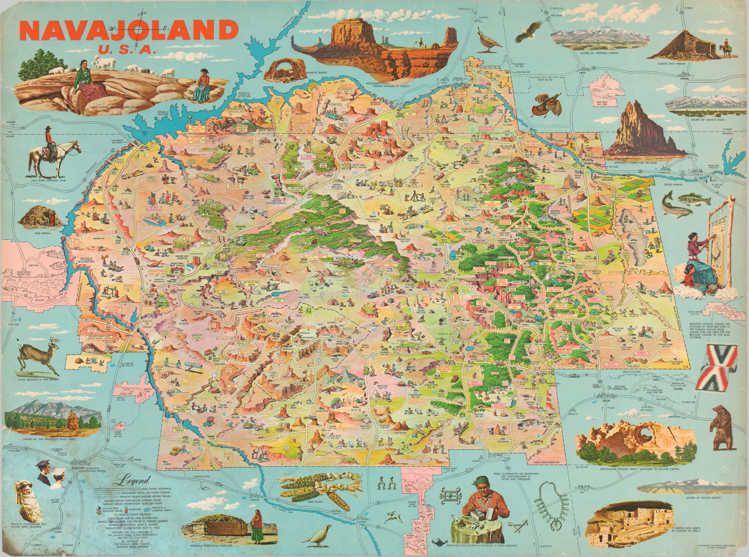
The Navajo Nation covers nearly 28,000 square miles throughout portions of Colorado, New Mexico, Arizona, and Utah and is larger than any of the ten smallest U.S. states. It’s the largest area maintained by an indigenous tribe in the United States and contains over 350,000 inhabitants.
It’s no wonder, then, why the Navajo Tribal Council would want to enlist the help of the talented illustrator Don Bloodgood to create this map to promote their lands, tribe, and heritage. The sky-blue border features stunning illustrations of prominent natural features, wildlife, and native craftsmanship.
Within the map, the Navajo people comprise the vast majority of the illustrations, which include an interesting mix of traditional and modern aspects of the culture. Uranium miners and rug weavers, dirt paths and state highways, ancient rock formations and modern convenience stations all co-exist in this idyllic representation.
Map Details
Publication Date: 1960
Author: Don Bloodgood
Sheet Width (in): 27.5
Sheet Height (in): 20.5
Condition: B
Condition Description: Heavily worn and soiled around the outer edges of the sheet. Numerous tears, chipped corners, and heavy soiling in the lower left corner. Between fair and good condition overall.
Out of stock