Native Tribes of North America, Central America and the Caribbean
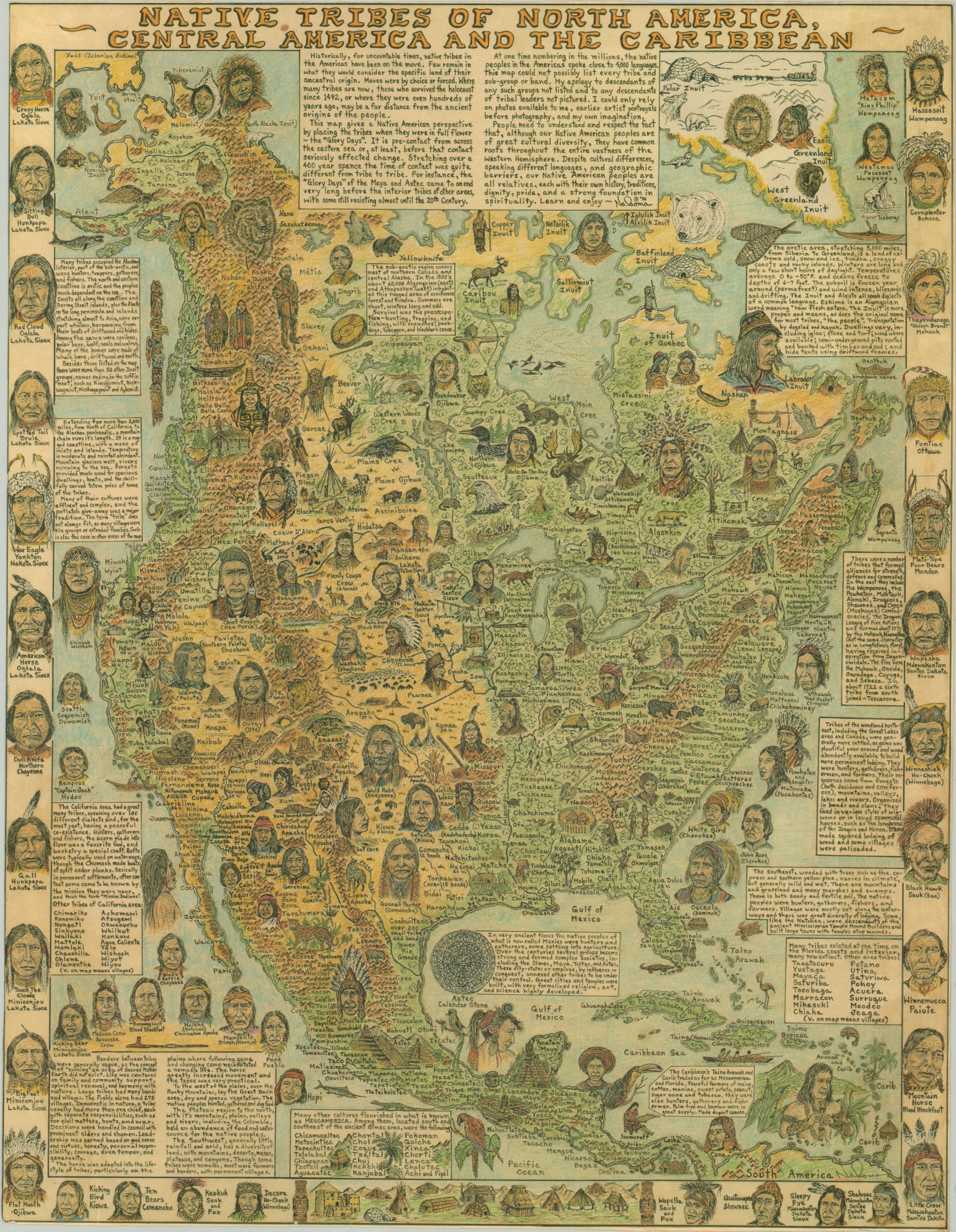
The ‘Glory Days’ of indigenous tribes across North America
Out of stock
Description
This remarkable piece of illustrated cartography was designed by Michael Mcardle-Nakoma and published in 1996. According to the author’s text below the title, “This map gives a Native American perspective by placing the tribes when they were in full flower – the ‘Glory Days’.”
Portraits of indigenous leaders and representative profiles are noted throughout the image and within the borders. Other vignettes highlight important architectural sites, various forms of habitation, and objects of cultural relevance like body looms and peace pipes. Blocks of text provide descriptive information and historical background for various regional groups ranging from Mesoamerica to the Arctic Circle. From Rumsey;
“Michael Mcardle-Nakoma is a Native American Minnesota artist, lecturer, writer, singer, and dancer. Nakoma’s strong Anishinabe-Lakota cultural traditions are reflected in his works and writings, though the verses he composes and the values expressed are general to the ancient teachings of all tribes. With over 3,000 presentations since the 1950’s, Nakoma is an established and respected speaker, endeavoring to foster a truer understanding of the Native American and the ancient, good values of the traditional pathway. His knowledge of ancient wisdom, earth sciences and astronomy offer an audience great insight into Mother Earth, Father Sky and the meanings of the Great Circle of Life, symbolized by the Medicine Wheel.”
Map Details
Publication Date: 1996
Author: Naboma
Sheet Width (in): 20.90
Sheet Height (in): 27.10
Condition: B+
Condition Description: Trimmed margins to the neatline and several small tears along the outer edges. Formerly mounted, but professionally lifted. Some slight adhesive residue on the verso does not affect the image.
Out of stock