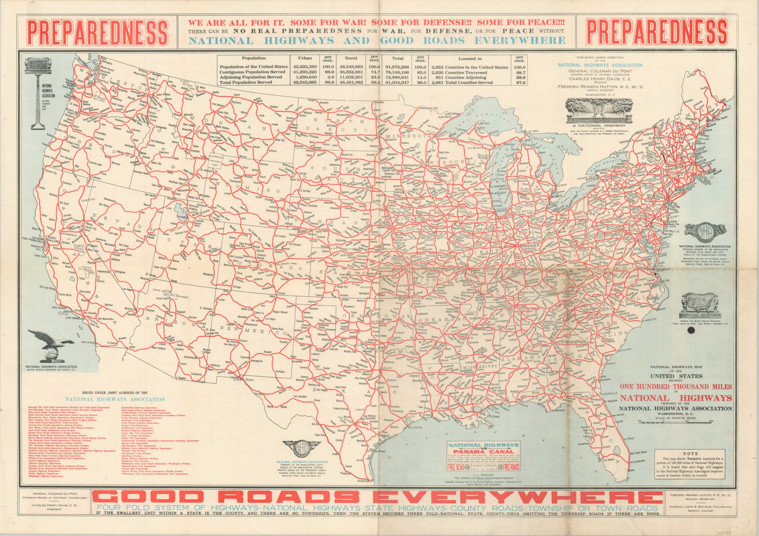
National Highways Map of the United States Showing One Hundred Thousand Miles of National Highways
$695.00
“There can be no real preparedness for war, for defense, or for peace without National Highways and Good Roads Everywhere”
1 in stock
Description
Until the late 19th century, roads in the United States were almost universally recognized as a local or state responsibility. Privately owned railroads dominated much of the interstate commerce, and the idea of a federally funded network of roads didn’t gain much traction until the 1890’s. Cyclists, oddly enough, were some of the most vocal proponents of early road funding legislature, and ultimately the ubiquity of the automobile (spearheaded by Henry Ford’s affordable 1907 Model-T) would compel Congress to pass a series of legislative measures approving federal funding for the construction of roads.
These laws, starting with the Federal Road Aid Act of 1916, were encouraged by various interest groups, but few were as successful as the National Highways Association (NHA). The NHA was organized in 1911 to promote the development, funding, and construction of ‘Good Roads Everywhere.’ Highways would ultimately become just one component of this broader network of interconnected transportation routes, described in some detail in the text on this 1915 map of the proposed nationwide system.
The persuasive image presents a comprehensive network of roads stretching from coast to coast across the continental United States. Hundreds of place names are labeled throughout, with a chart near the top of the sheet emphasizing the overwhelming percentage of the population that would benefit from ‘Good Roads Everywhere.’ This public benefit is contrasted with federal spending on the Panama Canal – “They cost the same. How many people does the second serve?”
This is the first edition of the map, designed by NHA Chief Cartographer John C. Mulford and published in November 1915 by the National Highways Association in Washington, D.C. For a corresponding broadsheet describing the system in further detail, see here.
Sources: Library of Congress; U.S. Department of Transportation;
Map Details
Publication Date: 1915
Author: John C. Mulford
Sheet Width (in): 27.5
Sheet Height (in): 19.5
Condition: B+
Condition Description: Creasing and minor to moderate wear visible along old fold lines. Most evident along the vertical centerfold. Some discoloration is also visible along the folds in the lower right segment. Good to very good condition overall.
$695.00
1 in stock

