
Nacogdoches
$150.00
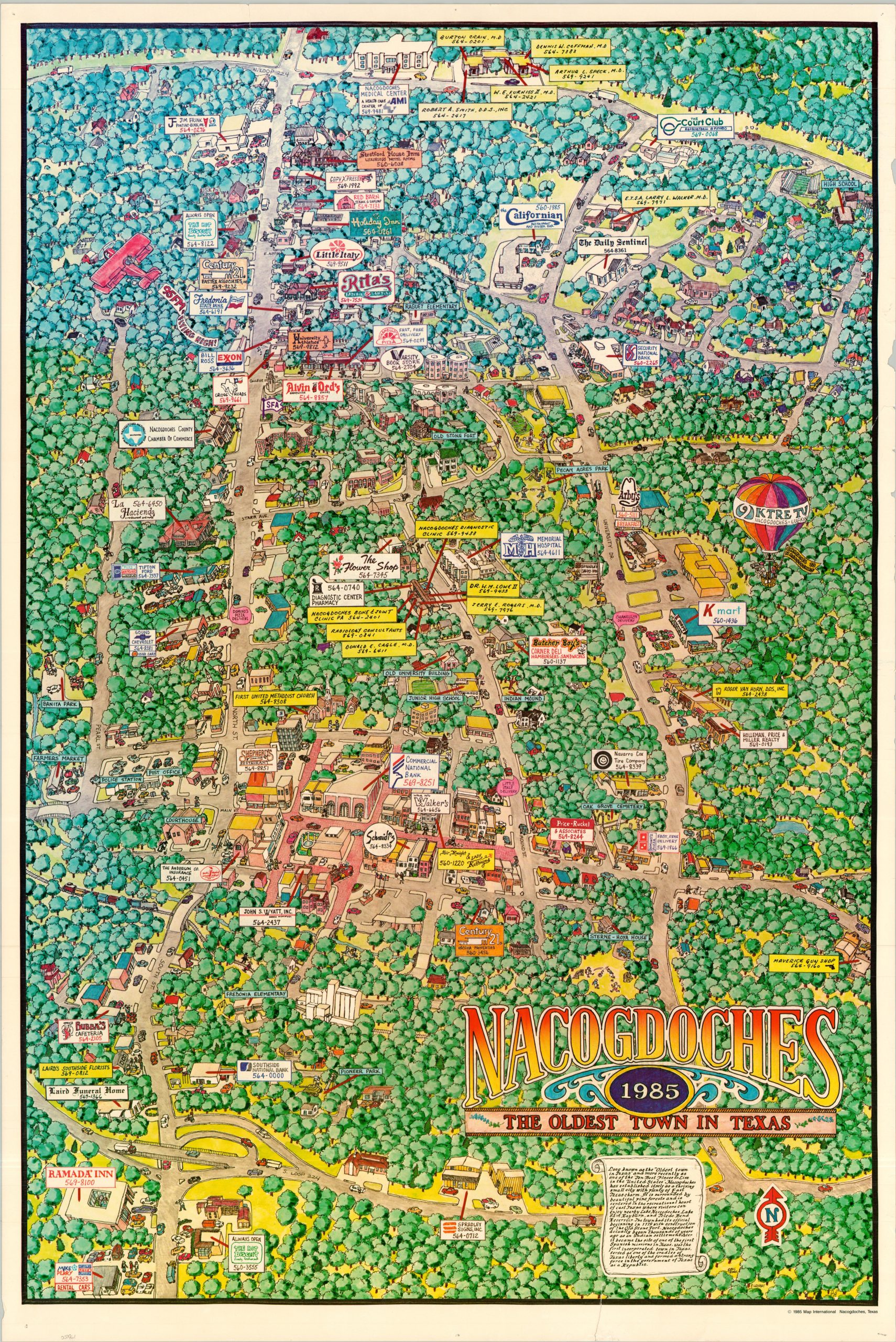
A colorful overview of ‘The Oldest Town in Texas.’
1 in stock
Description
This charming map of Nacogdoches, Texas, was published over two centuries after the town’s first beginnings as an old stone fort in 1779. It had since grown into a charming city with loads of East Texas charm, displayed in full vibrant color. Local businesses including retailers, restaurants, and professional services are labeled throughout, with contact information offering a sort of visual ‘Yellow Pages.’ Local amenities like parks, the farmer’s market, and abundant forests (perhaps overused?) are also shown.
The map was illustrated by Craig Thomas and P. Lehart. Published locally by Map International in 1985, shortly after Nacogdoches had been voted as one of the Ten Best Places to Live in the United States (according to accompanying text in the lower center).
Map Details
Publication Date: 1985
Author: Craig Thomas and P. Lehart
Sheet Width (in): 24.25
Sheet Height (in): 36.25
Condition: B
Condition Description: Large color printed map on a sheet of glossy paper. Heavy wear in the margins, including several small chips on the right side and three small closed tears (each under 2"), repaired on the verso with archival tape. Appears to be a bit faded, especially in the trees along the upper third. About good condition overall.
$150.00
1 in stock