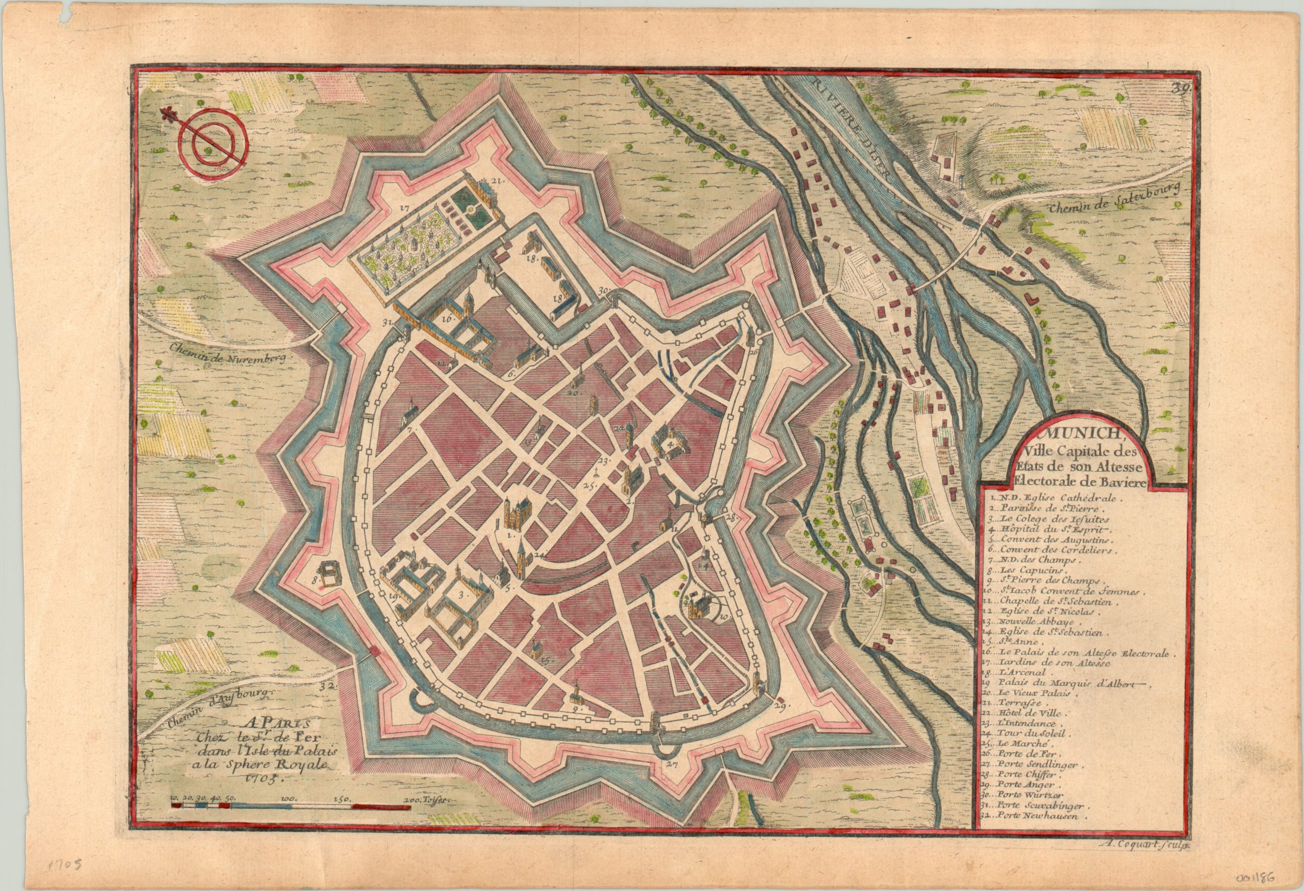
Munich Ville Capitale des Etats de son Altesse Electorale de Baviere
$125.00
Simplified plan of fortified Munich from the early 18th century.
1 in stock
Description
This attractive map of Munich and the surrounding countryside shows the city within fortified walls; first built in 1330 and extensively renovated during the Thirty Years War. Major buildings are illustrated in profile, relief is depicted pictorially, and an accompanying identifies thirty two locations of interest.
Of particular note are the Frauenkirche (1), Marienplatz (25), and numerous convents and monasteries – the name Munich is generally interpreted as meaning “by the monks.” Unfortunately the Hofbräuhaus is not identified, but it would have been found just northeast of the Holy Spirit Hospital (4).
At the time of publication by Nicholas de Fer in 1705, Munich was at the center of the Bavarian Uprising; a large scale revolt against the imperial occupation of Austria during the War of Spanish Succession. In December of that year, the insurgents were massacred by the forces of Emperor Joseph I just southwest of the city.
Map Details
Publication Date: 1705
Author: Nicholas de Fer
Sheet Width (in): 15.5
Sheet Height (in): 10.6
Condition: A-
Condition Description: Minor soiling and toning visible most evidently in the margins, with one small smudge in the title. A small chip in the sheet in the upper left, well away from the image. Lovely hand color with full margins.
$125.00
1 in stock

