Mounds State Park
Postwar trail map to Mounds State Park in Anderson, Indiana.
Out of stock
Description
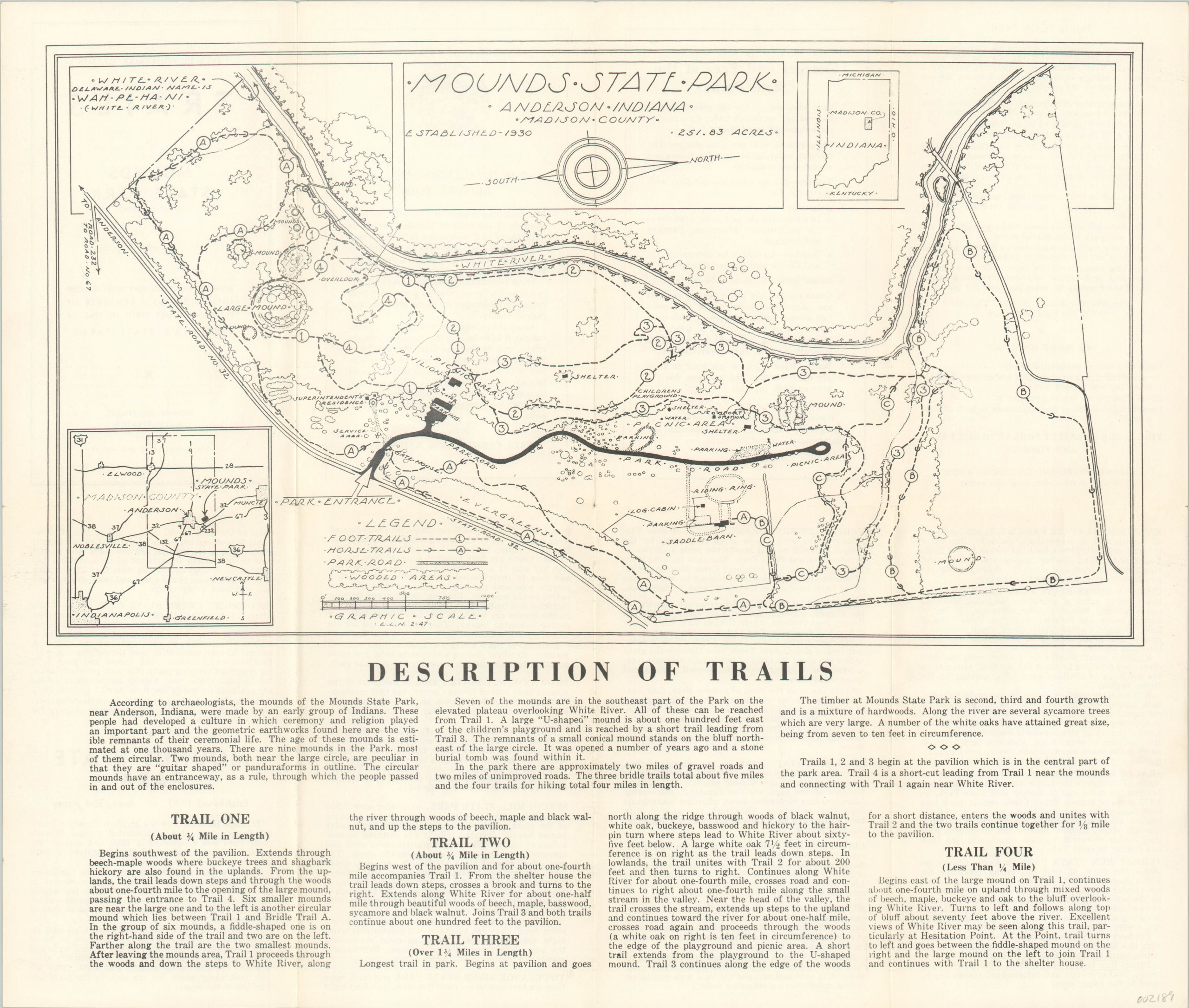
Mounds State Park in central Indiana gets its name from a serious of ten ancient burial mounds created over 2,000 years ago by the Adena people. The group is dominated by the Great Mound (‘Large’ on the map), which is over 300 feet wide and 30 feet high at its tallest point. After operating briefly as an amusement park, the area was sold to the Madison County Historical Society during the Great Depression and became an official state park in 1973.
This detailed trails map provides a pictorial overview of the park’s 251 acres. Horse and foot trails are identified according tot he legend in the lower left, and the latter include accompanying descriptions immediately below. The verso includes extensive information on rules, fees, and other state parks across Indiana.
Map Details
Publication Date: 1947
Author: Indiana Department of Conservation
Sheet Width (in): 17.90
Sheet Height (in): 15.20
Condition: A
Condition Description: Originally issued folded into 8 panels, with light wear and creasing along fold lines.
Out of stock