Motoring in Central and South America
$75.00
Mid-century driving guide to the southern portions of the Pan-American Highway.
1 in stock


Description
This fascinating guidebook to the southern portions of the Pan-American Highway was published in New York by the American Automobile Association International Travel Department. Though the concept for an intercontinental automobile route was first proposed at the Fifth International Conference of American States in 1923, it wasn’t until the 1950s that U.S. involvement began in earnest – partially in an effort to combat the growing threat of Communism in South America.
Even so, the Pan-American Highway remained a disjointed network of variable routes with no central oversight or authority. Thus guidebooks such as this one were necessary for adventurous motorists attempting to traverse the route.
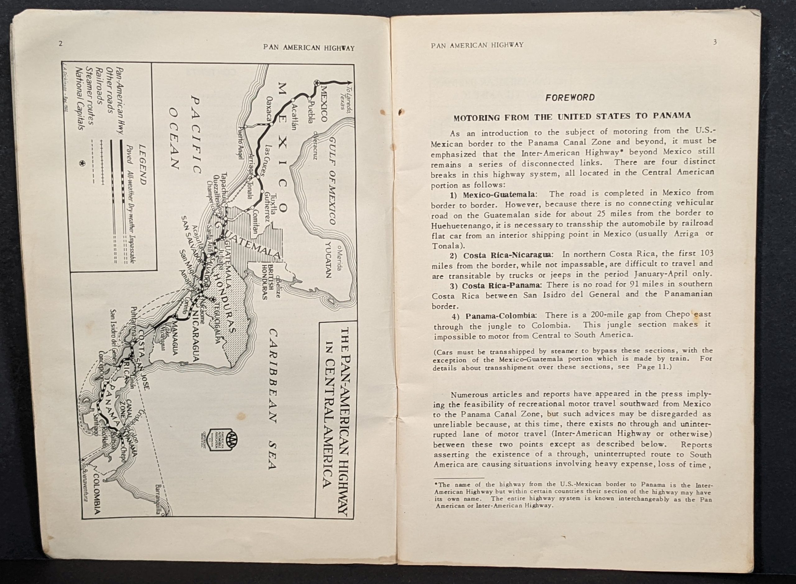
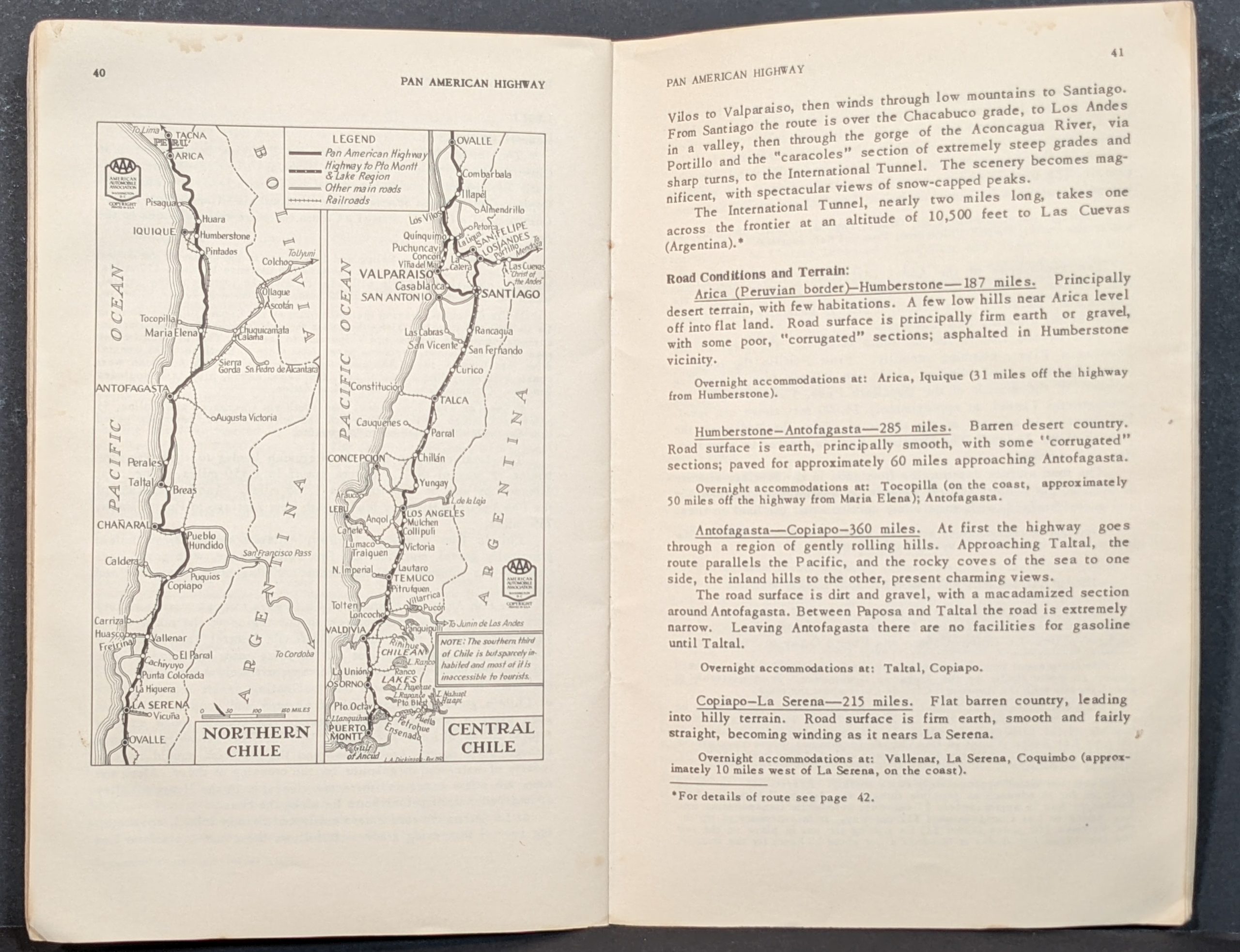
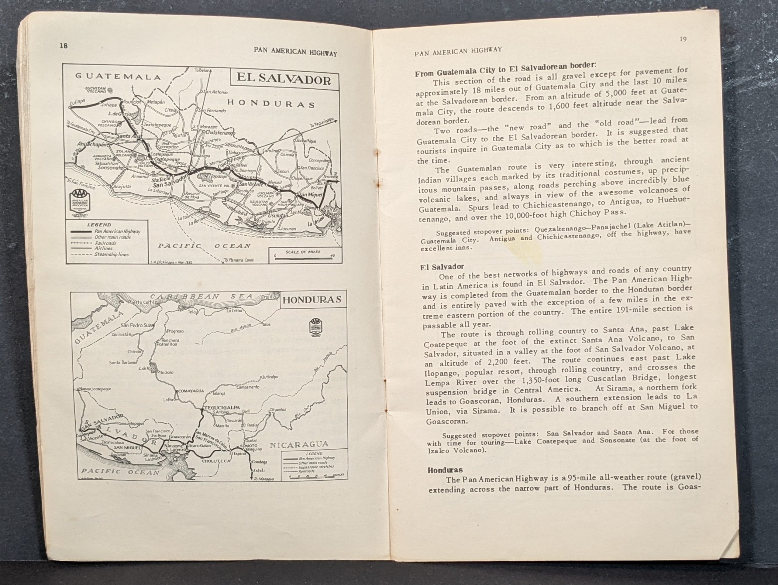
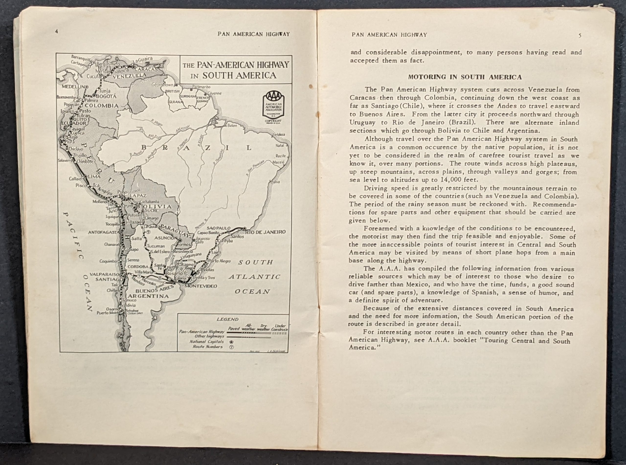
Maps designed by L.A. Dickinson of the American Automobile Association show the highway networks across Central and South America, as well as the individual countries through which the Pan-American Highway travels. Accompanying text outlines rules of the road, customs and passport regulations, route conditions, motor tourism amenities, and much more. The extensive list of recommended equipment is indicative of the intrepid spirit necessary to take such a road trip!
Map Details
Publication Date: 1953
Author: American Automobile Association
Sheet Width (in): 5.5
Sheet Height (in): 8.25
Condition: B+
Condition Description: 64 pp. guidebook with light blue paper wraps and stapled binding. Covers are heavily soiled and the contents show some faint damp staining confining to the fore-edge margin. The pages are faintly toned around the outer edges and lightly worn, consistent with age.
$75.00
1 in stock