
Moscauw
$1,600.00
A gorgeous example of one of the first views of Moscow published in Europe.
1 in stock
Description
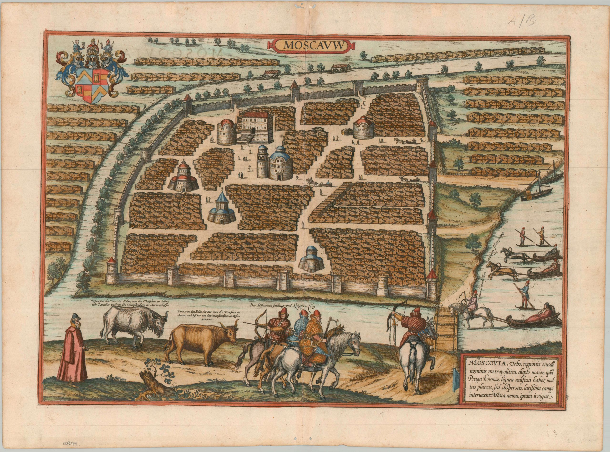
This magnificent bird’s-eye view of Moscow presents the capital of the Tsardom of Muscovy (Russia) under the rule of Ivan the Terrible. The heart of Moscow is encircled by a large stone wall with six distinctive architectural vignettes that represent the city’s major structures. The Kremlin complex (labeled Arx) is shown in the upper left, with the Ivan the Great Bell Tower pictured alongside the Cathedral of the Dormition. Other Orthodox churches are also pictured amidst the densely packed timber houses and broad streets. Outside the city walls, the wooden residential areas expand across the narrow Neglinnaya River, which protected the northern and western borders of the Kremlin.
The Moskva River, in the foreground, is frozen over and occupied by several skiers and sleds drawn by horsemen. This reflects the cold-weather transformation in which the solid rivers became the primary avenue for transportation. Several hunters on horseback are also front and center (probably Cossacks), sporting thick padded overcoats and daggers attached at the wrist to keep them from being lost in deep snow. The two bovines nearby are the European Bison and the Aurochs, both of which were all but extinct in Western Europe and highlighted the wild, untamed nature of Russia.
The historic aerial perspective was originally published in Cologne by Georg Braun and Frans Hogenberg as part of their monumental, multi-volume city atlas, Civitates Orbis Terrarum (Cities of the World). First issued around 1575, the composition was based directly on an influential 1565 manuscript map by the English merchant and explorer Anthony Jenkinson, who traveled extensively through Russia on behalf of the Muscovy Company. The view is one of the earliest of Moscow available to the general public of Europe and the first issued by Braun & Hogenberg. They would later follow up with a second plate in 1618, following the chaotic years of the Time of Troubles.
Map Details
Publication Date: c. 1575
Author: Braun & Hogenberg
Sheet Width (in): 22.10
Sheet Height (in): 16.40
Condition: B+
Condition Description: Copperplate engraved view with gorgeous full old color. Some creasing and faint wear along the vertical centerfold, including wrinkling along the upper edge and some small holes of worming in the top and bottom margins. Very good condition overall. Latin text on verso, resulting in some see through in the upper left.
$1,600.00
1 in stock