More of God’s Country
$165.00
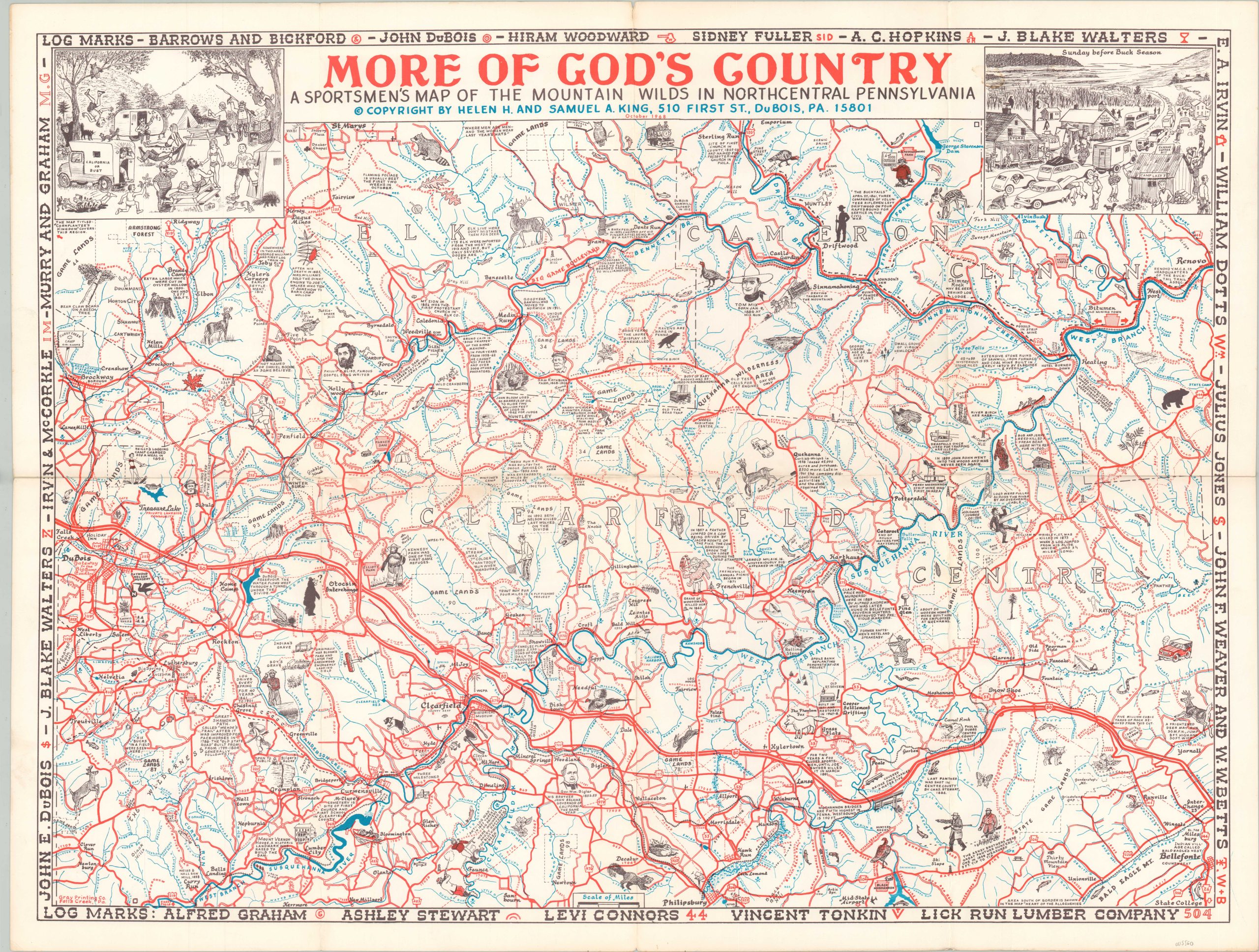
“A sportsmen’s map of the mountain wilds in northcentral Pennsylvania.”
1 in stock
Description
This spectacular local production was created by Helen and Samuel King and printed by the Gray Printing Company of Falls Creek, PA in 1968. Intimate familiarity with the region is on full display with the vibrant pictorial map, which labels a host of locations of interest, geographic features, historic sites, and more.
Scattered annotations provide information of interest to potential tourists and residents alike. Dozens of vignettes highlight recreational opportunities, abundant wildlife, and important people amid a robust transportation network of highways, roads, railroads, and rivers. Humorous scenes in the upper corners provide further visual evidence of a satisfying vacation spent in ‘God’s Country.’
The pictorial map is one of a number designed by the married couple in DuBois, PA that cover popular outdoor areas across Pennsylvania. Cornplanter’s Kingdom, another example, is referenced as the adjacent region in the upper left.
Map Details
Publication Date: 1968
Author: Helen and Samuel King
Sheet Width (in): 29.6
Sheet Height (in): 22
Condition: A
Condition Description: Creasing and light wear along originally issued fold lines.
$165.00
1 in stock