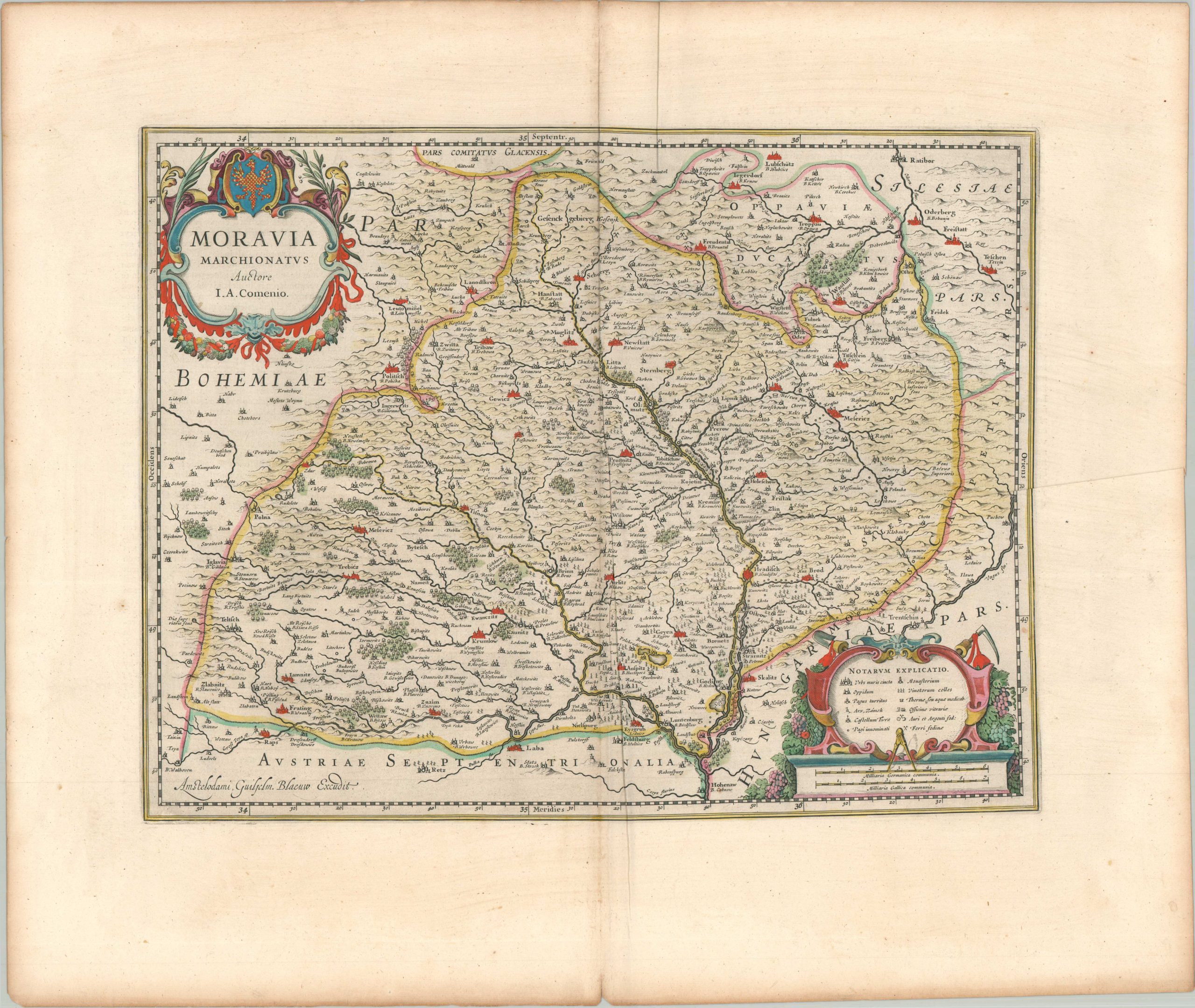
Moravia Marchionatus
$225.00
Moravia during the Thirty Years War.
1 in stock
Description
This attractive 17th-century map of the Margraviate of Moravia (Moravia Marchionatus) was published in Amsterdam c. 1640 by Willem Blaeu. It provides a detailed topographical survey of the region, centered on the Morava River (the March), which bisects the province as it flows south toward the Danube. A fascinating variety of settlements, geographic features, local industries (notably, vineyards), and ecclesiastical facilities are labeled, with a key in the lower right providing further information on the different symbols used. Olomouc and Brno were among two of the most important cities at the time, but strangely, they are not colored in red like many of the other urban centers.
Map Details
Publication Date: c. 1640
Author: Willem Blaeu
Sheet Width (in): 25.00
Sheet Height (in): 21.40
Condition: A-
Condition Description: Copperplate engraved plate on a strong sheet of watermarked laid paper. Old hand color. Heavy creasing along the centerfold and in the lower right, with some lighter extraneous wrinkling and faint marginal wear. Good to very good condition overall. Dutch text on verso.
$225.00
1 in stock