Moon Atlas
A detailed look at the moon during the height of the Space Race.
Out of stock


Description
“This work serves a dual purpose. It is a general atlas of the Moon, and can be used for identifying lunar features by means of maps, photographs, and a comprehensive gazetteer. It also embodies the results of research work, in the form of a three-color selenological Map and other associated features of special selenological interest.” – Introduction.
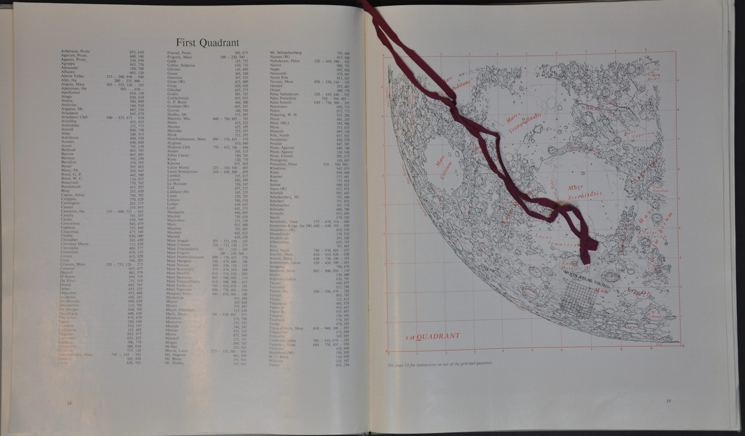
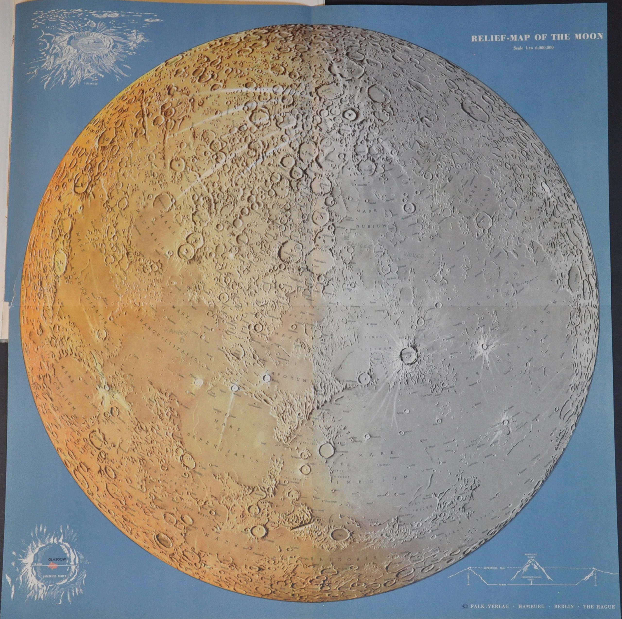
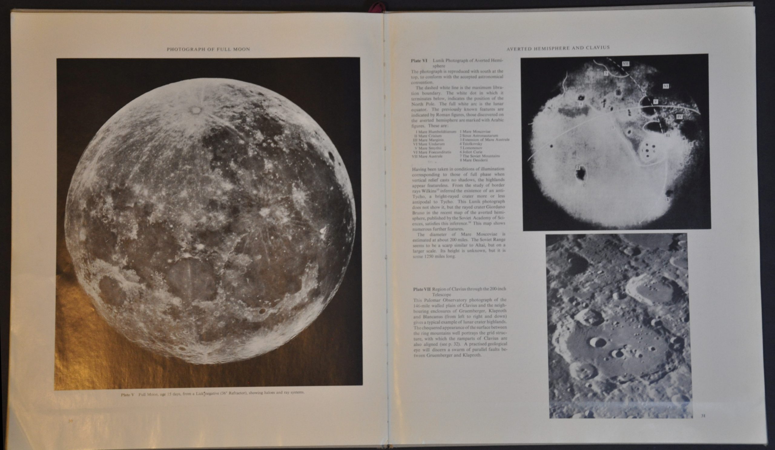
This incredible compilation of maps, photographs, text descriptions, and classification list offers one of the most detailed glimpses of the Moon available on Earth during the early 1960s. Data collected by satellite probes, high-powered telescopes, and manned space missions are expertly compiled into a document with both broad public and specific scientific interest. Of particular interest is a large color relief map by Falk-Verlag and a high-resolution image of the Clavius crater.
Copyright 1961 by V.A. Firsoff and originally produced by N.V. Cartografisch Instituut Bootsma at The Hague. This English edition was published in New York by the Viking Press in 1962.
Map Details
Publication Date: 1962
Author: V.A. Firsoff
Sheet Width (in): 11.75
Sheet Height (in): 13.75
Condition: A-
Condition Description: 32 pp. atlas bound in original gray boards. A weak spine has resulted in some splitting along the gutter. Includes both fold out maps (disbound for scanning) and the plastic viewing aid, attached by a maroon cord. Contents are lightly toned, consistent with age, but overall in very good condition.
Out of stock