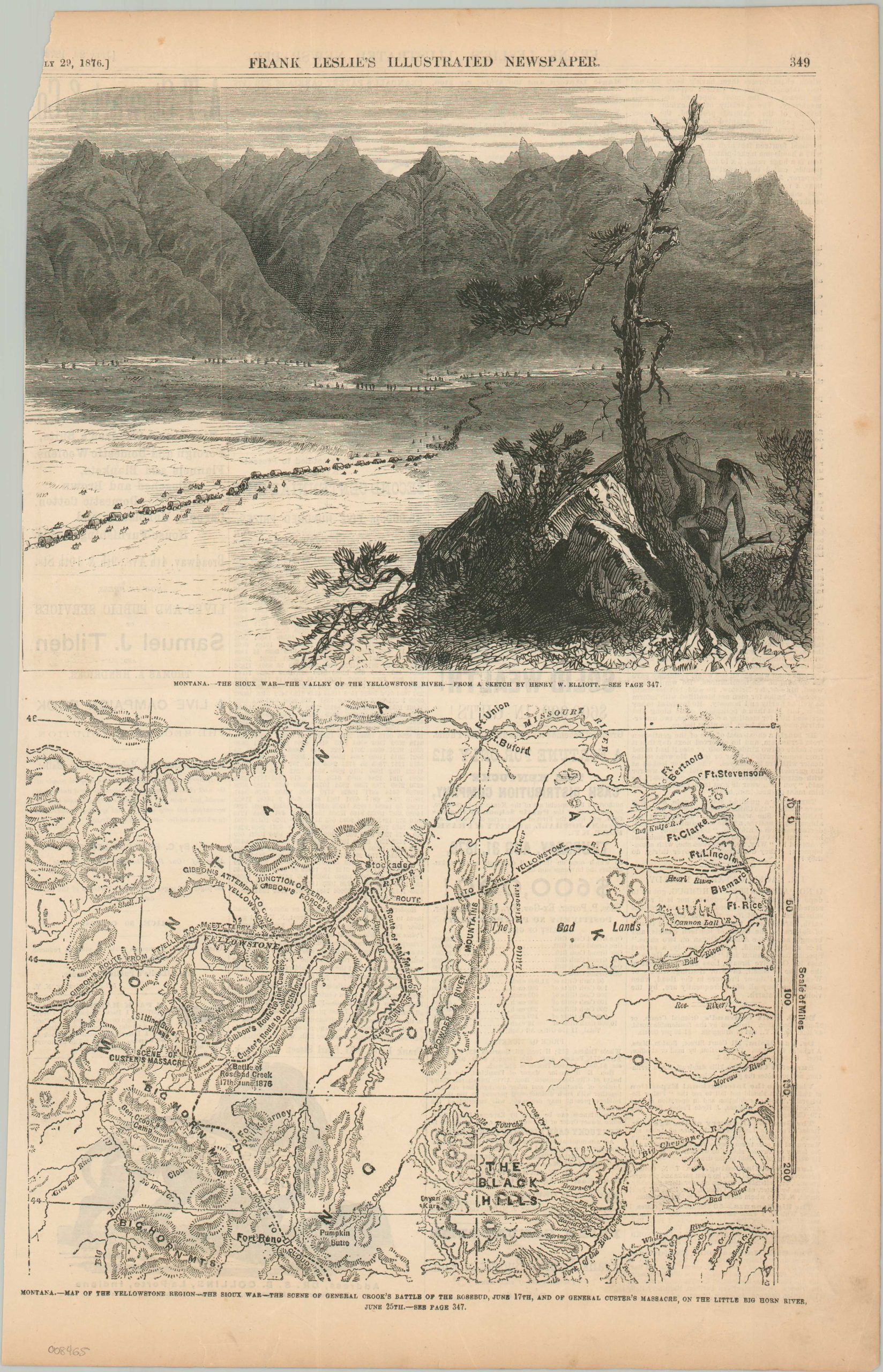
Montana – Map of the Yellowstone Region – The Sioux War – the Seen of General Crook’s Battle of the Rosebud, June 17th, and of General Custer’s Massacre, On the Little Big Horn River
$125.00
Contemporary reporting on the Battle of Little Bighorn.
1 in stock
Description
This important topographic map of Montana and the Dakota Territory was originally issued as part of the July 29th, 1876 issue of Frank Leslie’s Illustrated Newspaper. It highlights the theater of conflict in the ongoing Sioux War, where about a month prior, General George Custer decisively lost the Battle of the Little Bighorn. The preceding engagement, the Battle of the Rosebud, is also noted, along with troop movements, frontier fortifications, and notable geographic features. The upper image, based on a sketch by Henry Elliott, shows a Native American warrior overlooking a U.S. military convoy traveling through the Yellowstone River Valley.
Map Details
Publication Date: 1876
Author: Frank Leslie's Illustrated Newspaper
Sheet Width (in): 10.20
Sheet Height (in): 15.90
Condition: B
Condition Description: Single sheet extracted from an 1876 issue of Frank Leslie's Illustrated Newspaper. Trimmed left edge and chipped upper left corner. Moderately toned margins. About good condition overall.
$125.00
1 in stock