Montana 2
Highlighting Native American land cessions in Montana.
Out of stock
Description
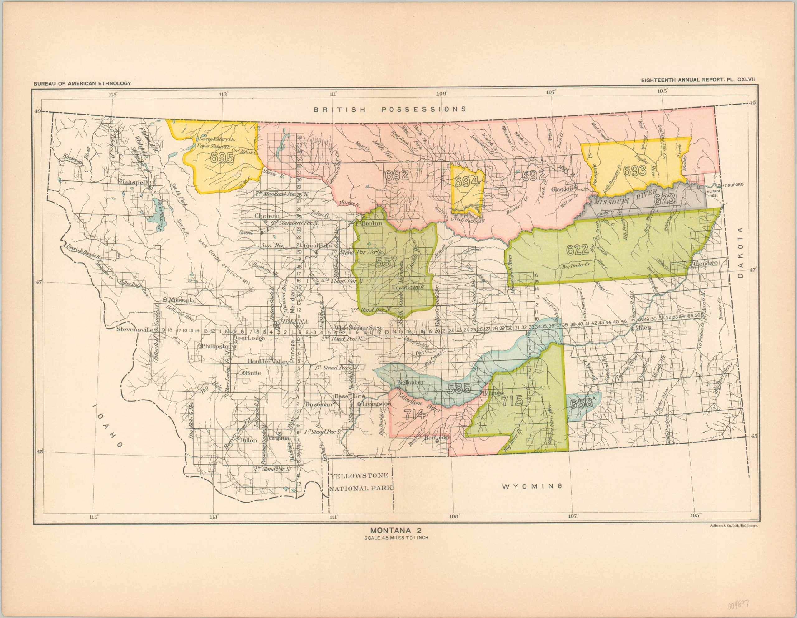
This map of Montana was originally published in 1899 by the Government Printing Office as part of the Eighteenth Annual Report of the Bureau of American Ethnology. The two-part volume (not included) provided a comprehensive overview of Native American land cessions across the United States, as well as details on foreign policy towards various tribes, a list of treaties, and more.
Each colored area represents a different parcel of land ceded to the federal government by a tribal representative. Numbers within reference the corresponding entry in the index of the report. For example, the historical data and remarks for Number 557 reads “Revoked by order of March 25 1875, for the reason that the Crow refused to remove and Congress did not ratify the agreement.”
The map also identifies surveyed townships, populated settlements, geographic features, Fort Buford, and Yellowstone National Park. Topographic information is largely absent, with the exception of the Little Rocky Mountains in the north of the state, though the large blank area labeled ‘Main Divide of Rocky Mtns’ indicates some rugged terrain.
Map Details
Publication Date: 1899
Author: Bureau of American Ethnology
Sheet Width (in): 14.5
Sheet Height (in): 11.25
Condition: A
Condition Description: Some light toning visible in the margins and creasing along vertical centerfold. Very good overall.
Out of stock