
Minneapolis The City of Lakes
$175.00
A groovy look at Mill City from the early 1970s.
1 in stock
Description
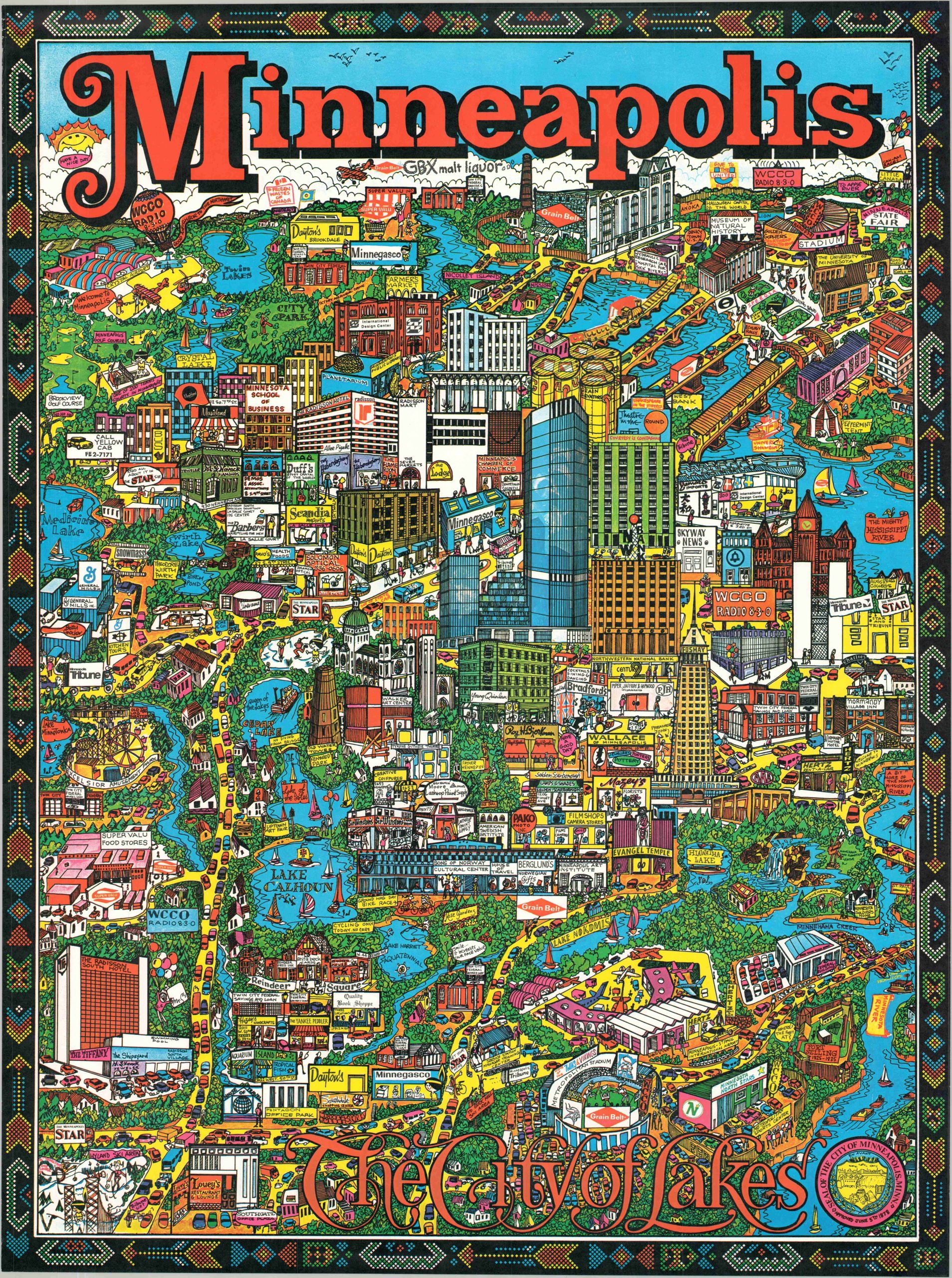
This brightly colored depiction of Minneapolis, Minnesota, was originally illustrated by Edward Langley and published in 1971 by the Vancouver-based Trans Continental Cartographers, Ltd. This later example, unattributed, was likely issued later in the 20th century, perhaps the late 1980s.
The image presents an interesting and contemporary compilation of civic pride, small business advertising, and artistic flair. Many of Minneapolis’ iconic landmarks, large buildings, and thriving industries (small and large) are depicted and labeled in an aesthetic very reminiscent of the 70s. Area attractions include Hyland Ski Area, Excelsior Amusement Park, the Minneapolis State Fair, Fort Snelling, and Metropolitan Stadium. Vibrant blue hues color the waters of the Mississippi River, and the many lakes that gave the city one of its well-deserved nicknames. Bumper-to-bumper traffic, indigenous beadwork patterns along the upper and lower edges, and the ubiquity of the Minnegasco mascot are other notable inclusions.
Map Details
Publication Date: c. 1980
Author: Edward B. Langley
Sheet Width (in): 28.00
Sheet Height (in): 40.00
Condition: A
Condition Description: Color printed map on a single-sided sheet. Faintly wrinkled and a bit of spotting on the (otherwise blank) verso that does not affect the image. Very good condition overall.
$175.00
1 in stock